Enable Location

We need your location to show you interesting places around you

Discover nearby places

Find interesting locations and hidden gems around you

Precise directions

Get accurate directions and distances to places

Your location is never shared with other users. It's only used when you tap the location button.

Log in to your account

Start exploring — it's free

Trusted by 62,817 travelers worldwide

Continue with Google
Continue with Apple
or

We will send you a code to connect

By continuing, you accept our Terms and Conditions and our Privacy Policy

Check your inbox

We've sent a pincode in your inbox. Please enter the code below.

North Central State Trail

North Central State Trail, National Recreation Trail through Michigan forests, United States.

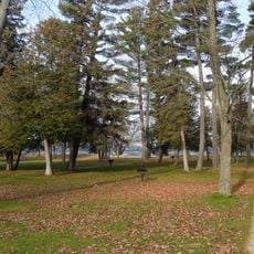
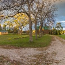
The North Central State Trail is a 75-mile recreation path that connects Gaylord to Mackinaw City, running through forests, farmland, and alongside trout streams. The crushed limestone surface makes it accessible for walking, cycling, biking, and jogging.

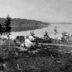
The path follows the route of the Michigan Central Railroad, built in 1881 to transport lumber and passengers between Mackinaw City and southern destinations. The tracks were eventually removed and the corridor became a public recreation route.

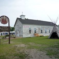
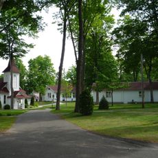
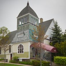
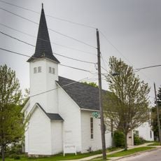
The path connects several towns like Gaylord, Vanderbilt, Wolverine, Indian River, Topinabee, and Cheboygan, where travelers find local shops and cafes. Each settlement has its own character and invites visitors to explore and rest during their journey.

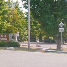
The route has several access points with facilities including restrooms, water stations, and parking areas for visitors. Year-round use requires different gear and preparation depending on the season.

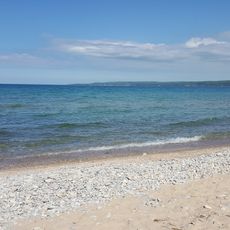
The route runs parallel to Mullett Lake for about 8 miles north of Indian River, one of Michigan's largest inland lakes. This lakeside section offers water views that most visitors find memorable.

The community of curious travelers

AroundUs brings together thousands of curated places, local tips, and hidden gems, enriched daily by 60,000 contributors worldwide.

Start exploring
Location
GPS coordinates
45.41320,-84.61120
Latest update
December 14, 2025 13:08
Around this place
Fort de Buade
United States of America

Fort de Buade

18 km
Petoskey State Park
United States of America

Petoskey State Park

23.2 km
Burt Lake State Park
United States of America

Burt Lake State Park

2.6 km
Aloha State Park
United States of America

Aloha State Park

16.4 km
University of Michigan Biological Station
United States of America

University of Michigan Biological Station

17.6 km
Bay View
United States of America

Bay View

25.1 km
Seventh Day Adventist Church
United States of America

Seventh Day Adventist Church

27.4 km
John Nyman House
United States of America

John Nyman House

27.6 km
Zion Evangelical Lutheran Church
United States of America

Zion Evangelical Lutheran Church

27.5 km
West Mitchell Street Bridge
United States of America

West Mitchell Street Bridge

27.7 km
Petoskey Downtown Historic District
United States of America

Petoskey Downtown Historic District

27.2 km
Old Cheboygan County Courthouse
United States of America

Old Cheboygan County Courthouse

27.1 km
Shafer's Grocery and Residence
United States of America

Shafer's Grocery and Residence

27.7 km
Meyer Fryman House
United States of America

Meyer Fryman House

27.5 km
George and Eugene Markle House
United States of America

George and Eugene Markle House

26.5 km
Faunce-McMichael Farm
United States of America

Faunce-McMichael Farm

8.6 km
I. N. Debenham House
United States of America

I. N. Debenham House

27.6 km
New Life Anglican Church
United States of America

New Life Anglican Church

27.4 km
J. B. Allen House
United States of America

J. B. Allen House

26.7 km
Phillip Rehkopf House
United States of America

Phillip Rehkopf House

27.4 km
Gerhard Fochtman House
United States of America

Gerhard Fochtman House

27.2 km
G. W. Olin House
United States of America

G. W. Olin House

26.5 km
Jacob VanZolenburg House
United States of America

Jacob VanZolenburg House

27.6 km
George McManus House
United States of America

George McManus House

27.6 km
Bert and John Hobbins House
United States of America

Bert and John Hobbins House

27.7 km
Frank Schapler House
United States of America

Frank Schapler House

27.7 km
Stout House
United States of America

Stout House

27 km
Petoskey Public Works Utility Building
United States of America

Petoskey Public Works Utility Building

27.5 km
Show the full map
« North Central State Trail - National Recreation Trail through Michigan forests, United States » is provided by Around Us (aroundus.com). Images and texts are derived from Wikimedia project under a Creative Commons license. You are allowed to copy, distribute, and modify copies of this page, under the conditions set by the license, as long as this note is clearly visible.

Discover hidden gems everywhere you go!

From secret cafés to breathtaking viewpoints, skip the crowded tourist spots and find places that match your style. Our app makes it easy with voice search, smart filtering, route optimization, and insider tips from travelers worldwide. Download now for the complete mobile experience.

Around Us App Screenshot

A unique approach to discovering new places

Le Figaro

All the places worth exploring

France Info

A tailor-made excursion in just a few clicks

20 Minutes

Around Us
Travel Guide & Maps
Download

Send to your phone

QR Code
1

Open the camera app on your mobile.

2

Point at the QR code with your camera. A notification will appear.

3

Tap the notification to open the link.