Enable Location

We need your location to show you interesting places around you

Discover nearby places

Find interesting locations and hidden gems around you

Precise directions

Get accurate directions and distances to places

Your location is never shared with other users. It's only used when you tap the location button.

Burt Lake State Park

Log in to your account

Start exploring — it's free

Trusted by 61,910 travelers worldwide

Continue with Google
Continue with Apple
or

We will send you a code to connect

By continuing, you accept our Terms and Conditions and our Privacy Policy

Check your inbox

We've sent a pincode in your inbox. Please enter the code below.

Burt Lake State Park

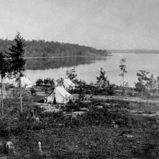
Burt Lake State Park, State park in northern Michigan, United States
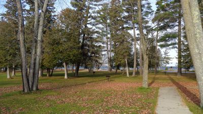
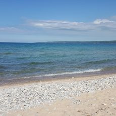
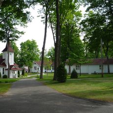
Burt Lake State Park sits along sandy shoreline on the southeastern edge of Burt Lake and offers various water recreation options. The grounds include camping facilities, boat launches, fishing areas, and swimming zones accessible from the main entrance.

The park was founded in 1920 by the Michigan Department of Natural Resources as one of the earliest state parks in northern Michigan. This facility was part of an early movement to preserve areas along the Great Lakes.

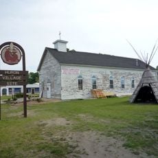
The park sits within the Inland Waterway region, where lakes and rivers have long served as important passage routes. Visitors today can experience these water corridors that were traditionally vital for movement and exchange.
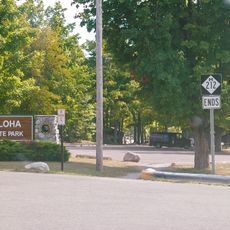
The park is easy to reach via the main entrance on State Park Drive and offers parking for day visitors and passing travelers. The grounds are well maintained and most accessible during warm months, though activities are possible year-round.

The park forms part of a 38-mile (61-kilometer) water chain system linking multiple lakes through rivers and enabling extended navigation routes. This passage allows paddlers and boaters to move between different lakes without leaving the water.

The community of curious travelers

AroundUs brings together thousands of curated places, local tips, and hidden gems, enriched daily by 60,000 contributors worldwide.

Start exploring
Location
Inception
1920
GPS coordinates
45.39610,-84.63440
Latest update
December 11, 2025 18:08
Around this place
Fort de Buade
United States of America

Fort de Buade

20.6 km
Petoskey State Park
United States of America

Petoskey State Park

21.4 km
Aloha State Park
United States of America

Aloha State Park

19.1 km
University of Michigan Biological Station
United States of America

University of Michigan Biological Station

19.2 km
United States of America

North Central State Trail

2.6 km
Bay View
United States of America

Bay View

23.2 km
Seventh Day Adventist Church
United States of America

Seventh Day Adventist Church

25.4 km
John Nyman House
United States of America

John Nyman House

25.5 km
Zion Evangelical Lutheran Church
United States of America

Zion Evangelical Lutheran Church

25.4 km
West Mitchell Street Bridge
United States of America

West Mitchell Street Bridge

25.6 km
Petoskey Downtown Historic District
United States of America

Petoskey Downtown Historic District

25.2 km
Shafer's Grocery and Residence
United States of America

Shafer's Grocery and Residence

25.6 km
Meyer Fryman House
United States of America

Meyer Fryman House

25.4 km
George and Eugene Markle House
United States of America

George and Eugene Markle House

24.5 km
Faunce-McMichael Farm
United States of America

Faunce-McMichael Farm

8.1 km
I. N. Debenham House
United States of America

I. N. Debenham House

25.6 km
New Life Anglican Church
United States of America

New Life Anglican Church

25.3 km
J. B. Allen House
United States of America

J. B. Allen House

24.6 km
Phillip Rehkopf House
United States of America

Phillip Rehkopf House

25.3 km
Gerhard Fochtman House
United States of America

Gerhard Fochtman House

25.1 km
G. W. Olin House
United States of America

G. W. Olin House

24.5 km
Jacob VanZolenburg House
United States of America

Jacob VanZolenburg House

25.5 km
George McManus House
United States of America

George McManus House

25.5 km
Bert and John Hobbins House
United States of America

Bert and John Hobbins House

25.6 km
Frank Schapler House
United States of America

Frank Schapler House

25.6 km
Stout House
United States of America

Stout House

24.9 km
Petoskey Public Works Utility Building
United States of America

Petoskey Public Works Utility Building

25.5 km
Frank Lesher House
United States of America

Frank Lesher House

25.7 km
Show the full map
« Burt Lake State Park - State park in northern Michigan, United States » is provided by Around Us (aroundus.com). Images and texts are derived from Wikimedia project under a Creative Commons license. You are allowed to copy, distribute, and modify copies of this page, under the conditions set by the license, as long as this note is clearly visible.

Discover hidden gems everywhere you go!

From secret cafés to breathtaking viewpoints, skip the crowded tourist spots and find places that match your style. Our app makes it easy with voice search, smart filtering, route optimization, and insider tips from travelers worldwide. Download now for the complete mobile experience.

Around Us App Screenshot

A unique approach to discovering new places

Le Figaro

All the places worth exploring

France Info

A tailor-made excursion in just a few clicks

20 Minutes

Around Us
Travel Guide & Maps
Download

Send to your phone

QR Code
1

Open the camera app on your mobile.

2

Point at the QR code with your camera. A notification will appear.

3

Tap the notification to open the link.