Enable Location

We need your location to show you interesting places around you

Discover nearby places

Find interesting locations and hidden gems around you

Precise directions

Get accurate directions and distances to places

Your location is never shared with other users. It's only used when you tap the location button.

Log in to your account

Start exploring — it's free

Trusted by 61,981 travelers worldwide

Continue with Google
Continue with Apple
or

We will send you a code to connect

By continuing, you accept our Terms and Conditions and our Privacy Policy

Check your inbox

We've sent a pincode in your inbox. Please enter the code below.

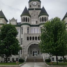
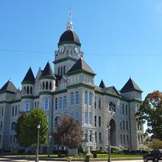
First Battle of Newtonia Historic District, Civil War battlefield in Newtonia, United States.

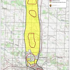
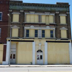
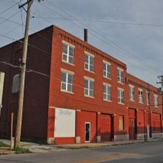
The First Battle of Newtonia Historic District is a battlefield across rural land with five standing structures and a cemetery on its grounds. The entire area spans 152 acres and contains more than 600 marked graves from those who fell in combat.

This site became a major confrontation during the American Civil War between Union and Confederate forces in 1862. The battle was notable because soldiers from Native American nations fought on both sides of the conflict.

This place holds memories of soldiers from different nations who clashed here, and visitors can see how the local community honors these stories today. The preserved graves and structures show how people continue to mark and remember those who fell.

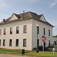
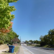
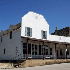
The site is set in open countryside with minimal facilities, so bringing water and supplies is a good idea before exploring. The Mathew H. Ritchey House serves as a helpful reference point for understanding the battle layout and walking the grounds.

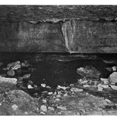
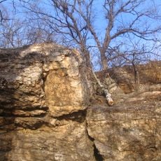
The Newtonia Branch stream and sections of the original Neosho Road have remained unchanged since 1862 and still run through the battlefield today. These preserved features allow visitors to see the landscape much as soldiers experienced it during the fighting.

The community of curious travelers

AroundUs brings together thousands of curated places, local tips, and hidden gems, enriched daily by 60,000 contributors worldwide.

Start exploring
Location
GPS coordinates
36.88500,-94.18667
Latest update
December 13, 2025 17:02
Around this place
Bonnie & Clyde Garage Apartment
United States of America

Bonnie & Clyde Garage Apartment

34.7 km
George Washington Carver National Monument
United States of America

George Washington Carver National Monument

18.8 km
66 Drive-In
United States of America

66 Drive-In

36 km
St. Peter the Apostle Catholic Church and Rectory
United States of America

St. Peter the Apostle Catholic Church and Rectory

35.8 km
United States of America

Jolly Mill

10.3 km
Big Sugar Creek State Park
United States of America

Big Sugar Creek State Park

30.9 km
Jacobs Cavern
United States of America

Jacobs Cavern

35.6 km
Wildcat Glades Conservation and Audubon Center
United States of America

Wildcat Glades Conservation and Audubon Center

33.5 km
Battle of Carthage State Historic Site
United States of America

Battle of Carthage State Historic Site

33.5 km
Old McDonald County Courthouse
United States of America

Old McDonald County Courthouse

36.9 km
Powell Bridge
United States of America

Powell Bridge

29.9 km
Joplin Downtown Historic District
United States of America

Joplin Downtown Historic District

36.7 km
Carthage Courthouse Square Historic District
United States of America

Carthage Courthouse Square Historic District

34.3 km
Joplin Supply Company
United States of America

Joplin Supply Company

36.9 km
Fox Theatre
United States of America

Fox Theatre

36.9 km
Second Baptist Church
United States of America

Second Baptist Church

16.8 km
Joplin Carnegie Library
United States of America

Joplin Carnegie Library

36.6 km
St. Louis and San Francisco Railroad Building
United States of America

St. Louis and San Francisco Railroad Building

36.6 km
Colonial Apartments
United States of America

Colonial Apartments

34.2 km
South Main Street Historic District
United States of America

South Main Street Historic District

36.9 km
Main and Eighth Streets Historic District
United States of America

Main and Eighth Streets Historic District

36.4 km
Carthage South Historic District
United States of America

Carthage South Historic District

33.5 km
Rains Brothers Building
United States of America

Rains Brothers Building

36.3 km
Neosho Wholesale Grocery Company
United States of America

Neosho Wholesale Grocery Company

16.1 km
Cassill Place Historic District
United States of America

Cassill Place Historic District

34.8 km
Lentz-Carter Merchandise Store
United States of America

Lentz-Carter Merchandise Store

13.9 km
Battle of Carthage Civil War Museum
United States of America

Battle of Carthage Civil War Museum

34.4 km
Jasper County Courthouse
United States of America

Jasper County Courthouse

34.5 km
Show the full map
« First Battle of Newtonia Historic District - Civil War battlefield in Newtonia, United States » is provided by Around Us (aroundus.com). Images and texts are derived from Wikimedia project under a Creative Commons license. You are allowed to copy, distribute, and modify copies of this page, under the conditions set by the license, as long as this note is clearly visible.

Discover hidden gems everywhere you go!

From secret cafés to breathtaking viewpoints, skip the crowded tourist spots and find places that match your style. Our app makes it easy with voice search, smart filtering, route optimization, and insider tips from travelers worldwide. Download now for the complete mobile experience.

Around Us App Screenshot

A unique approach to discovering new places

Le Figaro

All the places worth exploring

France Info

A tailor-made excursion in just a few clicks

20 Minutes

Around Us
Travel Guide & Maps
Download

Send to your phone

QR Code
1

Open the camera app on your mobile.

2

Point at the QR code with your camera. A notification will appear.

3

Tap the notification to open the link.