Devil's Grinding Mill, Cave formation in Stenkrith Park, Cumbria, England.
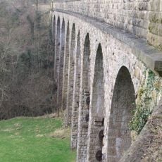
The cave system was carved by the River Eden flowing through partially collapsed underground passages. Natural arches and gorges mark where the water has continuously shaped the rock over time.
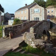
The site was first recorded in 1828 when travelers documented Staincroft Bridge, a natural rock formation spanning a deep ravine. This early documentation marked the beginning of written knowledge about the location.
The name comes from a local tale about a man named Deville whose fate became tied to this place. Local people have long connected this location with a dark legend that still circulates in the area today.
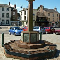
Access is via marked pathways from Kirkby Stephen leading to designated viewing areas throughout the formation. Wear sturdy footwear since the ground near flowing water tends to be slippery.
The formation developed in brockram, a mixture of limestone fragments embedded in sandstone rather than pure limestone found in typical cave systems. This unusual rock composition gives the location its distinctive geological character.
GPS coordinates: 54.46230,-2.35154
Latest update: December 14, 2025 18:03
Crosby Garrett Helmet
4.8 km
Pendragon Castle
4.9 km
Nine Standards Rigg
5.2 km
Hartley Castle
1.2 km
Wharton Hall
1.3 km
St Stephen's Church, Kirkby Stephen
1.3 km
St Andrew's Church, Crosby Garrett
4.9 km
Smardale Gill Viaduct
4.7 km
Stainmore Railway Company
370 m
Church of St Luke
4.4 km
Lammerside Castle
2.7 km
Smardale Bridge
5.5 km
Kirkby Stephen War Memorial
1.3 km
Frank's Bridge
1.3 km
Merrygill Viaduct
1.4 km
Milestone Opposite Tarn House (At Ngr Ny 749 034)
4.7 km
Boundary Stone To East Of White Brackens House (Nateby Parish)
2.9 km
Stone Approximately 75 Metres South Of North Yorkshire-Cumbria Boundary
5.3 km
Barn To North East Of Old Rectory
4.8 km
Crosby Garrett Viaduct at NT 727 093
4.9 km
The Old Rectory
4.8 km
Boundary Stone At Hollow Mill Cross
5.2 km
Boundary Stone To West Of Roadbridge Over Mill Beck
3.1 km
Pod Gill Viaduct
970 m
Smardale Railway Viaduct
4 km
Smardale Hall and adjoining buildings
3.4 km
Milestone, Wharton Fell, a mile S of jct with A685
3.3 km
Milestone, Nateby, N of Kirkby Stephen station
642 mVisited this place? Tap the stars to rate it and share your experience / photos with the community! Try now! You can cancel it anytime.
Discover hidden gems everywhere you go!
From secret cafés to breathtaking viewpoints, skip the crowded tourist spots and find places that match your style. Our app makes it easy with voice search, smart filtering, route optimization, and insider tips from travelers worldwide. Download now for the complete mobile experience.
A unique approach to discovering new places❞
— Le Figaro
All the places worth exploring❞
— France Info
A tailor-made excursion in just a few clicks❞
— 20 Minutes