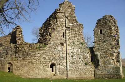
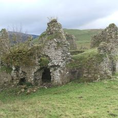
Pendragon Castle, Norman castle ruins in Mallerstang, England
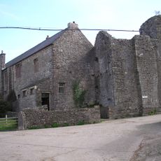
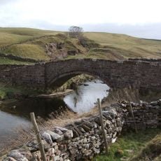
Pendragon Castle is a stone fortress ruin positioned on elevated ground beside the River Eden in a mountain valley. The remains show the typical layout of a Norman stronghold with towers and thick walls built to defend against attacks from neighboring Scotland.
The fortress was built around 1100 by Ranulph de Meschines for King William II to guard the Scottish border. In 1660, the Countess Anne Clifford repaired the decaying structures and added domestic buildings.
Local stories tie this fortress to the legend of King Uther Pendragon, who supposedly tried to redirect the River Eden to create a water defense around the walls. These tales remain part of how people in the valley understand their landscape.
You can reach the castle exterior via public footpaths and explore the ruins from outside. The interior remains closed for safety, but you can walk around the perimeter and enjoy clear views of the stonework and surrounding terrain.
When Anne Clifford rebuilt the ruins, she added practical buildings like a brewhouse, bakehouse, and stables, turning the fort into a livable residence in the 1600s. This transformation of a medieval military stronghold into a country dwelling shows how the site adapted to new purposes.
Location: Mallerstang
Inception: 12 century
Founders: Ranulf le Meschin, 3rd Earl of Chester
Architects: Anne Clifford
GPS coordinates: 54.41870,-2.33770
Latest update: December 8, 2025 13:40
Nine Standards Rigg
5.7 km
Wild Boar Fell
4.5 km
Hartley Castle
5.6 km
Wharton Hall
3.7 km
St Stephen's Church, Kirkby Stephen
6.2 km
High Seat
2.4 km
St Oswald's Church, Ravenstonedale
6.2 km
Devil's Grinding Mill
4.9 km
Ravenstonedale Priory
6.2 km
Smardale Gill Viaduct
7 km
Stainmore Railway Company
5 km
Milestone 150 Yards North East Of Methodist Chapel (Ngr 724 995)
6.6 km
Lammerside Castle
2.3 km
Smardale Bridge
6.9 km
Hell Gill Bridge
5.8 km
Frank's Bridge
6.1 km
Kirkby Stephen War Memorial
6.1 km
Merrygill Viaduct
5.7 km
Ais Gill Viaduct
5.2 km
Milestone Opposite Tarn House (At Ngr Ny 749 034)
3.4 km
Stone Approximately 75 Metres South Of North Yorkshire-Cumbria Boundary
3.3 km
Boundary Stone To East Of White Brackens House (Nateby Parish)
2.1 km
Cross shaft base and sundial 10 yards to south of church
6.2 km
Boundary Stone At Hollow Mill Cross
3.3 km
Milestone 850 Yards To North East Of Studfold (At Ngr 734 007)
5.2 km
Pod Gill Viaduct
5.3 km
Smardale Hall and adjoining buildings
6.9 km
Milestone, Nateby, N of Kirkby Stephen station
4.8 kmVisited this place? Tap the stars to rate it and share your experience / photos with the community! Try now! You can cancel it anytime.
Discover hidden gems everywhere you go!
From secret cafés to breathtaking viewpoints, skip the crowded tourist spots and find places that match your style. Our app makes it easy with voice search, smart filtering, route optimization, and insider tips from travelers worldwide. Download now for the complete mobile experience.
A unique approach to discovering new places❞
— Le Figaro
All the places worth exploring❞
— France Info
A tailor-made excursion in just a few clicks❞
— 20 Minutes