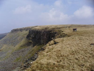
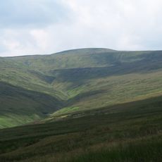
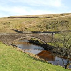
High Seat, Mountain summit in Yorkshire Dales, United Kingdom.
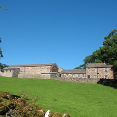
High Seat is a mountain summit in the Yorkshire Dales offering expansive views across the national park. Stone paths wind through grassland dotted with limestone formations that define the landscape.
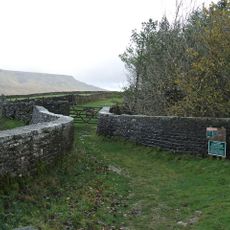
Local shepherds carved out the first routes to this summit during the 1800s to move sheep between seasonal grazing lands. These historical paths form the basis for many routes used by walkers and runners today.
The summit serves as a gathering point for fell runners who participate in annual competitions connecting multiple peaks across the Yorkshire Dales. These events are woven into the local sports culture of the region.
Weather can change rapidly on the exposed summit, so bring water, maps, and warm layers for any season. Little shelter is available at the top, making it wise to plan for sudden shifts in conditions.
The summit features rare limestone pavement with specialized plant species adapted to survive in the rock cracks. These hardy plants have evolved to thrive in the harsh conditions found at this elevation.
GPS coordinates: 54.40631,-2.30649
Latest update: December 14, 2025 09:46
Pendragon Castle
2.4 km
Nine Standards Rigg
5.6 km
Wild Boar Fell
5 km
Hartley Castle
7.3 km
Great Shunner Fell
6.1 km
Wharton Hall
5.8 km
St Stephen's Church, Kirkby Stephen
8 kmDevil's Grinding Mill
6.9 km
Stainmore Railway Company
7.1 km
Milestone 150 Yards North East Of Methodist Chapel (Ngr 724 995)
8 km
Lammerside Castle
4.6 km
Ravenseat Packhorse Bridge
6.4 km
Bridge Approximately 200 Metres East Of Firs Farmhouse
6.2 km
Kirkby Stephen War Memorial
8 km
Frank's Bridge
7.9 km
Hell Gill Bridge
4.7 km
Merrygill Viaduct
7.3 km
Ais Gill Viaduct
4.7 km
Milestone Opposite Tarn House (At Ngr Ny 749 034)
5.7 km
Stone Approximately 75 Metres South Of North Yorkshire-Cumbria Boundary
2.9 km
Boundary Stone To East Of White Brackens House (Nateby Parish)
4.2 km
Bridge Approximately 30 Metres East Of Stone House
5.7 km
Boundary Stone At Hollow Mill Cross
3 km
Milestone 850 Yards To North East Of Studfold (At Ngr 734 007)
6.8 km
Pod Gill Viaduct
7 km
Milestone, ½ mile N of Moorcock Inn
8 km
Milestone, Wharton Fell, a mile S of jct with A685
5.4 km
Milestone, Nateby, N of Kirkby Stephen station
6.9 kmVisited this place? Tap the stars to rate it and share your experience / photos with the community! Try now! You can cancel it anytime.
Discover hidden gems everywhere you go!
From secret cafés to breathtaking viewpoints, skip the crowded tourist spots and find places that match your style. Our app makes it easy with voice search, smart filtering, route optimization, and insider tips from travelers worldwide. Download now for the complete mobile experience.
A unique approach to discovering new places❞
— Le Figaro
All the places worth exploring❞
— France Info
A tailor-made excursion in just a few clicks❞
— 20 Minutes