Dent Head Viaduct
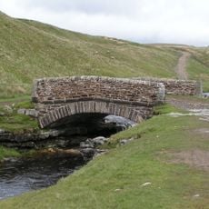
Dent Head Viaduct, Railway viaduct in Dentdale, England
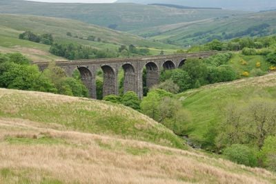
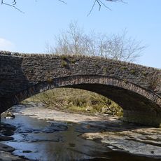
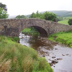
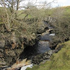
Dent Head Viaduct is a railway crossing in Dentdale with ten limestone arches that span across a mountain stream flowing toward the River Dee. The structure stands as a listed monument with typical Victorian railway engineering features.
The Midland Railway Company built this viaduct between 1869 and 1875 as a significant engineering challenge due to heavy rainfall in the region. The construction took longer than planned and demonstrates the determination of engineers to complete the project in difficult terrain.
The structure reflects Victorian railway engineering and uses blue limestone from the surrounding Yorkshire Dales that was quarried locally. These stones give the viaduct its distinctive appearance that blends with the moorland around it.
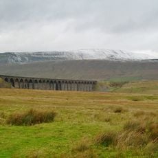
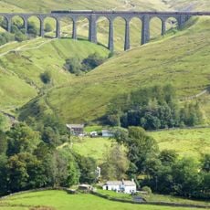
Several vantage points near the structure offer good views from different angles to observe the viaduct in full. The best times to visit and photograph are on clear days when the stonework and surrounding moorland are most visible.
The viaduct curves slightly eastward to follow the natural shape of Woldfell and adapt to the challenging landscape. This adjustment to the landform shows how engineers carefully planned to work with the difficult terrain rather than against it.
Location: Dent
GPS coordinates: 54.25400,-2.34200
Latest update: December 12, 2025 12:02
Ribblehead Viaduct
5.2 km
Whernside
4.9 km
Arten Gill viaduct
1.6 km
Great Knoutberry Hill
3 km
St John the Evangelist's Church, Cowgill
3.4 km
Church of St John the Baptist
6.1 km
Sportsmans Inn
2.2 km
Ling Ghyll Bridge
5.9 km
Ewegales Bridge
3.4 km
Widdale Bridge
6 km
Dandra Garth
5.9 km
Milestone
4.1 km
Passenger Waiting Room On East Side Of Railway Track At Dent Station
3.5 km
Gibbs Hall
4.8 km
Milestone (Sedbergh 8) Approximately 200 Metres East Of Broadfield Lane On South Side Of Road
4.3 km
MILESTONE
6.2 km
Boundary Stone
1.5 km
Milestone (Sedbergh 7) Approximately 170 Metres West Of Sundial Cottage
5.7 km
Milestone
2.1 km
Milestone
4.9 km
Milestone (Sedbergh 11) Opposite Small Barn At Studley Garth (Not Included)
605 m
Footbridge Over Thorn Gill (At Ngr 777794)
4.9 km
Milestone (Sedbergh 6) Approximately 75 Metres West Of Kirk Bridge
6.3 km
Milestone (Sedbergh 7) Approximately 10 Metres West Of East Little Town
5.9 km
Milestone
3.1 km
Milestone, just N of West/North Ridings boundary
2.2 km
Milestone (Sedbergh 10) Approximately 120 Metres South East Of Sportsmans Inn
2.2 km
Milestone (Sedbergh 9) On South Side Of Road Approximately 50 Metres South West Of Cowgill Bridge
3.4 kmVisited this place? Tap the stars to rate it and share your experience / photos with the community! Try now! You can cancel it anytime.
Discover hidden gems everywhere you go!
From secret cafés to breathtaking viewpoints, skip the crowded tourist spots and find places that match your style. Our app makes it easy with voice search, smart filtering, route optimization, and insider tips from travelers worldwide. Download now for the complete mobile experience.
A unique approach to discovering new places❞
— Le Figaro
All the places worth exploring❞
— France Info
A tailor-made excursion in just a few clicks❞
— 20 Minutes