Enable Location

We need your location to show you interesting places around you

Discover nearby places

Find interesting locations and hidden gems around you

Precise directions

Get accurate directions and distances to places

Your location is never shared with other users. It's only used when you tap the location button.

Mission Reach Paddling Trail Access Point

Log in to your account

Start exploring — it's free

Trusted by 64,042 travelers worldwide

Continue with Google
Continue with Apple
or

We will send you a code to connect

By continuing, you accept our Terms and Conditions and our Privacy Policy

Check your inbox

We've sent a pincode in your inbox. Please enter the code below.

Mission Reach Paddling Trail Access Point
Discussion Reviews 1 Photos 1 Collections
4 Popularity

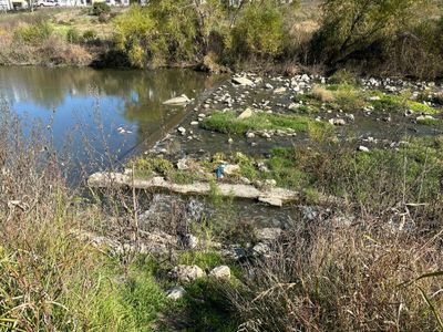
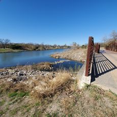
Mission Reach Paddling Trail Access Point, Recreational paddling trail south of San Antonio, United States.

The Mission Reach Paddling Trail is a paddling route that stretches several miles south of San Antonio along the San Antonio River with multiple launch points marked by blue poles. The route passes through restored riparian areas and flows by historic mission sites.

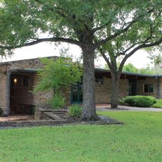
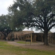
The waterway connects to the history of the San Antonio Missions, founded by Spanish settlers and designated as a UNESCO World Heritage Site in 2015. This recognition led to the restoration of riparian areas and the creation of today's paddling trail.

The waterway passes by several mission sites while flowing through habitats with native Texas plants and animals that have been restored over time. Visitors encounter wildlife like herons and fish as they travel through these renewed shoreline areas.

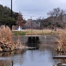
Paddlers should take time to locate all entry points and plan their route, as dams are found along the way. At Espada Dam, carrying your watercraft is needed to rejoin the trail below.

Davis Lake is one of only a few places in San Antonio where stand-up paddle boarding is allowed on the river. Visitors can try this different water sport in a location where most other sections restrict it.

The community of curious travelers

AroundUs brings together thousands of curated places, local tips, and hidden gems, enriched daily by 60,000 contributors worldwide.

Start exploring
Address
927 VFW Blvd, San Antonio, TX 78223
GPS coordinates
29.36991,-98.47548
Latest update
December 6, 2025 19:10
Instagrammable spots to visit in San Antonio

San Antonio offers many places to photograph that show the city's history and culture. The Alamo is a former mission known for its colonial architecture. The River Walk winds through downtown with restaurants and bridges that reflect in the water. The Pearl District shows modern reuse of historic...

Reviews
Share your experience

No review yet

Discussions
Start a discussion...

No discussion yet

« Mission Reach Paddling Trail Access Point - Recreational paddling trail south of San Antonio, United States » is provided by Around Us (aroundus.com). Images and texts are derived from Wikimedia project under a Creative Commons license. You are allowed to copy, distribute, and modify copies of this page, under the conditions set by the license, as long as this note is clearly visible.

Discover hidden gems everywhere you go!

From secret cafés to breathtaking viewpoints, skip the crowded tourist spots and find places that match your style. Our app makes it easy with voice search, smart filtering, route optimization, and insider tips from travelers worldwide. Download now for the complete mobile experience.

Around Us App Screenshot

A unique approach to discovering new places

Le Figaro

All the places worth exploring

France Info

A tailor-made excursion in just a few clicks

20 Minutes

Around Us
Travel Guide & Maps
Download

Send to your phone

QR Code
1

Open the camera app on your mobile.

2

Point at the QR code with your camera. A notification will appear.

3

Tap the notification to open the link.