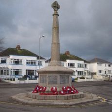
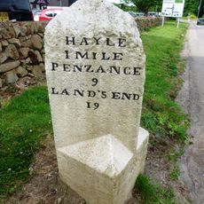
Upton Towans
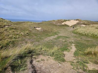
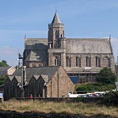
Upton Towans is a dune and grassland area in Cornwall north of Hayle with about 3 miles of beach on the east side of St Ives Bay. The site has wide sandy areas, soft dunes covered with wild grasses and shrubs, and natural features shaped by wind and sea.
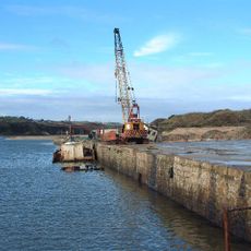
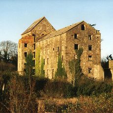
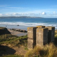
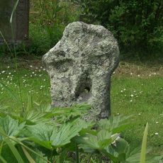
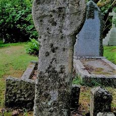
The site was once home to the National Explosives Works, where dynamite was manufactured in the early 20th century, including work done by women factory workers. Industrial remnants like carts and pipes remain scattered across the dunes, now reclaimed by nature.
The name 'Towans' comes from the Cornish language and refers to the sand dunes that have shaped coastal life for generations. The dunes are used today as a natural space where locals and visitors come to walk, relax, and connect with the landscape.
The location is easily reached by car or public transport from nearby towns like Hayle, with parking available close to the beach. The walking route through the dunes is moderate in difficulty and requires sturdy footwear due to uneven ground; bring drinking water as there are no sources along the way.
Adders, a native snake species, can sometimes be spotted sunbathing on the warm sand during summer months, offering a rare wildlife encounter. This hidden natural feature makes exploration of the dunes an unexpectedly rich experience for those paying attention.
Location: Cornwall
Address: Upton Towans Beach, S W Coast Path, Gwithian, Hayle TR27 5BT, UK
Phone: +441872261735
Website: https://visitcornwall.com/beaches/west-cornwall/camborne/gwithian-towans-beach
GPS coordinates: 50.21204,-5.40071
Latest update: January 8, 2026 16:38
Godrevy Lighthouse
3.4 km
The Bucket of Blood
2.1 km
Angarrack Viaduct
2.4 km
St Elwyn's Church, Hayle
3.1 km
St Gothian's Church, Gwithian
1.6 km
St Felicitas and St Piala's Church, Phillack
2 km
Hayle Harbour
3.4 km
The Royal Standard Inn, 61, Including No. 62 And Adjoining Boundary Stone
3.1 km
Loggan's Mill
1.6 km
The War Memorial
2.8 km
The Cornubia Tavern
2.5 km
Milestone At Sw601391
2.9 km
Hayle Viaduct
3.4 km
Milestone At Sw577386
1.6 km
National Explosives
162 m
Churchyard Wall Parallel To North Of Church And Gateways North Of Church Of Saint Winnear
3.5 km
Milestone At Sw587384
2.1 km
Carnsew Gallery
3.2 km
Milestone At Sw564378
2.6 km
Cross At Approximately 4 Metres South West Of Tower
2 km
Cross At Approximately 15 Metres North Of Tower Of Church Of Saint Winnear
3.5 km
Milestone At Roseworthy Hill On Former A30
3.5 km
Milestone At Sw 57339 37649
2.6 km
Milestone At Connor Downs
2.1 km
Cross At Approximately 6 Metres North Of Church Of Saint Winnear
3.5 km
The Passmore Edwards Institute
2.9 km
Guilford viaduct
2.4 km
Bridge And Boundary Stone At Sw5687 3830
2 kmVisited this place? Tap the stars to rate it and share your experience / photos with the community! Try now! You can cancel it anytime.
Discover hidden gems everywhere you go!
From secret cafés to breathtaking viewpoints, skip the crowded tourist spots and find places that match your style. Our app makes it easy with voice search, smart filtering, route optimization, and insider tips from travelers worldwide. Download now for the complete mobile experience.
A unique approach to discovering new places❞
— Le Figaro
All the places worth exploring❞
— France Info
A tailor-made excursion in just a few clicks❞
— 20 Minutes