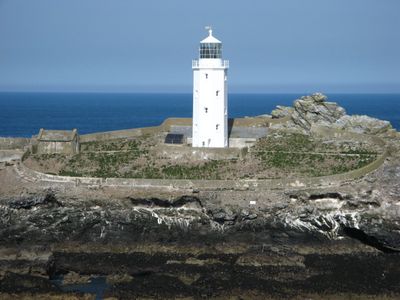
Godrevy Lighthouse, Maritime lighthouse in St Ives Bay, Cornwall
Godrevy Lighthouse is a white octagonal tower standing 26 meters tall on an island about 300 meters from the Cornwall mainland. The structure marks the dangerous Stones reef and now operates on solar power, with its main light relocated to a steel platform in 2012.
Construction of the lighthouse followed the 1854 wreck of the steamer Nile, prompted by petitions from local seaman Richard Short to Trinity House. The tower was built in direct response to this maritime disaster and the recognized danger posed by the reef.
The lighthouse inspired Virginia Woolf's novel 'To the Lighthouse' following her 1892 visit to the Cornwall coast. The book brought the location wider attention beyond its maritime role and continues to draw visitors curious about this literary connection.
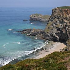
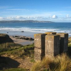
The island is visible from the mainland and accessible on foot at low tide, though you should check tide tables before visiting. The location sits in St Ives Bay with good access options from nearby coastal paths.
Three lighthouse keepers maintained the beacon manually until 1934, when automation took over and the original fog bell fell silent. This shift to automated lighting marked a major turning point in how this stretch of coast was protected.
Location: Gwinear-Gwithian
Inception: March 1, 1859
Architects: James Walker
Height: 26 m
GPS coordinates: 50.24249,-5.40022
Latest update: December 7, 2025 20:41
The Bucket of Blood
5.3 km
Angarrack Viaduct
5.6 km
St Elwyn's Church, Hayle
6.3 km
Godrevy Head to St Agnes
5.8 km
Church of Saint Winnear
6.5 km
St Gothian's Church, Gwithian
2.5 km
St Felicitas and St Piala's Church, Phillack
5.3 km
Upton Towans
3.4 km
The Royal Standard Inn, 61, Including No. 62 And Adjoining Boundary Stone
6.3 km
Loggan's Mill
5 km
The War Memorial
6.1 km
The Cornubia Tavern
5.8 km
Milestone At Sw577386
4.9 km
National Explosives
3.5 km
Milestone At Sw601391
5.1 km
Milestone At Sw564378
5.9 km
Milestone At Sw587384
5.3 km
Churchyard Wall Parallel To North Of Church And Gateways North Of Church Of Saint Winnear
6.5 km
Cross At Approximately 4 Metres South West Of Tower
5.3 km
Cross At Approximately 15 Metres North Of Tower Of Church Of Saint Winnear
6.5 km
Cross At Approximately 6 Metres North Of Church Of Saint Winnear
6.5 km
Milestone Approximately 356M North-East Of Merry Meeting Farm
5.9 km
Milestone At Roseworthy Hill On Former A30
5.3 km
Milestone At Sw 57339 37649
6 km
Milestone At Connor Downs
4.7 km
Bridge And Boundary Stone At Sw5687 3830
5.3 km
Guilford viaduct
5.8 km
The Passmore Edwards Institute
6.1 kmVisited this place? Tap the stars to rate it and share your experience / photos with the community! Try now! You can cancel it anytime.
Discover hidden gems everywhere you go!
From secret cafés to breathtaking viewpoints, skip the crowded tourist spots and find places that match your style. Our app makes it easy with voice search, smart filtering, route optimization, and insider tips from travelers worldwide. Download now for the complete mobile experience.
A unique approach to discovering new places❞
— Le Figaro
All the places worth exploring❞
— France Info
A tailor-made excursion in just a few clicks❞
— 20 Minutes