Plage de Vert Bois

Log in to your account

AroundUs is a community-driven map of interesting places, built by curious explorers like you. It grows with every review, story, and photo you share.
Connect to save your favorite spots, contribute locations, and create personalized routes.
By continuing, you accept our Terms and Conditions and our Privacy Policy

Plage de Vert Bois

Add to collection
Map
Suggest a change
Share

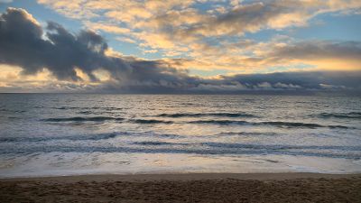
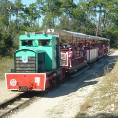
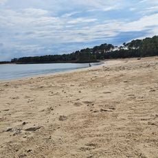
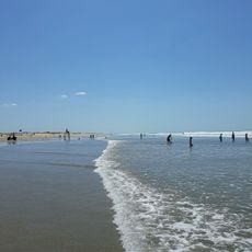
Plage de Vert Bois, Sandy beach in Dolus-d'Oléron, France

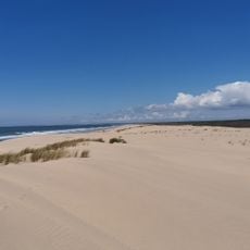
Plage de Vert Bois is a sandy beach stretching several kilometers along the southwest coast of Oléron Island. The shoreline features light golden sand backed by maritime pine forests and meets clear shallow waters ideal for wading.

A major storm in 1999 destroyed the coastal road that once ran alongside this beach, allowing the area to return to its natural state. This reshaping left a lasting mark on the landscape and how people now access and use the shoreline.

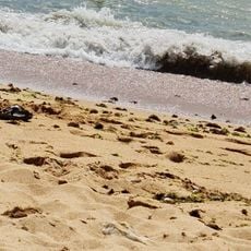
The beach is a gathering place where visitors can observe local residents collecting shellfish and oysters during low tide, a practice that defines the region's way of life. These daily routines continue practices that have shaped the community for generations.

Free parking and public facilities including showers and restrooms are located near the beach entrance. Lifeguards monitor the waters during summer months, making it a safer choice for families and less experienced swimmers.

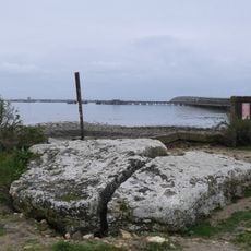
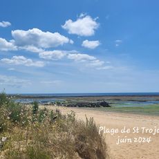
This beach connects seamlessly with Saint-Trojan beach next door, creating an extended shoreline where natural rock formations emerge during low tide. Visitors can walk between the two and explore the exposed rocks as the water recedes.

Location: France métropolitaine

Address: Plage de Vert Bois, France

GPS coordinates: 45.88003,-1.26732

Latest update: December 6, 2025 19:06

Photos
What to see on Oléron Island: tourist sites, historical monuments, and beaches to visit

Oléron Island, the largest island in mainland France after Corsica, features a military, maritime, and natural heritage reflecting its strategic position facing the Atlantic Ocean. This Charente island, connected to the mainland since 1966 by a nearly three-kilometer-long bridge, houses fortifications built under Louis XIV, such as the Citadel of Château d'Oléron and Fort Louvois, as well as the famous Fort Boyard positioned on its sandbank offshore. The Chassiron Lighthouse, standing at forty-six meters high, marks the northern tip of the island and guides ships through the waters of the Pertuis d'Antioche. Beyond its defensive legacy, the island offers various natural areas where sandy beaches, pine forests, and salt marshes alternate. Saint-Trojan-les-Bains extends its wooded shoreline to the south, while Boyardville features a protected coast on its eastern side. Visitors also observe oyster farming along the La Baudissière channel and explore the colorful huts that house artist workshops at the port of Château d'Oléron. The Saltworks Museum traces the history of salt extraction, a resource that shaped the local economy for centuries.

Reviews

Visited this place? Tap the stars to rate it and share your experience / photos with the community! Try now! You can cancel it anytime.

« Plage de Vert Bois - Sandy beach in Dolus-d'Oléron, France » is provided by Around Us (aroundus.com). Images and texts are derived from Wikimedia project under a Creative Commons license. You are allowed to copy, distribute, and modify copies of this page, under the conditions set by the license, as long as this note is clearly visible.

Discover hidden gems everywhere you go!

From secret cafés to breathtaking viewpoints, skip the crowded tourist spots and find places that match your style. Our app makes it easy with voice search, smart filtering, route optimization, and insider tips from travelers worldwide. Download now for the complete mobile experience.

Around Us App Screenshot

A unique approach to discovering new places

Le Figaro

All the places worth exploring

France Info

A tailor-made excursion in just a few clicks

20 Minutes