Enable Location

We need your location to show you interesting places around you

Discover nearby places

Find interesting locations and hidden gems around you

Precise directions

Get accurate directions and distances to places

Your location is never shared with other users. It's only used when you tap the location button.

Oléron Bridge

Log in to your account

Start exploring — it's free

Trusted by 63,045 travelers worldwide

Continue with Google
Continue with Apple
or

We will send you a code to connect

By continuing, you accept our Terms and Conditions and our Privacy Policy

Check your inbox

We've sent a pincode in your inbox. Please enter the code below.

Oléron Bridge
Discussion Reviews 2 Photos 1 Collections
43.4k Popularity

Oléron Bridge, Bridge in Bourcefranc-le-Chapus, France

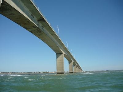
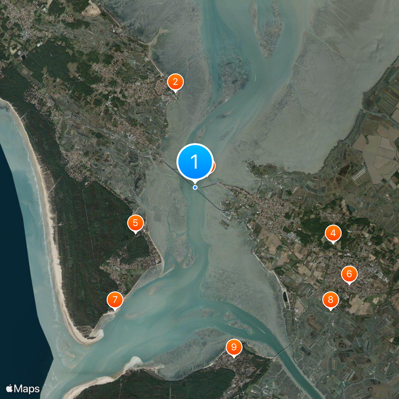
The Oléron Bridge stretches across the Coureau d'Oléron strait between the mainland and Oléron Island, covering a distance of 2,862 meters (around 9,390 feet). It consists of 46 continuous concrete sections arranged in a gentle curve over the water.

The crossing opened on June 21, 1966, and held the record as the longest in France until 1974. That year the Saint-Nazaire crossing overtook it in the ranking of French structures.

The bridge represents a significant connection for the Atlantic coast region, linking the mainland to Oléron, the second-largest French metropolitan island after Corsica.

Inside the hollow deck runs a water pipeline, electrical lines, telephone cables, and fiber optics linking the island to the mainland. Pedestrians and cyclists can cross on separate paths while enjoying views of the coastline.

During assembly of the prestressed beams in the 1960s, construction crews advanced at a rate of eight meters (about 26 feet) per day. This pace was considered a notable technical achievement in bridge construction at the time.

The community of curious travelers

AroundUs brings together thousands of curated places, local tips, and hidden gems, enriched daily by 60,000 contributors worldwide.

Start exploring
Inception
1966
Length
2,862 m
Longest Span
79 m
GPS coordinates
45.85310,-1.18000
Latest update
December 14, 2025 21:01
What to see on Oléron Island: tourist sites, historical monuments, and beaches to visit

Oléron Island, the largest island in mainland France after Corsica, features a military, maritime, and natural heritage reflecting its strategic position facing the Atlantic Ocean. This Charente island, connected to the mainland since 1966 by a nearly three-kilometer-long bridge, houses...

Reviews
Share your experience

No review yet

Discussions
Start a discussion...

No discussion yet

« Oléron Bridge - Bridge in Bourcefranc-le-Chapus, France » is provided by Around Us (aroundus.com). Images and texts are derived from Wikimedia project under a Creative Commons license. You are allowed to copy, distribute, and modify copies of this page, under the conditions set by the license, as long as this note is clearly visible.

Discover hidden gems everywhere you go!

From secret cafés to breathtaking viewpoints, skip the crowded tourist spots and find places that match your style. Our app makes it easy with voice search, smart filtering, route optimization, and insider tips from travelers worldwide. Download now for the complete mobile experience.

Around Us App Screenshot

A unique approach to discovering new places

Le Figaro

All the places worth exploring

France Info

A tailor-made excursion in just a few clicks

20 Minutes

Around Us
Travel Guide & Maps
Download

Send to your phone

QR Code
1

Open the camera app on your mobile.

2

Point at the QR code with your camera. A notification will appear.

3

Tap the notification to open the link.