Arch
Location: Garfield County
GPS coordinates: 38.12876,-111.16194
Latest update: November 23, 2025 22:18
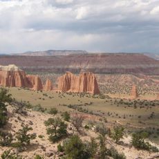
Capitol Reef National Park
7.9 km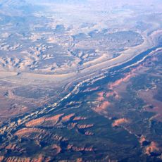
Waterpocket Fold
13.5 km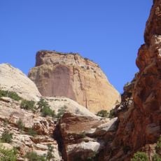
Golden Throne
10.2 km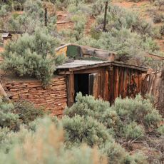
Hanks' Dugouts
5.6 km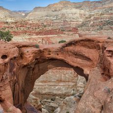
Cassidys Arch
15.7 km
Pioneer Register
9.2 km
Nicks Peak
3.5 km
The Three Brothers
12.7 km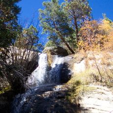
Single Tree Falls
14.8 km
Circle Cliffs
15 km
Twin Peaks
13.4 km
Sheets Gulch Arch
5.7 km
Overlook Waterpocket Fold
14.4 km
Pioneer Register
9.2 km
Burro Wash Arch
8.1 km
Egyptian Temple
10.1 km
Water Tanks
9.5 km
Cassidy Arch
15.7 km
Cottonwood Seeps
2.9 km
Overlook Capitol Reef NP
14.6 km
Laurel and Hardy Arch
3.4 km
Golden Throne Viewpoint
9.8 km
Scenic viewpoint
11.8 km
Scenic viewpoint
11.8 km
Waterfall
15.7 km
Waterfall
3.8 km
Waterfall
14.9 km
Waterfall
4 kmReviews
Visited this place? Tap the stars to rate it and share your experience / photos with the community! Try now! You can cancel it anytime.
Discover hidden gems everywhere you go!
From secret cafés to breathtaking viewpoints, skip the crowded tourist spots and find places that match your style. Our app makes it easy with voice search, smart filtering, route optimization, and insider tips from travelers worldwide. Download now for the complete mobile experience.

A unique approach to discovering new places❞
— Le Figaro
All the places worth exploring❞
— France Info
A tailor-made excursion in just a few clicks❞
— 20 Minutes