Waterpocket Fold

Log in to your account

AroundUs is a community-driven map of interesting places, built by curious explorers like you. It grows with every review, story, and photo you share.
Connect to save your favorite spots, contribute locations, and create personalized routes.
By continuing, you accept our Terms and Conditions and our Privacy Policy
Add to collection
Map
Suggest a change
Share

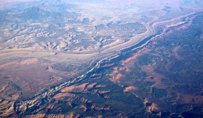
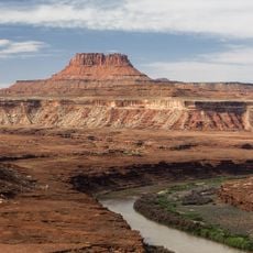
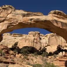
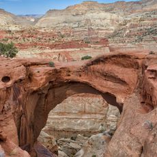
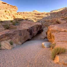
Waterpocket Fold, Monoclinal fold in Capitol Reef National Park, Utah, US.

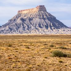
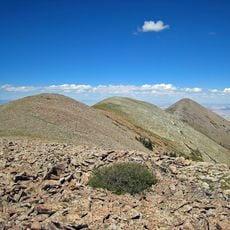
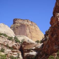
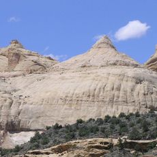
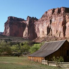
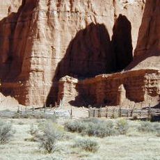
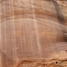
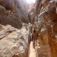
Waterpocket Fold is a massive monoclinal fold running about 100 miles through southern Utah, featuring tilted rock layers that form a dramatic step-like ridge across the desert landscape. The exposed stone walls display varied colors and textures, with numerous natural depressions carved into the sandstone surface.

This geological structure formed roughly 65 million years ago during the Laramide Orogeny, when powerful tectonic forces reshaped the western North American landscape. The same geological processes that created this fold also shaped the surrounding regions, leaving a lasting mark on the terrain.

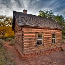
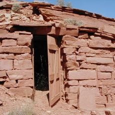
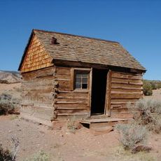
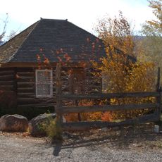
Native American tribes utilized the natural water pockets along the fold's surface for sustenance and navigation through the desert environment over many centuries.

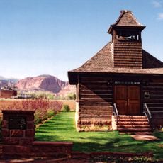
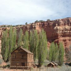
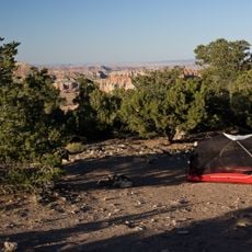
Access the fold via Utah State Route 24 or Notom Road, with several viewpoints providing different perspectives of the rock formations. Bring plenty of water in the hot season and wear sturdy shoes, as unpaved roads and hiking trails can be rough and exposed.

The scattered water pockets in the sandstone collect and hold rainwater, providing vital water sources for desert wildlife including bighorn sheep and numerous bird species. These natural reservoirs allow animals to survive in this otherwise extremely arid environment.

Location: Wayne County

Elevation above the sea: 1,989 m

GPS coordinates: 38.24998,-111.16739

Latest update: December 10, 2025 15:55

Photos
Around this place
Show the full map
Fishlake National Forest
United States of America

Fishlake National Forest

85.8 km
Anasazi State Park Museum
United States of America

Anasazi State Park Museum

43.9 km
Factory Butte
United States of America

Factory Butte

30.4 km
Mount Ellen
United States of America

Mount Ellen

34.7 km
Golden Throne
United States of America

Golden Throne

3.8 km
Elijah Cutler Behunin Cabin
United States of America

Elijah Cutler Behunin Cabin

3.6 km
Navajo Dome
United States of America

Navajo Dome

7.5 km
Fruita Schoolhouse
United States of America

Fruita Schoolhouse

8.2 km
Hanks' Dugouts
United States of America

Hanks' Dugouts

8.4 km
Fruita Rural Historic District
United States of America

Fruita Rural Historic District

7.8 km
Torrey Log Church-Schoolhouse
United States of America

Torrey Log Church-Schoolhouse

22.7 km
Ekker Butte
United States of America

Ekker Butte

16.8 km
Cathedral Valley Corral
United States of America

Cathedral Valley Corral

30.6 km
Civilian Conservation Corps Powder Magazine
United States of America

Civilian Conservation Corps Powder Magazine

7.9 km
Hans Peter Nielson Gristmill
United States of America

Hans Peter Nielson Gristmill

30.7 km
Lesley Morrell Line Cabin and Corral
United States of America

Lesley Morrell Line Cabin and Corral

31.2 km
Charles W. and Leah Lee House
United States of America

Charles W. and Leah Lee House

23.3 km
Loa Tithing Office
United States of America

Loa Tithing Office

44.9 km
Hickman Natural Bridge
United States of America

Hickman Natural Bridge

7.3 km
Cassidys Arch
United States of America

Cassidys Arch

5.2 km
Fruita Ranger Station
United States of America

Fruita Ranger Station

9.5 km
Pioneer Register
United States of America

Pioneer Register

4.3 km
Capitol Reef National Park Visitor Center
United States of America

Capitol Reef National Park Visitor Center

9.5 km
Hickman Bridge Trail
United States of America

Hickman Bridge Trail

6.8 km
Little Wild Horse Canyon
United States of America

Little Wild Horse Canyon

39.9 km
Carl’s Critter Garden
United States of America

Carl’s Critter Garden

42.2 km
Cohab Canyon
United States of America

Cohab Canyon

6.9 km
Cathedral Valley Campground
United States of America

Cathedral Valley Campground

30.5 km
Show the full map
Reviews

Visited this place? Tap the stars to rate it and share your experience / photos with the community! Try now! You can cancel it anytime.

« Waterpocket Fold - Monoclinal fold in Capitol Reef National Park, Utah, US » is provided by Around Us (aroundus.com). Images and texts are derived from Wikimedia project under a Creative Commons license. You are allowed to copy, distribute, and modify copies of this page, under the conditions set by the license, as long as this note is clearly visible.

Discover hidden gems everywhere you go!

From secret cafés to breathtaking viewpoints, skip the crowded tourist spots and find places that match your style. Our app makes it easy with voice search, smart filtering, route optimization, and insider tips from travelers worldwide. Download now for the complete mobile experience.

Around Us App Screenshot

A unique approach to discovering new places

Le Figaro

All the places worth exploring

France Info

A tailor-made excursion in just a few clicks

20 Minutes