Fishlake National Forest

Log in to your account

AroundUs is a community-driven map of interesting places, built by curious explorers like you. It grows with every review, story, and photo you share.
Connect to save your favorite spots, contribute locations, and create personalized routes.
By continuing, you accept our Terms and Conditions and our Privacy Policy
Add to collection
Map
Suggest a change
Share

Fishlake National Forest, National forest and nature reserve in Utah, United States.

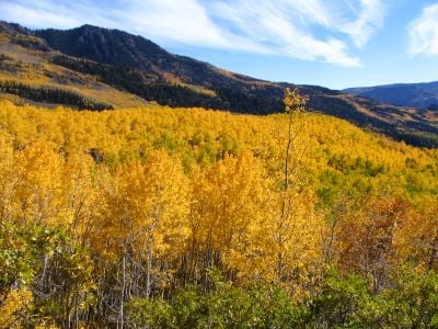
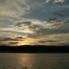
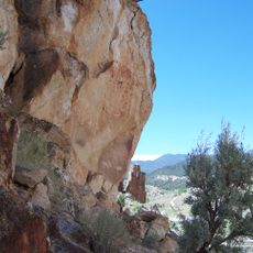
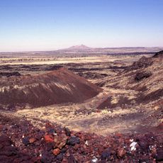
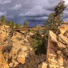
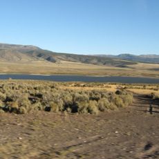
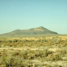
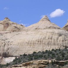
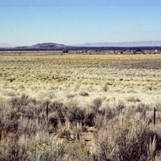
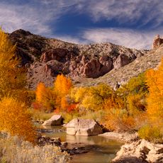
Fishlake National Forest spreads across a large area of mountains, lakes, and forests spanning several counties in central Utah. The landscape includes diverse terrain with dense woods, open meadows, and multiple bodies of water at varying elevations.

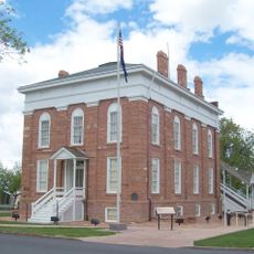
The forest was established in 1907 through the combination of two earlier forest reserves. This merger created the large connected forest area that visitors explore today.

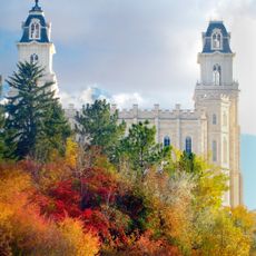
Several Native American tribes made their home here for thousands of years, and their presence is still visible through archaeological sites scattered throughout the area. Walking through the forest, you might notice these historical markers that tell stories of the people who came before.

The forest offers several campgrounds, hiking and horseback riding trails, and lakes for fishing and boating activities. Spring through fall provides the best conditions for visiting, when most facilities and trails are fully accessible.

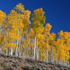
Hidden within the forest is Pando, an enormous colony of aspen trees connected by a single root system. This organism holds the distinction of being the largest living thing on Earth by total weight.

Location: Beaver County

Location: Juab County

Location: Millard County

Location: Piute County

Location: Sevier County

Location: Wayne County

Operator: United States Forest Service

Website: http://fs.usda.gov/fishlake

GPS coordinates: 38.70830,-111.95900

Latest update: December 7, 2025 10:06

Photos
Around this place
Show the full map
Pando
United States of America

Pando

27.2 km
Yuba State Park
United States of America

Yuba State Park

74.9 km
Mystic Hot Springs
United States of America

Mystic Hot Springs

15.5 km
Fremont Indian State Park and Museum
United States of America

Fremont Indian State Park and Museum

35.8 km
Utah Territorial Statehouse
United States of America

Utah Territorial Statehouse

43 km
Black Rock Desert volcanic field
United States of America

Black Rock Desert volcanic field

55 km
Delano Peak
United States of America

Delano Peak

52.1 km
Hell's Backbone Road
United States of America

Hell's Backbone Road

87.9 km
Otter Creek Reservoir
United States of America

Otter Creek Reservoir

60.2 km
Pahvant Butte
United States of America

Pahvant Butte

69.7 km
Mormon Pioneer National Heritage Area
United States of America

Mormon Pioneer National Heritage Area

68.9 km
Fort Cameron
United States of America

Fort Cameron

73.5 km
Navajo Dome
United States of America

Navajo Dome

78.4 km
Frisco Charcoal Kilns
United States of America

Frisco Charcoal Kilns

38.2 km
Fruita Schoolhouse
United States of America

Fruita Schoolhouse

77.6 km
The Cinders
United States of America

The Cinders

55.2 km
Emery LDS Church
United States of America

Emery LDS Church

66.3 km
Casino Star Theatre
United States of America

Casino Star Theatre

51.1 km
Marysvale Canyon
United States of America

Marysvale Canyon

34.2 km
Piute County Courthouse
United States of America

Piute County Courthouse

57.2 km
Noyes Building
United States of America

Noyes Building

79.6 km
Richfield Carnegie Library
United States of America

Richfield Carnegie Library

12.6 km
Fruita Rural Historic District
United States of America

Fruita Rural Historic District

78.1 km
Canute Peterson House
United States of America

Canute Peterson House

79.7 km
Torrey Log Church-Schoolhouse
United States of America

Torrey Log Church-Schoolhouse

65.4 km
Centerfield School and Meetinghouse
United States of America

Centerfield School and Meetinghouse

47.8 km
Monroe Presbyterian Church
United States of America

Monroe Presbyterian Church

16.3 km
Cathedral Valley Corral
United States of America

Cathedral Valley Corral

58.6 km
Show the full map
Reviews

Visited this place? Tap the stars to rate it and share your experience / photos with the community! Try now! You can cancel it anytime.

« Fishlake National Forest - National forest and nature reserve in Utah, United States » is provided by Around Us (aroundus.com). Images and texts are derived from Wikimedia project under a Creative Commons license. You are allowed to copy, distribute, and modify copies of this page, under the conditions set by the license, as long as this note is clearly visible.

Discover hidden gems everywhere you go!

From secret cafés to breathtaking viewpoints, skip the crowded tourist spots and find places that match your style. Our app makes it easy with voice search, smart filtering, route optimization, and insider tips from travelers worldwide. Download now for the complete mobile experience.

Around Us App Screenshot

A unique approach to discovering new places

Le Figaro

All the places worth exploring

France Info

A tailor-made excursion in just a few clicks

20 Minutes