Enable Location

We need your location to show you interesting places around you

Discover nearby places

Find interesting locations and hidden gems around you

Precise directions

Get accurate directions and distances to places

Your location is never shared with other users. It's only used when you tap the location button.

Otter Creek Reservoir

Log in to your account

Start exploring — it's free

Trusted by 62,474 travelers worldwide

Continue with Google
Continue with Apple
or

We will send you a code to connect

By continuing, you accept our Terms and Conditions and our Privacy Policy

Check your inbox

We've sent a pincode in your inbox. Please enter the code below.

Otter Creek Reservoir

Otter Creek Reservoir, high alpine reservoir in Piute County, Utah, United States

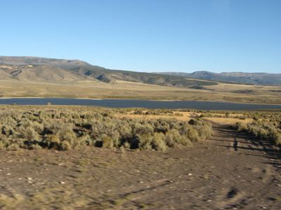
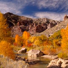
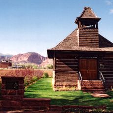
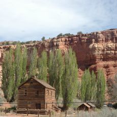
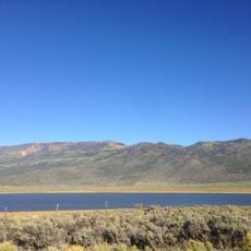
Otter Creek Reservoir is a large body of water in Piute County, Utah, surrounded by mountains and open flatlands. The lake offers clear water for fishing, boating, and camping, with several accessible points along the shoreline including developed facilities at the state park on the southern end.

The dam was built in 1897 by Mormon farmers to irrigate their crops and is one of Utah's oldest dams. The state park on the southern shore was established in 1965 and has become a popular recreation destination.

The reservoir lies west of Antimony and is accessed via a dirt road, with the state park offering better parking and developed amenities. Visitors should note that primitive camping areas lack running water, so bringing your own drinking water is necessary.

The lake is stocked with fish including rainbow trout that grow quickly under good conditions, with larger catches reaching four to eight pounds. The site is also an important stop on the Pacific Migratory Bird Flyway, especially in spring and fall, when birdwatchers can observe numerous species passing through.

The community of curious travelers

AroundUs brings together thousands of curated places, local tips, and hidden gems, enriched daily by 60,000 contributors worldwide.

Start exploring
Location
Elevation above the sea
1,944 m
GPS coordinates
38.16944,-112.02250
Latest update
February 9, 2026 08:23
Around this place
Pando
United States of America

Pando

46.2 km
Fishlake National Forest
United States of America

Fishlake National Forest

60.2 km
Dixie National Forest
United States of America

Dixie National Forest

39.7 km
Mystic Hot Springs
United States of America

Mystic Hot Springs

52.3 km
Fremont Indian State Park and Museum
United States of America

Fremont Indian State Park and Museum

53 km
Delano Peak
United States of America

Delano Peak

37.7 km
Hell's Backbone Road
United States of America

Hell's Backbone Road

43.2 km
Box-Death Hollow Wilderness
United States of America

Box-Death Hollow Wilderness

46 km
Red Canyon
United States of America

Red Canyon

53.8 km
Fort Cameron
United States of America

Fort Cameron

52 km
Frisco Charcoal Kilns
United States of America

Frisco Charcoal Kilns

38.6 km
Marysvale Canyon
United States of America

Marysvale Canyon

44.2 km
Piute County Courthouse
United States of America

Piute County Courthouse

18.9 km
Torrey Log Church-Schoolhouse
United States of America

Torrey Log Church-Schoolhouse

54.7 km
Monroe Presbyterian Church
United States of America

Monroe Presbyterian Church

52.4 km
Hans Peter Nielson Gristmill
United States of America

Hans Peter Nielson Gristmill

47.3 km
Panguitch Historic District
United States of America

Panguitch Historic District

53 km
Charles W. and Leah Lee House
United States of America

Charles W. and Leah Lee House

54.2 km
John and Ella Morrill House
United States of America

John and Ella Morrill House

18.9 km
Loa Tithing Office
United States of America

Loa Tithing Office

42 km
Soren Simonsen House
United States of America

Soren Simonsen House

52.5 km
William Burt House
United States of America

William Burt House

54.5 km
Monroe City Hall
United States of America

Monroe City Hall

52.3 km
Bryce Wildlife Adventure
United States of America

Bryce Wildlife Adventure

54.4 km
Red Canyon Arch
United States of America

Red Canyon Arch

53.5 km
Koosharem Reservoir
United States of America

Koosharem Reservoir

50.5 km
Bullion Canyon
United States of America

Bullion Canyon

36.8 km
Casto Canyon
United States of America

Casto Canyon

50.7 km
Show the full map
« Otter Creek Reservoir - high alpine reservoir in Piute County, Utah, United States » is provided by Around Us (aroundus.com). Images and texts are derived from Wikimedia project under a Creative Commons license. You are allowed to copy, distribute, and modify copies of this page, under the conditions set by the license, as long as this note is clearly visible.

Discover hidden gems everywhere you go!

From secret cafés to breathtaking viewpoints, skip the crowded tourist spots and find places that match your style. Our app makes it easy with voice search, smart filtering, route optimization, and insider tips from travelers worldwide. Download now for the complete mobile experience.

Around Us App Screenshot

A unique approach to discovering new places

Le Figaro

All the places worth exploring

France Info

A tailor-made excursion in just a few clicks

20 Minutes

Around Us
Travel Guide & Maps
Download

Send to your phone

QR Code
1

Open the camera app on your mobile.

2

Point at the QR code with your camera. A notification will appear.

3

Tap the notification to open the link.