Black Rock Desert volcanic field

Log in to your account

AroundUs is a community-driven map of interesting places, built by curious explorers like you. It grows with every review, story, and photo you share.
Connect to save your favorite spots, contribute locations, and create personalized routes.
Continue with Google
Continue with Apple
Continue with X
Continue with Facebook
Continue with email
By continuing, you accept our Terms and Conditions and our Privacy Policy
Create an account

Black Rock Desert volcanic field

Add to collection
Map
Suggest a change
Share

Black Rock Desert volcanic field, Volcanic field in west-central Utah, US

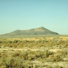
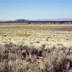
Black Rock Desert volcanic field is a volcanic zone in central Utah featuring cinder cones and lava flows spread across a broad landscape. The area displays multiple types of volcanic formations that developed over millions of years as molten rock reached the surface.

The oldest volcanic eruptions occurred more than 6 million years ago, creating rhyolite lava domes and basalt flows in the northern section. A younger eruptive phase later added more features to the volcanic landscape.

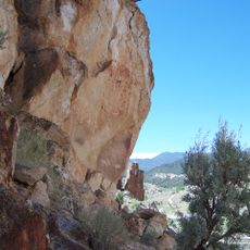
Petroglyphs scattered across the area mark where ancient peoples once traveled near prehistoric lakeshores. These rock carvings remain visible today and show how people lived in and moved through this volcanic terrain.

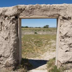
The area can be reached via dirt roads from nearby towns, and visitors should gather information at local ranger stations before heading out. Preparation for desert conditions and navigation tools are helpful when exploring this remote landscape.

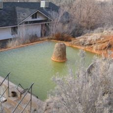
One of Utah's most recent volcanic episodes happened in this area during the medieval period, leaving fresh-looking cinder cones and dark basalt flows across the ground. These comparatively young features stand out from much older volcanic formations nearby.

Location: Utah

GPS coordinates: 38.96667,-112.50000

Latest update: December 11, 2025 11:00

Photos
Around this place
Mystic Hot Springs
United States of America

Mystic Hot Springs

50.2 km
Telescope Array Project
United States of America

Telescope Array Project

51 km
Fremont Indian State Park and Museum
United States of America

Fremont Indian State Park and Museum

45.6 km
Utah Territorial Statehouse
United States of America

Utah Territorial Statehouse

15.1 km
Pahvant Butte
United States of America

Pahvant Butte

18.9 km
Fort Deseret
United States of America

Fort Deseret

35.8 km
The Cinders
United States of America

The Cinders

528 m
Marysvale Canyon
United States of America

Marysvale Canyon

54 km
Richfield Carnegie Library
United States of America

Richfield Carnegie Library

42.4 km
Monroe Presbyterian Church
United States of America

Monroe Presbyterian Church

49.5 km
Edward and Elizabeth Partridge House
United States of America

Edward and Elizabeth Partridge House

14.8 km
Thuesen-Petersen House
United States of America

Thuesen-Petersen House

45.9 km
Scipio Town Hall
United States of America

Scipio Town Hall

46.3 km
Jens Larson Jenson Lime Kiln
United States of America

Jens Larson Jenson Lime Kiln

40.8 km
Martin Johnson House
United States of America

Martin Johnson House

49.9 km
Elsinore White Rock Schoolhouse
United States of America

Elsinore White Rock Schoolhouse

43.7 km
Soren Simonsen House
United States of America

Soren Simonsen House

49.4 km
Peter Quarnberg House
United States of America

Peter Quarnberg House

45.9 km
Kanosh Tithing Office
United States of America

Kanosh Tithing Office

19.1 km
Redmond Town Hall
United States of America

Redmond Town Hall

55.2 km
Monroe City Hall
United States of America

Monroe City Hall

49.6 km
Fillmore American Legion Hall
United States of America

Fillmore American Legion Hall

15.2 km
Peterson–Burr House
United States of America

Peterson–Burr House

55.2 km
Peter and Jessie Huntsman House
United States of America

Peter and Jessie Huntsman House

15 km
Territorial Statehouse State Park Museum
United States of America

Territorial Statehouse State Park Museum

15.1 km
Topaz Museum
United States of America

Topaz Museum

43.4 km
Millard County Courthouse
United States of America

Millard County Courthouse

15.2 km
Great Basin Museum
United States of America

Great Basin Museum

43.4 km
Show the full map
Reviews

Visited this place? Tap the stars to rate it and share your experience / photos with the community! Try now! You can cancel it anytime.

« Black Rock Desert volcanic field - Volcanic field in west-central Utah, US » is provided by Around Us (aroundus.com). Images and texts are derived from Wikimedia project under a Creative Commons license. You are allowed to copy, distribute, and modify copies of this page, under the conditions set by the license, as long as this note is clearly visible.

Discover hidden gems everywhere you go!

From secret cafés to breathtaking viewpoints, skip the crowded tourist spots and find places that match your style. Our app makes it easy with voice search, smart filtering, route optimization, and insider tips from travelers worldwide. Download now for the complete mobile experience.

Around Us App Screenshot

A unique approach to discovering new places

Le Figaro

All the places worth exploring

France Info

A tailor-made excursion in just a few clicks

20 Minutes