Fort Deseret

Log in to your account

AroundUs is a community-driven map of interesting places, built by curious explorers like you. It grows with every review, story, and photo you share.
Connect to save your favorite spots, contribute locations, and create personalized routes.
By continuing, you accept our Terms and Conditions and our Privacy Policy
Add to collection
Map
Suggest a change
Share

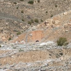
Fort Deseret, Adobe fort in Millard County, Utah.

Fort Deseret is a square adobe fort with two corner bastions designed for defense and equipped with multiple firing ports. The walls rise about 10 feet high and enclose space that once sheltered an entire pioneer community.

Mormon settlers constructed this fort in 1865 during the Black Hawk War when the US Army was preoccupied with the Civil War. It was built as a direct response to conflicts in the region that threatened settler communities.

The fort served as the community center where settlers gathered for protection and social connection. It shows how frontier families built their daily lives around a shared defensive space that was as much about belonging as about safety.

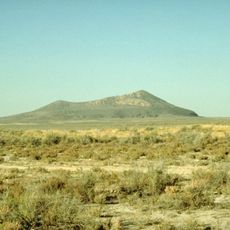
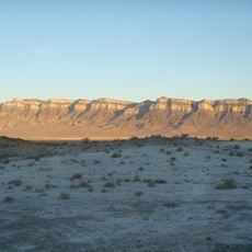
The fort sits about 1 mile south of Deseret town alongside Highway 257 and is straightforward to locate. It operates as an undeveloped state park with minimal facilities, maintained by community volunteers who keep the grounds accessible.

The adobe construction technique used here was uncommon for territorial Utah forts, making it a rare surviving example of this building method. Visitors can still see portions of the original walls, offering a tangible connection to how pioneers adapted local materials for defense.

Location: Utah

GPS coordinates: 39.26500,-112.65361

Latest update: December 14, 2025 11:02

Photos
Around this place
Notch Peak
United States of America

Notch Peak

66.6 km
Topaz Mountain
United States of America

Topaz Mountain

62.8 km
Yuba State Park
United States of America

Yuba State Park

55.4 km
Little Sahara Recreation Area
United States of America

Little Sahara Recreation Area

59.3 km
Telescope Array Project
United States of America

Telescope Array Project

22.3 km
Utah Territorial Statehouse
United States of America

Utah Territorial Statehouse

43.5 km
Black Rock Desert volcanic field
United States of America

Black Rock Desert volcanic field

35.8 km
Baker Hot Springs
United States of America

Baker Hot Springs

39.3 km
Pahvant Butte
United States of America

Pahvant Butte

17.2 km
Fumarole Butte
United States of America

Fumarole Butte

40.2 km
The Cinders
United States of America

The Cinders

36 km
Casino Star Theatre
United States of America

Casino Star Theatre

73.1 km
Swasey Mountain
United States of America

Swasey Mountain

58.7 km
Edward and Elizabeth Partridge House
United States of America

Edward and Elizabeth Partridge House

43.3 km
Thuesen-Petersen House
United States of America

Thuesen-Petersen House

47.5 km
Scipio Town Hall
United States of America

Scipio Town Hall

47.5 km
Jens Larson Jenson Lime Kiln
United States of America

Jens Larson Jenson Lime Kiln

71.9 km
Oberg-Metcalf House
United States of America

Oberg-Metcalf House

73.1 km
Peter Quarnberg House
United States of America

Peter Quarnberg House

47.3 km
Kanosh Tithing Office
United States of America

Kanosh Tithing Office

54.8 km
Fillmore American Legion Hall
United States of America

Fillmore American Legion Hall

43.7 km
Peter and Jessie Huntsman House
United States of America

Peter and Jessie Huntsman House

43.4 km
Territorial Statehouse State Park Museum
United States of America

Territorial Statehouse State Park Museum

43.6 km
Topaz Museum
United States of America

Topaz Museum

11.8 km
Millard County Courthouse
United States of America

Millard County Courthouse

43.6 km
Sevier Bridge Reservoir
United States of America

Sevier Bridge Reservoir

63.9 km
Great Basin Museum
United States of America

Great Basin Museum

11.8 km
Paul Bunyan's Woodpile
United States of America

Paul Bunyan's Woodpile

72.5 km
Show the full map
Reviews

Visited this place? Tap the stars to rate it and share your experience / photos with the community! Try now! You can cancel it anytime.

« Fort Deseret - Adobe fort in Millard County, Utah » is provided by Around Us (aroundus.com). Images and texts are derived from Wikimedia project under a Creative Commons license. You are allowed to copy, distribute, and modify copies of this page, under the conditions set by the license, as long as this note is clearly visible.

Discover hidden gems everywhere you go!

From secret cafés to breathtaking viewpoints, skip the crowded tourist spots and find places that match your style. Our app makes it easy with voice search, smart filtering, route optimization, and insider tips from travelers worldwide. Download now for the complete mobile experience.

Around Us App Screenshot

A unique approach to discovering new places

Le Figaro

All the places worth exploring

France Info

A tailor-made excursion in just a few clicks

20 Minutes