Paul Bunyan's Woodpile, Geological formation in Juab County, United States
Description
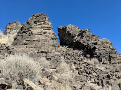
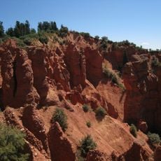
Paul Bunyan's Woodpile is a rock formation near Jericho featuring hexagonal columns arranged in a horizontal pattern across the landscape. The columns formed as ancient lava cooled slowly, creating a distinctive natural structure in the high desert terrain.
History
This rock formation developed around 30 million years ago when magma cooled beneath the surface, creating columnar joints that eventually exposed to weathering. The slow underground cooling process shaped the distinctive pattern visitors see today.
Culture
The Bureau of Land Management maintains this site, allowing visitors to explore the geological formations through established hiking trails.
Practical
The hiking route crosses open desert terrain with minimal shade, so bring plenty of water and sun protection. Sturdy footwear is essential because the ground is rocky and uneven throughout the walk.
Did you know?
The horizontal orientation of the rock columns differs from typical vertical patterns, resulting from specific underground cooling processes.
AroundUs brings together thousands of curated places, local tips, and hidden gems, enriched daily by 60,000 contributors worldwide. Discover all places nearby (Juab County).
Mount Nebo
31 km
Payson Utah Temple
42.1 km
Tintic Standard Reduction Mill
30.9 km
Yuba State Park
43.8 km
Little Sahara Recreation Area
17 km
Mammoth
17.9 km
West Mountain
43.8 km
George Carter Whitmore Mansion
24.8 km
Harker Canyon (Tooele County, Utah)
39.4 km
Edwin Robert Booth House
24.8 km
Juab County Jail
24.8 km
Santaquin Junior High School
37.2 km
Payson Presbyterian Church
44.4 km
David Morgan House
27.3 km
Eureka LDS Church Meetinghouse
21 km
Oscar M. Booth House
24.5 km
Knight Grain Elevator
20.7 km
Eureka Lilly Headframe
21.1 km
Hans Peter Olsen House
44.1 km
Fountain Green Hydroelectric Plant Historic District
42.3 km
Big Canyon
22.6 km
Mount Nebo Wilderness
30.5 km
Camp Maple Dell
42.6 km
Payson Canyon
44.2 km
Devils Kitchen (Juab County, Utah)
36.8 km
Homansville Canyon
23.6 km
Eureka Historic District
21 km
McClellan Lake
44.6 kmDiscover hidden gems everywhere you go!
From secret cafés to breathtaking viewpoints, skip the crowded tourist spots and find places that match your style. Our app makes it easy with voice search, smart filtering, route optimization, and insider tips from travelers worldwide. Download now for the complete mobile experience.
A unique approach to discovering new places❞
— Le Figaro
All the places worth exploring❞
— France Info
A tailor-made excursion in just a few clicks❞
— 20 Minutes