Enable Location

We need your location to show you interesting places around you

Discover nearby places

Find interesting locations and hidden gems around you

Precise directions

Get accurate directions and distances to places

Your location is never shared with other users. It's only used when you tap the location button.

Single Tree Falls

Log in to your account

Join the adventure

Create your free account and start exploring (like 60k+ others)

We will send you a code to connect

or
Continue with Google
Continue with Apple
By continuing, you accept our Terms and Conditions and our Privacy Policy

Check your inbox

We've sent a pincode in your inbox. Please enter the code below.

Single Tree Falls

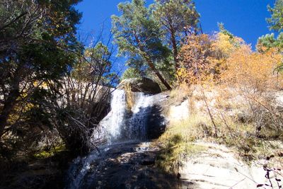
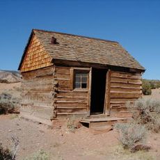
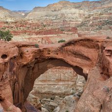
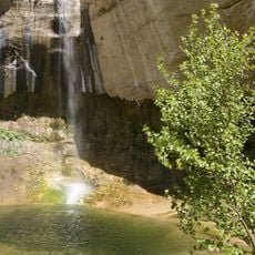
Single Tree Falls, Natural waterfall in Wayne County, Utah

Description

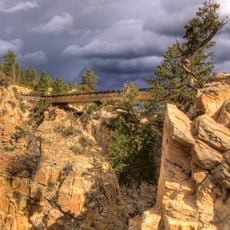
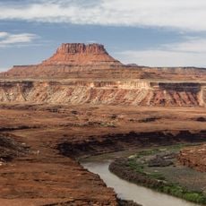
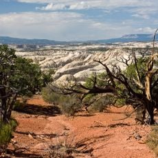
Single Tree Falls is a waterfall in Wayne County that drops over multiple rock tiers, creating different water patterns as it descends. The formation sits within a layered landscape where water moves through stone at varying speeds depending on the season.

History

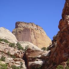
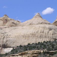
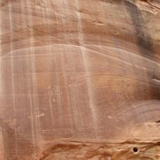
The waterfall developed over millions of years as water slowly carved through rock layers in the desert landscape of Wayne County. This erosion process created the stepped structure that exists today.

Culture

Nature photographers and environmental researchers regularly visit Single Tree Falls to document seasonal changes and water flow patterns in desert environments.

Practical

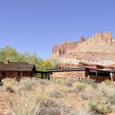
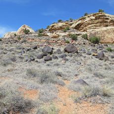
Visitors should wear sturdy shoes since the paths are rocky and can be slippery, and bring plenty of water. There is little natural shade in the area, so sun protection is important, particularly during midday hours.

Did you know?

Water volume changes dramatically between seasons, with spring snowmelt creating powerful flows while winter shows only thin streams. These extreme shifts mean each visit offers a different experience.

Location
GPS coordinates
38.16011,-111.32663
Latest update
December 6, 2025 19:08

AroundUs brings together thousands of curated places, local tips, and hidden gems, enriched daily by 60,000 contributors worldwide. Discover all places nearby (Wayne County).

Natural monuments in Utah: archaeological sites, rock formations, thermal springs

Utah preserves thousands of years of human history alongside some of North America's most varied geological landscapes. The region contains extensive rock art panels and Ancestral Pueblo ruins, including the 13th-century stone structures at Bears Ears National Monument and the 650-plus petroglyphs...

Around this place
Fishlake National Forest
United States of America

Fishlake National Forest

82.2 km
Calf Creek Falls
United States of America

Calf Creek Falls

37.7 km
Anasazi State Park Museum
United States of America

Anasazi State Park Museum

29 km
Hell's Backbone Road
United States of America

Hell's Backbone Road

31.8 km
Golden Throne
United States of America

Golden Throne

14 km
Elijah Cutler Behunin Cabin
United States of America

Elijah Cutler Behunin Cabin

19.3 km
Navajo Dome
United States of America

Navajo Dome

17.7 km
Fruita Schoolhouse
United States of America

Fruita Schoolhouse

15.8 km
Hanks' Dugouts
United States of America

Hanks' Dugouts

12.5 km
Fruita Rural Historic District
United States of America

Fruita Rural Historic District

15.4 km
Torrey Log Church-Schoolhouse
United States of America

Torrey Log Church-Schoolhouse

17.5 km
Ekker Butte
United States of America

Ekker Butte

33.4 km
Cathedral Valley Corral
United States of America

Cathedral Valley Corral

36.2 km
Civilian Conservation Corps Powder Magazine
United States of America

Civilian Conservation Corps Powder Magazine

14.5 km
Hans Peter Nielson Gristmill
United States of America

Hans Peter Nielson Gristmill

23 km
Lesley Morrell Line Cabin and Corral
United States of America

Lesley Morrell Line Cabin and Corral

36.2 km
Charles W. and Leah Lee House
United States of America

Charles W. and Leah Lee House

17.9 km
Hickman Natural Bridge
United States of America

Hickman Natural Bridge

16.5 km
Cassidys Arch
United States of America

Cassidys Arch

14.3 km
Fruita Ranger Station
United States of America

Fruita Ranger Station

15.7 km
Pioneer Register
United States of America

Pioneer Register

15.6 km
Upper Calf Creek Falls
United States of America

Upper Calf Creek Falls

35.3 km
Capitol Reef National Park Visitor Center
United States of America

Capitol Reef National Park Visitor Center

15.7 km
Lower Calf Creek Falls
United States of America

Lower Calf Creek Falls

37.7 km
Hickman Bridge Trail
United States of America

Hickman Bridge Trail

16.7 km
Cohab Canyon
United States of America

Cohab Canyon

16.6 km
Cathedral Valley Campground
United States of America

Cathedral Valley Campground

35.2 km
McGath Point Bench
United States of America

McGath Point Bench

37.1 km
Show the full map
« Single Tree Falls - Natural waterfall in Wayne County, Utah » is provided by Around Us (aroundus.com). Images and texts are derived from Wikimedia project under a Creative Commons license. You are allowed to copy, distribute, and modify copies of this page, under the conditions set by the license, as long as this note is clearly visible.

Discover hidden gems everywhere you go!

From secret cafés to breathtaking viewpoints, skip the crowded tourist spots and find places that match your style. Our app makes it easy with voice search, smart filtering, route optimization, and insider tips from travelers worldwide. Download now for the complete mobile experience.

Around Us App Screenshot

A unique approach to discovering new places

Le Figaro

All the places worth exploring

France Info

A tailor-made excursion in just a few clicks

20 Minutes

Around Us
Travel Guide & Maps
Download

Send to your phone

QR Code
1

Open the camera app on your mobile.

2

Point at the QR code with your camera. A notification will appear.

3

Tap the notification to open the link.