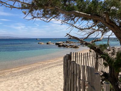
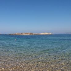
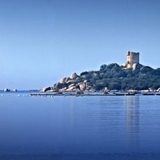
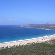
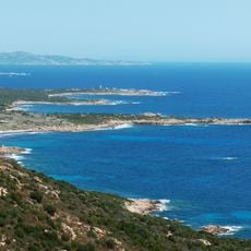
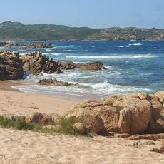
St Jean, Mediterranean beach in Pianottoli-Caldarello, France.
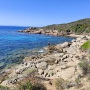
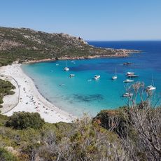
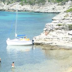
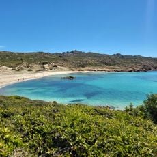
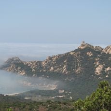
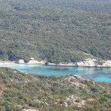
St Jean is a beach on southern Corsica with turquoise water that sits within a large protected marine area. The shoreline features fine sand and is backed by gentle coastal terrain that slopes naturally to the water's edge.
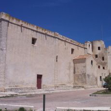
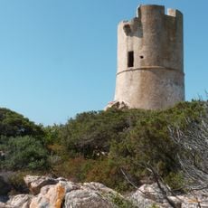
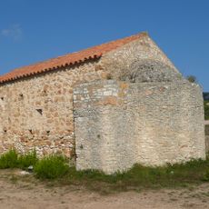
The area has been tied to fishing for many generations, shaping how the local community developed and organized itself around the sea. This maritime heritage remains evident in the way the coast is used today.
The shore brings together visitors and local people who share the space and maintain fishing traditions as part of their daily routine. This blend of tourism and traditional practices shapes how the community relates to the water and the coast.
The beach is easy to reach with free access and nearby parking available for visitors. The shoreline is flat and easy to walk along, making it accessible for families and people of varying abilities.
The beach sits within a protected zone where anchoring is restricted in certain coastal areas to safeguard rare marine life and plants. These rules protect sea stars, noble pen shells, and other species that live on the seafloor.
Location: Pianottoli-Caldarello
Address: 20131 Pianottoli-Caldarello, France
GPS coordinates: 41.46030,9.05028
Latest update: December 6, 2025 19:03
Corsica is a Mediterranean island with a varied landscape that ranges from rocky coastlines to white sand beaches, mountain lakes, and deep canyons. The island combines water in many forms: quiet coves with clear seas, mountain streams flowing through granite rock, and lagoons at sheltered coastal sections. These locations show the geological history of the island, with rock formations shaped by wind and water over thousands of years. Along the coast stand old watchtowers from the time when the island needed protection from attacks by sea, while inland prehistoric sites give evidence of early settlers.From the black pebble beaches on the northern coast to the long sandy beaches in the south, the island offers a range of landscapes. Some beaches lie in remote coves accessible only on foot or by boat, others are found at river mouths where fresh water meets the sea. In the mountains there are waterfalls and clear alpine lakes at elevations over 6000 feet (1800 meters). Roads through the canyons follow river courses and connect the coast to the interior, passing through narrow valleys between steep rock walls.
Plage de Roccapina
10.5 km
Phare de la Madonetta
11.4 km
Plage de la Tonnara
5.9 km
Figari Reservoir
8.2 km
Gouvernail de la Corse
11.8 km
Îlots des Moines
11.8 km
Couvent Saint-François de Bonifacio
11.7 km
Torra di Roccapina
10.9 km
Torra di Caldarellu
814 m
Chapelle San Quilico de Montilati
11.1 km
Torra d'Ulmetu
5.8 km
Chapelle Sainte-Réparata, Bonifacio
10.6 km
Plage du Fazzio
10.4 km
Roccapina Lion
10.5 km
Stagnolo
6.5 km
Tournant de l'Extrême-Sud
9.4 km
Chevanu
1.5 km
Église Saint-Érasme de Bonifacio
11 km
Erbaju beach
11.8 km
Église Saint-François de Bonifacio
11.7 km
Église Saint-Barthélemy de Bonifacio
11.8 km
Scenic viewpoint
9.7 km
Scenic viewpoint
9.5 km
Sdragonato
11.1 km
Figari Beach
2.2 km
Pargan Beach
9.7 km
Murtoli Golf Links
11.2 km
Église de l'Annonciation de Pianottoli-Caldarello
2.9 kmVisited this place? Tap the stars to rate it and share your experience / photos with the community! Try now! You can cancel it anytime.
Discover hidden gems everywhere you go!
From secret cafés to breathtaking viewpoints, skip the crowded tourist spots and find places that match your style. Our app makes it easy with voice search, smart filtering, route optimization, and insider tips from travelers worldwide. Download now for the complete mobile experience.
A unique approach to discovering new places❞
— Le Figaro
All the places worth exploring❞
— France Info
A tailor-made excursion in just a few clicks❞
— 20 Minutes