See the monuments around you in AROpen chests in the app
Around Us is built for your phone — point your camera at the streets and discover the monuments and places around you in augmented reality.Around Us is built for your phone — chests unlock when you walk, explore and capture nearby places.
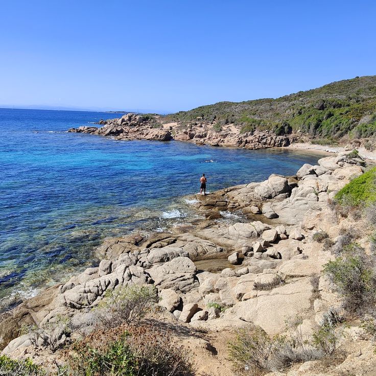
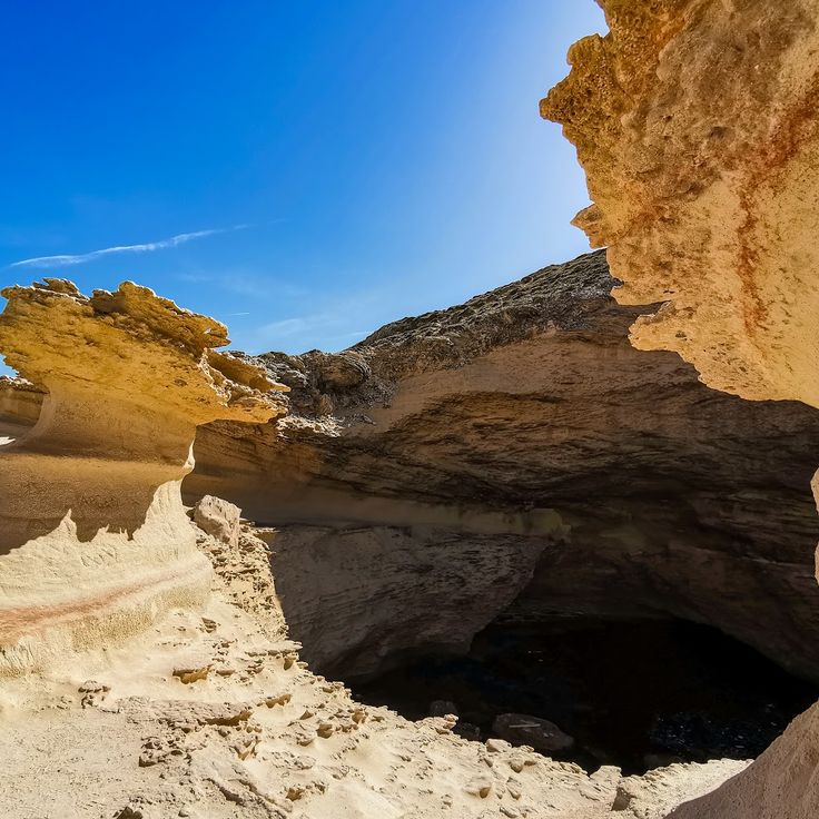
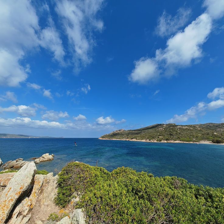
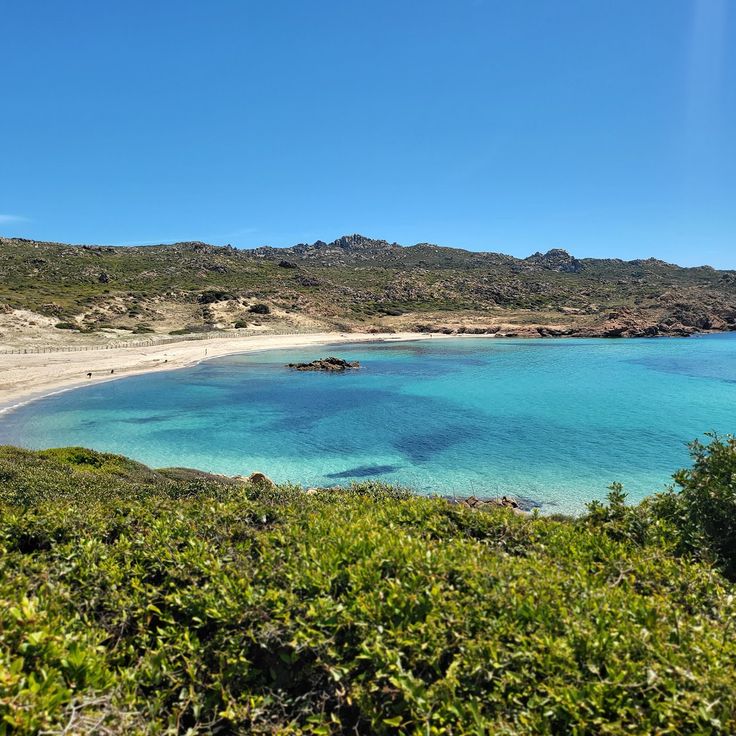
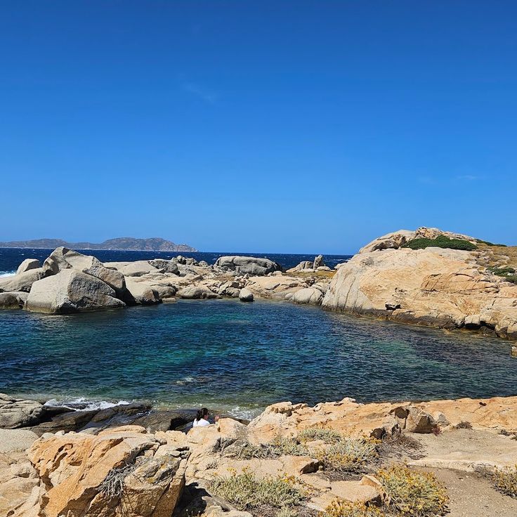
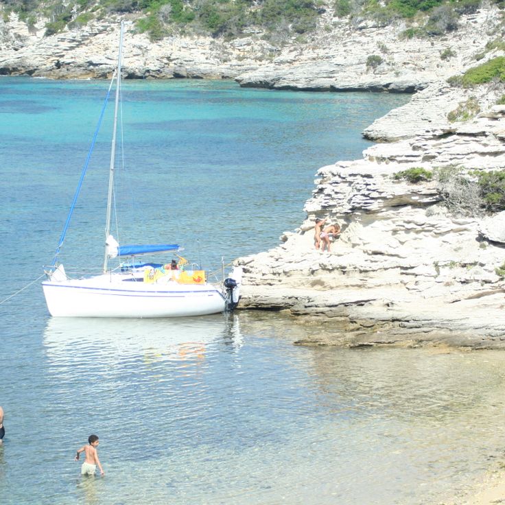
Corsica is a Mediterranean island with varied landscapes ranging from rocky coastlines to white sand beaches, mountain lakes, and deep canyons. The island displays its geological history through rock formations shaped over thousands of years by wind and water. Along the coast stand old watchtowers built when the island needed protection from sea attacks, while inland prehistoric sites show traces of early settlers. From dark pebble beaches on the northern coast to long sandy beaches in the south, the island offers diverse landscapes to explore.
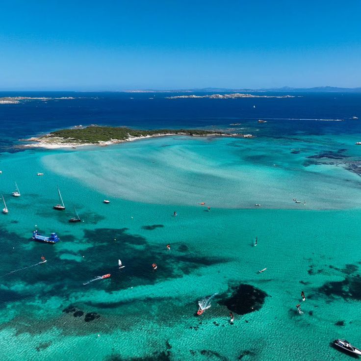
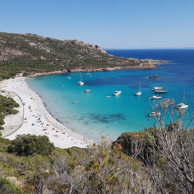
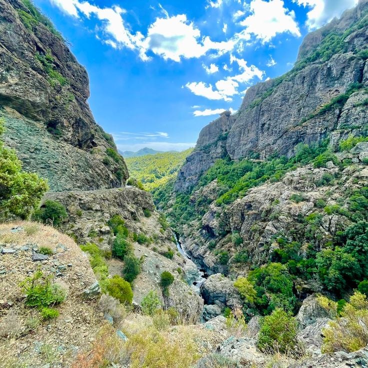
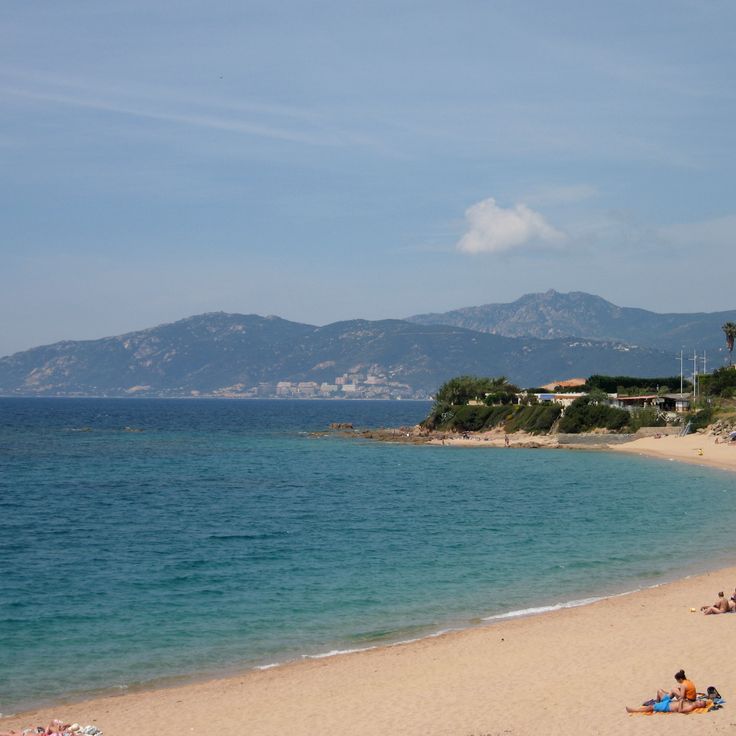
Some beaches sit in remote coves accessible only on foot or by boat. Others lie at river mouths where fresh water meets the sea. In the mountains you find waterfalls and clear alpine lakes at higher elevations. Roads through the canyons follow river courses and connect the coast to the interior, passing through narrow valleys between steep rock walls. Water shapes the landscape in many forms here: quiet coves with clear seas, mountain streams flowing through granite, and lagoons along sheltered coastal sections.
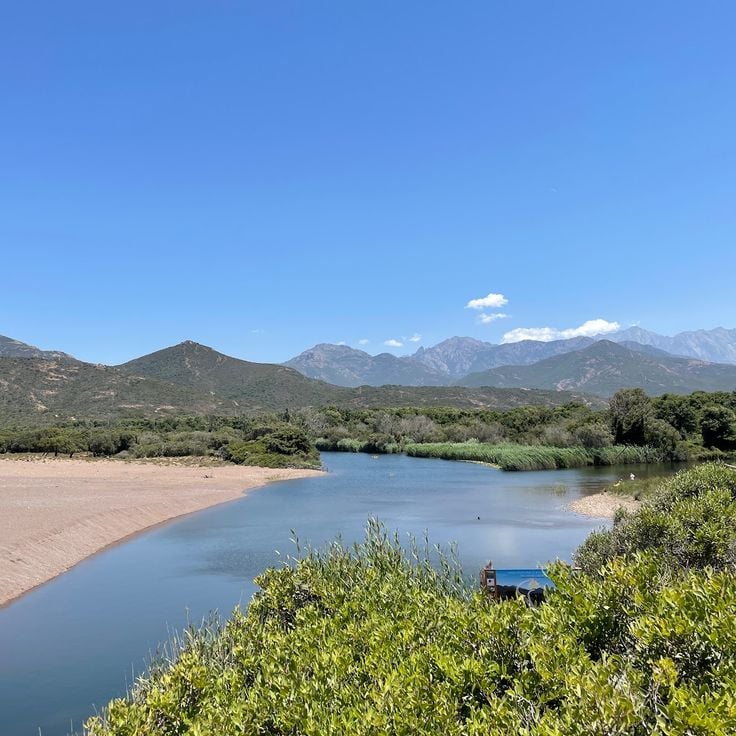
The inland areas and coastal regions connect through these natural waterways and together show the rich natural heritage of Corsica. Places like the sandy beaches of Cala Longa, the dark pebble beaches of Nonza, the waterfalls of Purcaraccia, and mountain lakes like Lac de Capitellu give a sense of the island's different natural environments.
Corsica is a Mediterranean island with varied landscapes ranging from rocky coastlines to white sand beaches, mountain lakes, and deep canyons. The island displays its geological history through rock formations shaped over thousands of years by wind and water. Along the coast stand old watchtowers built when the island needed protection from sea attacks, while inland prehistoric sites show traces of early settlers. From dark pebble beaches on the northern coast to long sandy beaches in the south, the island offers diverse landscapes to explore.
Some beaches sit in remote coves accessible only on foot or by boat. Others lie at river mouths where fresh water meets the sea. In the mountains you find waterfalls and clear alpine lakes at higher elevations. Roads through the canyons follow river courses and connect the coast to the interior, passing through narrow valleys between steep rock walls. Water shapes the landscape in many forms here: quiet coves with clear seas, mountain streams flowing through granite, and lagoons along sheltered coastal sections.
The inland areas and coastal regions connect through these natural waterways and together show the rich natural heritage of Corsica. Places like the sandy beaches of Cala Longa, the dark pebble beaches of Nonza, the waterfalls of Purcaraccia, and mountain lakes like Lac de Capitellu give a sense of the island's different natural environments.
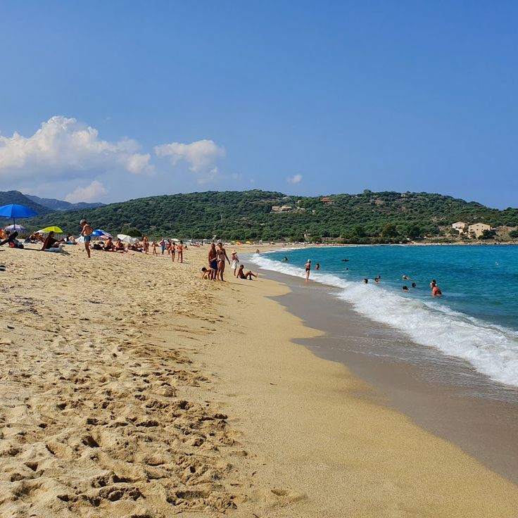
Cala Longa is a remote beach in southern Corsica with clear water, located about 2 hours on foot from the port of Tizzano. The trail passes through Mediterranean scrub and along rocky shoreline until the cove opens up. From here you can see the Senetosa lighthouse on the offshore peninsula. The shore is made of light sand and smooth stones, and the water stays calm even with a light breeze. Those who come here find quiet and largely untouched nature, far from roads and settlements.
Saint Antoine Cave opens in the limestone cliffs near Bonifacio and can be reached by swimming from the sea. The water here is clear enough for snorkeling, and the white rock walls show the geological character of southern Corsica. Light enters through openings in the stone, and the color of the water changes depending on the time of day. Visitors arrive by boat or swim to explore this corner of the coast, where the rock face drops directly into the Mediterranean.
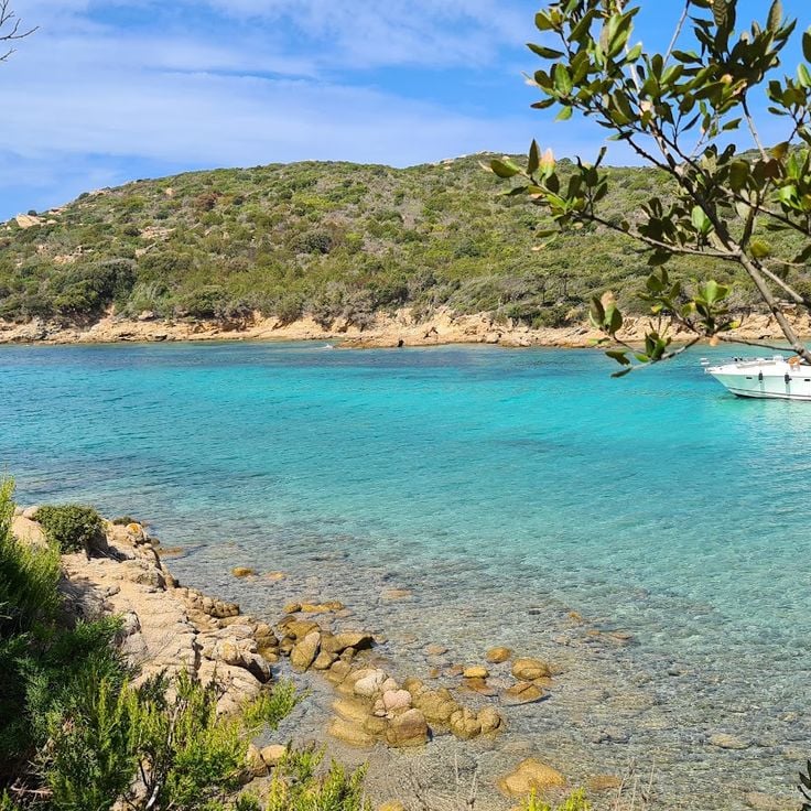
Piantarella Bay is a protected inlet near Bonifacio, situated beside Sperone beach. The shallow turquoise waters are ideal for kayaking, swimming, and windsurfing. The gentle depth allows less experienced swimmers to move with confidence. The clear water shifts through shades of blue, and on calm days the sky reflects on the surface. Small boats rest at anchor while families walk along the sandy shore or gather in the shallow areas. This bay is part of the natural locations of Corsica that reveal the geological heritage of the Mediterranean island, where sandy beaches meet rocky coastlines.
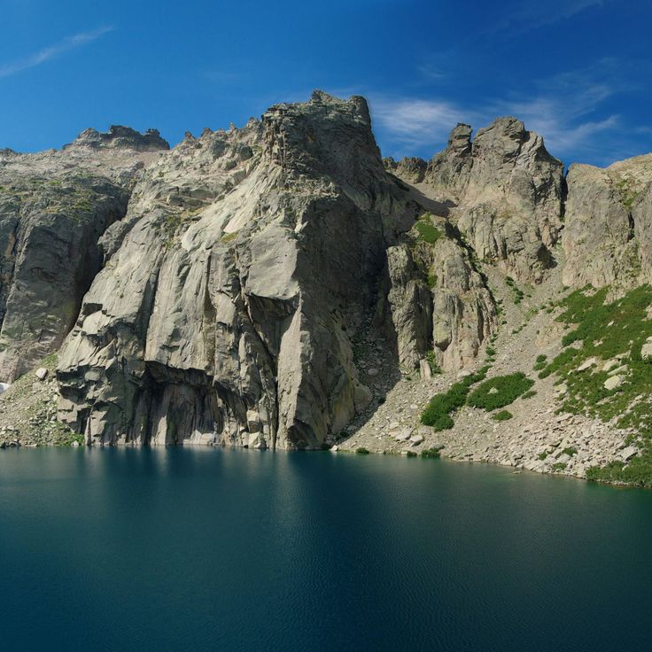
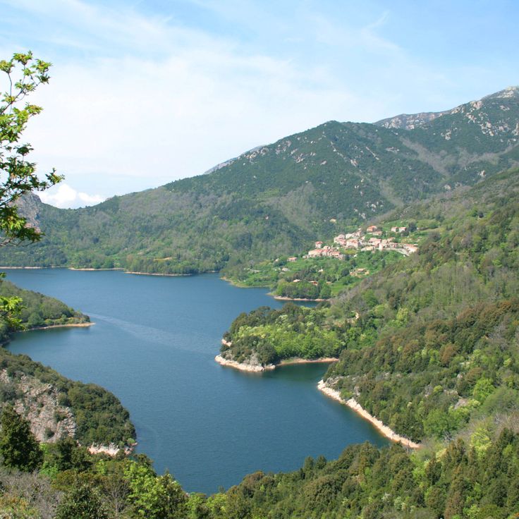
Lake Capitellu is a mountain lake located at 1930 meters in the Restonica valley and serves as the second body of water along a hiking route that passes through granite formations. To reach Lake Capitellu, hikers first follow the path to Lake Melo and then continue their ascent over rocky terrain. The surroundings consist of bare rock, steep slopes, and clear water fed by snowmelt. The trail requires sure footing and good fitness, as it crosses scree and exposed sections. The landscape becomes more barren the higher you climb, with little vegetation and wide views of the Corsican mountains.
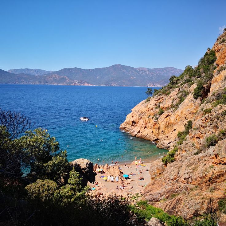
This remote cove with clear waters lies on the southern coast of Corsica and can be reached only by boat or through a coastal trail that takes around two and a half hours, starting from the village of Tizzano. Cala di Conca displays the typical granite formations of the island, and the turquoise sea invites swimming. There are no facilities nearby, so visitors should bring supplies and water. The trail follows the coastline through Mediterranean scrub and offers views of the open sea along the way.
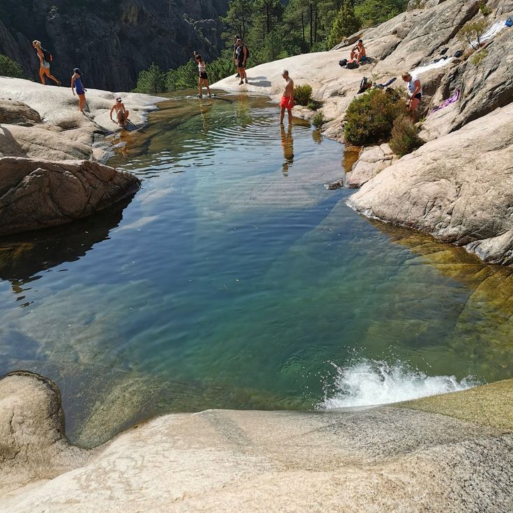
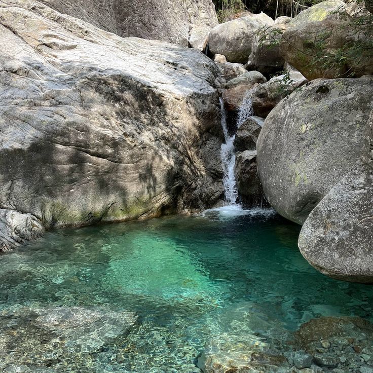
These cascades in the Bavella mountains form a series of natural basins carved from granite rock. Water flows down through several levels and collects in pools of different sizes. The setting shows the typical stone of the Corsican highlands, with smooth rock walls and vegetation adapted to the altitude. Access involves narrow passages between boulders and climbing over slick surfaces. The site lies away from main trails and requires accompaniment by a professional guide, both for safety and to protect the sensitive environment.
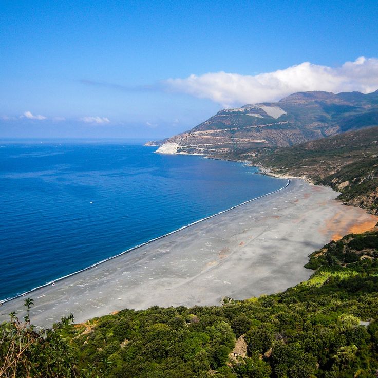
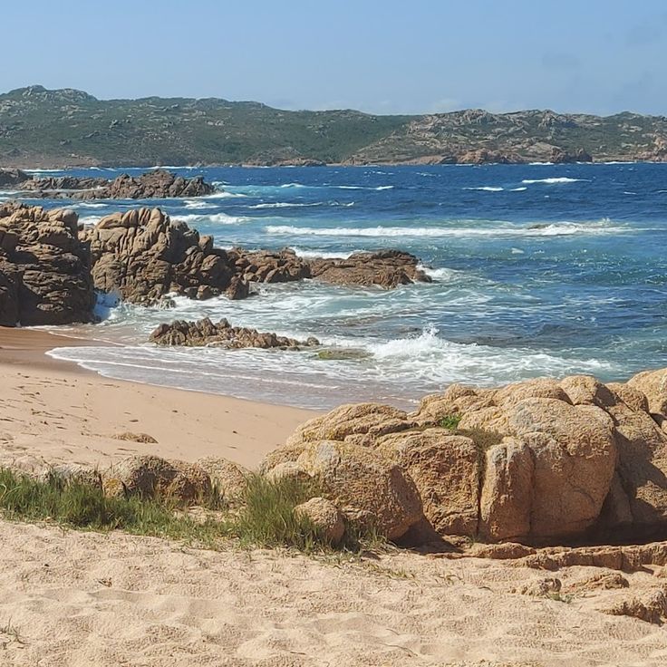
This beach below Nonza village is covered with black pebbles and sits on the Cap Corse peninsula. The descent takes about twenty minutes on foot down stone steps. The dark color of the pebbles comes from the mineral composition of the surrounding rock. The water is clear and the beach stretches along the coast. The location makes this spot quiet, as reaching it requires some effort. From below you see the village perched on the cliff and the steep rock face behind it.
This canyon runs through narrow rock walls in the mountains south of Ajaccio, dropping over several cascades between high stone walls. The water flows cold and often appears greenish as it passes through the rock. In spring and summer, groups come here for canyoning, rappelling down the falls and moving through natural pools. Access is technical and requires gear. The walk from the parking area to the entry point takes about half an hour through dense forest and uneven trails. The valley is narrow and sunlight reaches the water only at certain hours.
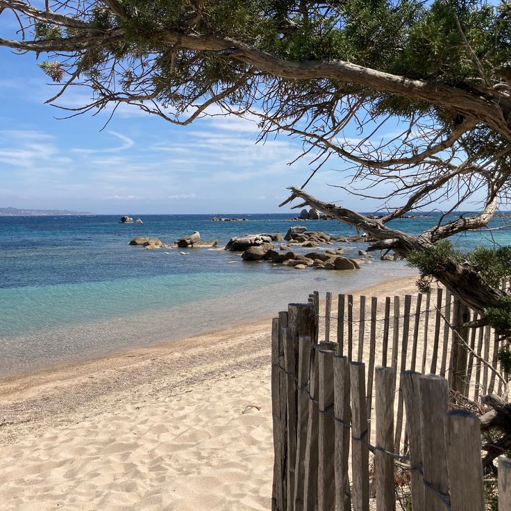
This beach lies in a protected bay in southern Corsica, offering white sand and calm, clear water. Sant'Amanza Beach ends in a natural inlet framed by surrounding hills. Dunes and low coastal vegetation shape the landscape, while walkers often find shells and driftwood along the shore. The bay is popular with sailors and swimmers who appreciate the shelter from wind and shallow waters.
This beach sits south of Sartène on the western coast of Corsica, displaying a cove with pale sand between granite rocks. Roccapina Beach offers shallow water and a long stretch of shoreline where the sea meets smooth boulders. Above the cove, a Genoese tower from the 16th century stands on a rocky outcrop. The rock formation to the left of the beach resembles a reclining lion and is visible from the shore. Access is through a walking path of about 20 minutes from the parking area along the coastal road. The area is part of a protected zone with Mediterranean scrubland and few trees near the water.
Tonnara Beach sits along the southern coast of Corsica, combining clear Mediterranean waters with a quiet bay framed by granite boulders. This beach displays the geological variety of the island, where pale sand meets the characteristic rock that shapes the Corsican shoreline. The water remains shallow near the shore, making it easy to swim and observe the seabed and fish below. The rock formations offer natural shelter from wind and create a protected setting. Visitors come here to snorkel in the transparent water or to walk along the coast, where granite and the Mediterranean meet.
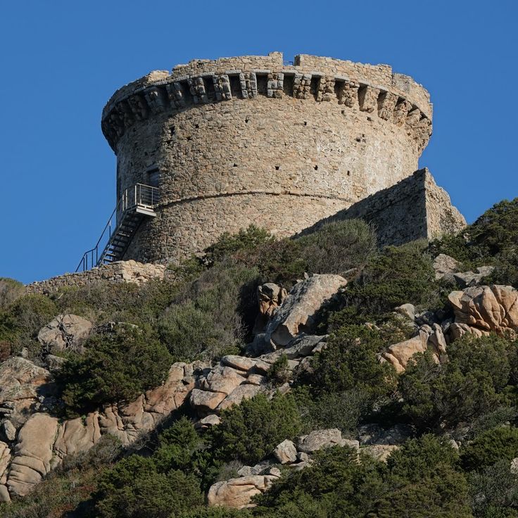
This 16th-century coastal watchtower stands on a rocky promontory in southern Corsica and shows the strategic defense the island organized against pirates. The Genoese tower is built from gray granite and rises above the sea, offering wide views over the bay and surrounding cliffs. Visitors can walk up the steep path to the tower and explore the thick stone walls that resisted attacks for centuries. The clear water below the promontory shimmers in different shades of blue, while walking trails follow the rocky coastline and reach hidden coves. The tower was built at a higher point to detect enemy ships early, serving as part of a signal network along the Corsican coast.
This beach lies north of Porto-Vecchio and shows the coastal landscape of South Corsica with its granite formations. The water is clear, the sand soft underfoot. Pine trees grow close to the shore. The rocks provide shelter. Several paths lead down to the sea. The beach is part of the coastal routes that connect remote coves. From the water you can see the wooded slopes and the rock blocks typical of the region. A place that displays the geological diversity of Corsica.
This mountain road in Inzecca Gorge is carved into granite formations and winds through narrow valleys between red granite walls that rise up to 300 meters (980 feet). The road connects Ghisoni to Ghisonaccia and passes through tight sections where rock overhangs the roadway. In some places, the gorge is so narrow that light feels subdued. The stone shows different shades of red, and the Inzecca River flows below through the gorge. The road follows along the rock faces and offers views of the canyons and the mountainous interior of Corsica.
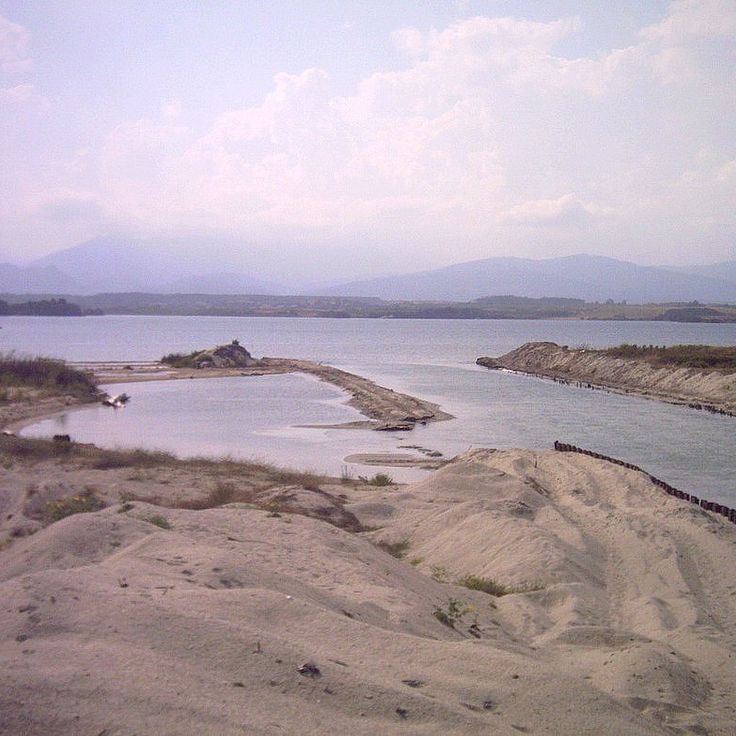
This delta in Galéria forms where the Fango River reaches the Mediterranean Sea. It shows how river water and sea waves meet to create wetlands along the shore. Water plants grow between the banks, and birds use the shallow areas for resting and feeding. The Fango Delta displays the natural connection between fresh water and salt water on the Corsican coast and belongs to the protected natural areas of the island.
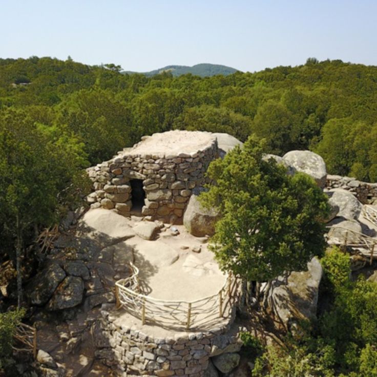
This archaeological site near Levie represents the early human occupation documented across Corsica's natural and hidden locations. Cucuruzzu dates to the Bronze Age and sits within a forested area dotted with granite boulders and cork oak trees. The settlement features fortifications and dwellings built from dry stone walls that blend into the landscape. A woodland path winds through Mediterranean scrub and beneath old trees to reach the ruins. The place shows how ancient communities lived within Corsica's wild interior and connects the island's geological history with human habitation.
Chevanu Beach is a sandy beach along the Mediterranean coast featured in this collection of natural locations and hidden beaches in Corsica. It is reached by a 20-minute walk through native vegetation and granite rock formations. The beach sits in a relatively sheltered cove where clear seawater meets fine light sand. The surroundings show the typical Corsican coastal landscape with low maquis shrubs and scattered stone formations. The path to the beach runs through natural terrain without paved walkways, making access somewhat more demanding. At the beach itself there are no tourist facilities, and visitors find mainly quietness and direct contact with nature.
Punta di Spanu is a rocky promontory that juts into the Mediterranean between Lumio and the coastline, offering direct views over the Gulf of Calvi. Vegetation consists of low native plants that tolerate wind and salt air. The rock drops steeply to the water, and the sea displays different shades of blue depending on the time of day. Fishermen sometimes use the sheltered spots, and hikers follow the narrow path along the coast. Waves break against the cliffs, and when the weather is calm, the water is clear enough to see the bottom.
This beach lies west of Ajaccio and stretches along a wide arc of white sand. The bay opens to the Mediterranean and catches the waves rolling in from open water. Surfers come here when the wind is right and the water rises into swells. The sand is pale and fine, the vegetation behind it low, and the view reaches far across the water. On some days the surf is strong, on others the bay lies flat. The road in passes through scrubland and rock before the beach appears. Away from the city, there is space here and a sense of openness that few beaches near Ajaccio offer.
Lake Tolla sits at 550 meters elevation in a landscape of pine forests and rocky slopes. The water appears calm and dark blue, surrounded by wooded shores that slope gently toward the lake. Narrow mountain roads wind through the vegetation from Cuttoli-Corticchiato. Along the shore, there are a few access points where visitors pause to enjoy the silence or reach the cool water. The lake shows the connection between human use and the nature of Corsica, at an elevation that still belongs to the forested zones but already offers a taste of the mountain world.
The Urbino Lagoon sits in northern Corsica and forms a calm body of water framed by mountain slopes in the distance. The shoreline invites walking, and the shallow depth makes the water pleasant for paddling. Some people take kayaks to explore the bay, while others stay on the beach and enjoy the view of the ranges in the background. The water is usually calm, and the surroundings feel untouched. This lagoon belongs to Corsica's varied coastal landscapes, which range from rocky coves to sandy beaches, and shows the natural character of the island with its mountains and water features.
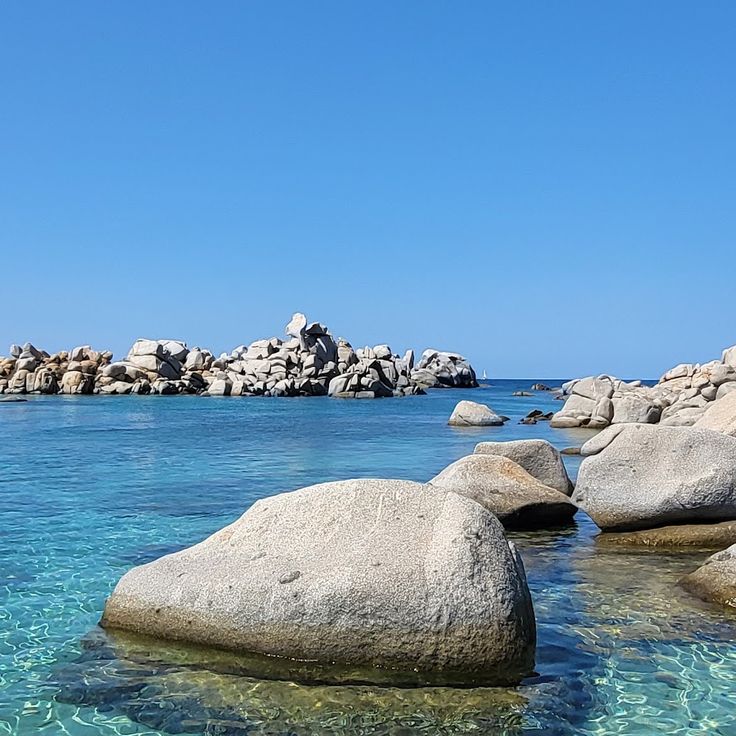
This beach sits on the Lavezzi Islands, a small archipelago off the southern coast of Corsica. You reach it by boat from Bonifacio, about 40 minutes away. The sand is white, made from crushed shells and coral. The water is shallow and transparent, and you can see to the bottom. Granite boulders frame the cove. Fish swim close to shore, and you sometimes spot dolphins in the distance. The islands are uninhabited and protected, with no facilities. Visitors bring their own supplies and shade. Mornings are quieter, with more boats arriving in the afternoon.
San Giovanni Beach lies along the coast of the Figari Gulf and offers a quiet setting with fine sand sections between natural rock formations. The cove shows the geological profile of southern Corsica with pale sand and granite boulders at the shoreline. A Genoese watchtower from the 16th century stands on a rise and marks the coastline. The water is clear and shallow near the shore, which makes access easier. The surroundings are dry and covered with Mediterranean vegetation, typical of this part of the island.
This remote cove at Fazzio Beach shows how the geological relief of the Mediterranean island of Corsica reaches the coast. The beach sits tucked between steep hillsides in southern Corsica. An old footpath called Strada Vecia leads for about one hour through the slopes to reach the shore. The water runs clear and the beach stays quiet. Few people visit here because the walk demands effort. The cove sits sheltered between rocks that drop toward the sea. Those who make the walk find a place to swim with no facilities or shade.
This beach runs for about 2 kilometers along the mouth of the Rizzanese river and is surrounded by several ponds. The water appears light and clear, while the coastline slopes gently toward the sea. The natural setting is characterized by flat terrain where saltwater lagoons mix with the river delta. Low vegetation grows among the dunes along the beach. On calm days, you can walk here along the shore without meeting many people, as the bay is located somewhat away from the main roads.
Isolella Beach contributes to Corsica's collection of hidden beaches and brings together several coves south of Ajaccio along a winding coastal road. This shoreline consists of pale sand, smooth pebbles, and low rocks that reach into the sea. The water is usually calm and clear. Some coves rest between low rock points, while others open directly to the sea. In summer, families from nearby come here to swim or sit on the stones. A few trees offer shade. The beaches are reached by narrow paths that drop down from the road.
Lotu Beach is a white sand beach with clear waters that forms part of Corsica's varied coastline. Located away from main roads, it is accessible only by ferry from Saint-Florent, a journey of about 30 minutes. This beach represents the range of coastal landscapes found across the island, offering visitors a place to experience the quiet coves and clean seas that characterize Corsican shores.
This beach runs along the Balagne coast and offers fine sand over a considerable length. The water is clear and the waves attract surfers during summer. You find facilities for different water sports and rental stations for equipment. The surroundings show typical Mediterranean vegetation with maquis shrub and scattered pine trees. Access is through a road that passes agricultural land. In the early morning the beach is quiet, while afternoons bring more visitors. The bay opens wide to the sea and the wind often blows fresh from the water.
Ficajola Beach in the Calanques of Piana is part of Corsica's varied coastline with rocky coves and clear seas. The beach lies about 10 minutes on foot from parking areas and features smooth pebbles worn by Mediterranean waters. Granite rocks surround the cove and cast shade in the afternoon. The water is so clear you can see the sea floor from the shore. A path branches off from the main road and passes through low Mediterranean shrubs to reach the beach.
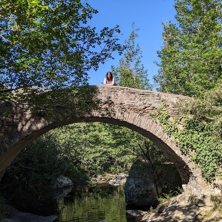
This Genoese bridge crosses the Guadubughju river with a single stone arch, showing the medieval construction methods of the Genoese in Corsica. The Pont Génois Guadubughju sits in a natural setting where river water flows between rocks and the old structure fits into the landscape. The bridge once connected mountain villages and today stands as evidence of historical paths through the Corsican wilderness.
Cala Longa is a remote beach in southern Corsica with clear water, located about 2 hours on foot from the port of Tizzano. The trail passes through Mediterranean scrub and along rocky shoreline until the cove opens up. From here you can see the Senetosa lighthouse on the offshore peninsula. The shore is made of light sand and smooth stones, and the water stays calm even with a light breeze. Those who come here find quiet and largely untouched nature, far from roads and settlements.
Saint Antoine Cave opens in the limestone cliffs near Bonifacio and can be reached by swimming from the sea. The water here is clear enough for snorkeling, and the white rock walls show the geological character of southern Corsica. Light enters through openings in the stone, and the color of the water changes depending on the time of day. Visitors arrive by boat or swim to explore this corner of the coast, where the rock face drops directly into the Mediterranean.
Piantarella Bay is a protected inlet near Bonifacio, situated beside Sperone beach. The shallow turquoise waters are ideal for kayaking, swimming, and windsurfing. The gentle depth allows less experienced swimmers to move with confidence. The clear water shifts through shades of blue, and on calm days the sky reflects on the surface. Small boats rest at anchor while families walk along the sandy shore or gather in the shallow areas. This bay is part of the natural locations of Corsica that reveal the geological heritage of the Mediterranean island, where sandy beaches meet rocky coastlines.
Lake Capitellu is a mountain lake located at 1930 meters in the Restonica valley and serves as the second body of water along a hiking route that passes through granite formations. To reach Lake Capitellu, hikers first follow the path to Lake Melo and then continue their ascent over rocky terrain. The surroundings consist of bare rock, steep slopes, and clear water fed by snowmelt. The trail requires sure footing and good fitness, as it crosses scree and exposed sections. The landscape becomes more barren the higher you climb, with little vegetation and wide views of the Corsican mountains.
This remote cove with clear waters lies on the southern coast of Corsica and can be reached only by boat or through a coastal trail that takes around two and a half hours, starting from the village of Tizzano. Cala di Conca displays the typical granite formations of the island, and the turquoise sea invites swimming. There are no facilities nearby, so visitors should bring supplies and water. The trail follows the coastline through Mediterranean scrub and offers views of the open sea along the way.
These cascades in the Bavella mountains form a series of natural basins carved from granite rock. Water flows down through several levels and collects in pools of different sizes. The setting shows the typical stone of the Corsican highlands, with smooth rock walls and vegetation adapted to the altitude. Access involves narrow passages between boulders and climbing over slick surfaces. The site lies away from main trails and requires accompaniment by a professional guide, both for safety and to protect the sensitive environment.
This beach below Nonza village is covered with black pebbles and sits on the Cap Corse peninsula. The descent takes about twenty minutes on foot down stone steps. The dark color of the pebbles comes from the mineral composition of the surrounding rock. The water is clear and the beach stretches along the coast. The location makes this spot quiet, as reaching it requires some effort. From below you see the village perched on the cliff and the steep rock face behind it.
This canyon runs through narrow rock walls in the mountains south of Ajaccio, dropping over several cascades between high stone walls. The water flows cold and often appears greenish as it passes through the rock. In spring and summer, groups come here for canyoning, rappelling down the falls and moving through natural pools. Access is technical and requires gear. The walk from the parking area to the entry point takes about half an hour through dense forest and uneven trails. The valley is narrow and sunlight reaches the water only at certain hours.
This beach lies in a protected bay in southern Corsica, offering white sand and calm, clear water. Sant'Amanza Beach ends in a natural inlet framed by surrounding hills. Dunes and low coastal vegetation shape the landscape, while walkers often find shells and driftwood along the shore. The bay is popular with sailors and swimmers who appreciate the shelter from wind and shallow waters.
This beach sits south of Sartène on the western coast of Corsica, displaying a cove with pale sand between granite rocks. Roccapina Beach offers shallow water and a long stretch of shoreline where the sea meets smooth boulders. Above the cove, a Genoese tower from the 16th century stands on a rocky outcrop. The rock formation to the left of the beach resembles a reclining lion and is visible from the shore. Access is through a walking path of about 20 minutes from the parking area along the coastal road. The area is part of a protected zone with Mediterranean scrubland and few trees near the water.
Tonnara Beach sits along the southern coast of Corsica, combining clear Mediterranean waters with a quiet bay framed by granite boulders. This beach displays the geological variety of the island, where pale sand meets the characteristic rock that shapes the Corsican shoreline. The water remains shallow near the shore, making it easy to swim and observe the seabed and fish below. The rock formations offer natural shelter from wind and create a protected setting. Visitors come here to snorkel in the transparent water or to walk along the coast, where granite and the Mediterranean meet.
This 16th-century coastal watchtower stands on a rocky promontory in southern Corsica and shows the strategic defense the island organized against pirates. The Genoese tower is built from gray granite and rises above the sea, offering wide views over the bay and surrounding cliffs. Visitors can walk up the steep path to the tower and explore the thick stone walls that resisted attacks for centuries. The clear water below the promontory shimmers in different shades of blue, while walking trails follow the rocky coastline and reach hidden coves. The tower was built at a higher point to detect enemy ships early, serving as part of a signal network along the Corsican coast.
This beach lies north of Porto-Vecchio and shows the coastal landscape of South Corsica with its granite formations. The water is clear, the sand soft underfoot. Pine trees grow close to the shore. The rocks provide shelter. Several paths lead down to the sea. The beach is part of the coastal routes that connect remote coves. From the water you can see the wooded slopes and the rock blocks typical of the region. A place that displays the geological diversity of Corsica.
This mountain road in Inzecca Gorge is carved into granite formations and winds through narrow valleys between red granite walls that rise up to 300 meters (980 feet). The road connects Ghisoni to Ghisonaccia and passes through tight sections where rock overhangs the roadway. In some places, the gorge is so narrow that light feels subdued. The stone shows different shades of red, and the Inzecca River flows below through the gorge. The road follows along the rock faces and offers views of the canyons and the mountainous interior of Corsica.
This delta in Galéria forms where the Fango River reaches the Mediterranean Sea. It shows how river water and sea waves meet to create wetlands along the shore. Water plants grow between the banks, and birds use the shallow areas for resting and feeding. The Fango Delta displays the natural connection between fresh water and salt water on the Corsican coast and belongs to the protected natural areas of the island.
This archaeological site near Levie represents the early human occupation documented across Corsica's natural and hidden locations. Cucuruzzu dates to the Bronze Age and sits within a forested area dotted with granite boulders and cork oak trees. The settlement features fortifications and dwellings built from dry stone walls that blend into the landscape. A woodland path winds through Mediterranean scrub and beneath old trees to reach the ruins. The place shows how ancient communities lived within Corsica's wild interior and connects the island's geological history with human habitation.
Chevanu Beach is a sandy beach along the Mediterranean coast featured in this collection of natural locations and hidden beaches in Corsica. It is reached by a 20-minute walk through native vegetation and granite rock formations. The beach sits in a relatively sheltered cove where clear seawater meets fine light sand. The surroundings show the typical Corsican coastal landscape with low maquis shrubs and scattered stone formations. The path to the beach runs through natural terrain without paved walkways, making access somewhat more demanding. At the beach itself there are no tourist facilities, and visitors find mainly quietness and direct contact with nature.
Punta di Spanu is a rocky promontory that juts into the Mediterranean between Lumio and the coastline, offering direct views over the Gulf of Calvi. Vegetation consists of low native plants that tolerate wind and salt air. The rock drops steeply to the water, and the sea displays different shades of blue depending on the time of day. Fishermen sometimes use the sheltered spots, and hikers follow the narrow path along the coast. Waves break against the cliffs, and when the weather is calm, the water is clear enough to see the bottom.
This beach lies west of Ajaccio and stretches along a wide arc of white sand. The bay opens to the Mediterranean and catches the waves rolling in from open water. Surfers come here when the wind is right and the water rises into swells. The sand is pale and fine, the vegetation behind it low, and the view reaches far across the water. On some days the surf is strong, on others the bay lies flat. The road in passes through scrubland and rock before the beach appears. Away from the city, there is space here and a sense of openness that few beaches near Ajaccio offer.
Lake Tolla sits at 550 meters elevation in a landscape of pine forests and rocky slopes. The water appears calm and dark blue, surrounded by wooded shores that slope gently toward the lake. Narrow mountain roads wind through the vegetation from Cuttoli-Corticchiato. Along the shore, there are a few access points where visitors pause to enjoy the silence or reach the cool water. The lake shows the connection between human use and the nature of Corsica, at an elevation that still belongs to the forested zones but already offers a taste of the mountain world.
The Urbino Lagoon sits in northern Corsica and forms a calm body of water framed by mountain slopes in the distance. The shoreline invites walking, and the shallow depth makes the water pleasant for paddling. Some people take kayaks to explore the bay, while others stay on the beach and enjoy the view of the ranges in the background. The water is usually calm, and the surroundings feel untouched. This lagoon belongs to Corsica's varied coastal landscapes, which range from rocky coves to sandy beaches, and shows the natural character of the island with its mountains and water features.
This beach sits on the Lavezzi Islands, a small archipelago off the southern coast of Corsica. You reach it by boat from Bonifacio, about 40 minutes away. The sand is white, made from crushed shells and coral. The water is shallow and transparent, and you can see to the bottom. Granite boulders frame the cove. Fish swim close to shore, and you sometimes spot dolphins in the distance. The islands are uninhabited and protected, with no facilities. Visitors bring their own supplies and shade. Mornings are quieter, with more boats arriving in the afternoon.
San Giovanni Beach lies along the coast of the Figari Gulf and offers a quiet setting with fine sand sections between natural rock formations. The cove shows the geological profile of southern Corsica with pale sand and granite boulders at the shoreline. A Genoese watchtower from the 16th century stands on a rise and marks the coastline. The water is clear and shallow near the shore, which makes access easier. The surroundings are dry and covered with Mediterranean vegetation, typical of this part of the island.
This remote cove at Fazzio Beach shows how the geological relief of the Mediterranean island of Corsica reaches the coast. The beach sits tucked between steep hillsides in southern Corsica. An old footpath called Strada Vecia leads for about one hour through the slopes to reach the shore. The water runs clear and the beach stays quiet. Few people visit here because the walk demands effort. The cove sits sheltered between rocks that drop toward the sea. Those who make the walk find a place to swim with no facilities or shade.
This beach runs for about 2 kilometers along the mouth of the Rizzanese river and is surrounded by several ponds. The water appears light and clear, while the coastline slopes gently toward the sea. The natural setting is characterized by flat terrain where saltwater lagoons mix with the river delta. Low vegetation grows among the dunes along the beach. On calm days, you can walk here along the shore without meeting many people, as the bay is located somewhat away from the main roads.
Isolella Beach contributes to Corsica's collection of hidden beaches and brings together several coves south of Ajaccio along a winding coastal road. This shoreline consists of pale sand, smooth pebbles, and low rocks that reach into the sea. The water is usually calm and clear. Some coves rest between low rock points, while others open directly to the sea. In summer, families from nearby come here to swim or sit on the stones. A few trees offer shade. The beaches are reached by narrow paths that drop down from the road.
Lotu Beach is a white sand beach with clear waters that forms part of Corsica's varied coastline. Located away from main roads, it is accessible only by ferry from Saint-Florent, a journey of about 30 minutes. This beach represents the range of coastal landscapes found across the island, offering visitors a place to experience the quiet coves and clean seas that characterize Corsican shores.
This beach runs along the Balagne coast and offers fine sand over a considerable length. The water is clear and the waves attract surfers during summer. You find facilities for different water sports and rental stations for equipment. The surroundings show typical Mediterranean vegetation with maquis shrub and scattered pine trees. Access is through a road that passes agricultural land. In the early morning the beach is quiet, while afternoons bring more visitors. The bay opens wide to the sea and the wind often blows fresh from the water.
Ficajola Beach in the Calanques of Piana is part of Corsica's varied coastline with rocky coves and clear seas. The beach lies about 10 minutes on foot from parking areas and features smooth pebbles worn by Mediterranean waters. Granite rocks surround the cove and cast shade in the afternoon. The water is so clear you can see the sea floor from the shore. A path branches off from the main road and passes through low Mediterranean shrubs to reach the beach.
This Genoese bridge crosses the Guadubughju river with a single stone arch, showing the medieval construction methods of the Genoese in Corsica. The Pont Génois Guadubughju sits in a natural setting where river water flows between rocks and the old structure fits into the landscape. The bridge once connected mountain villages and today stands as evidence of historical paths through the Corsican wilderness.