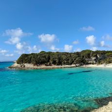
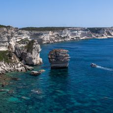
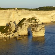
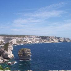
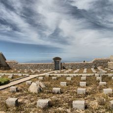
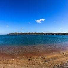
Cala di Chiesa, Beach in Bonifacio, France
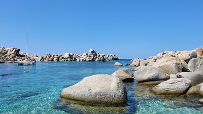
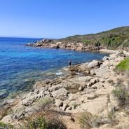
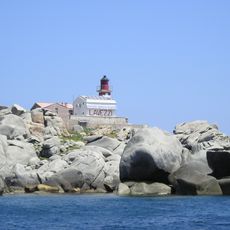
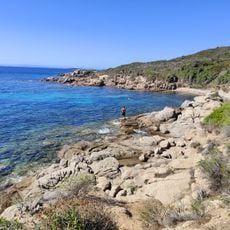
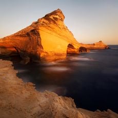
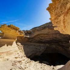
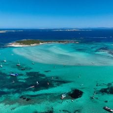
Cala di Chiesa is a small sandy cove surrounded by tall granite cliffs on Corsica's southern Mediterranean coast. The bay forms a natural amphitheater where steep stone walls rise from the water, creating a sheltered pocket of beach.
This cove sits along ancient Mediterranean shipping routes used by multiple civilizations for movement and trade. The location has been part of the region's maritime connections for centuries.
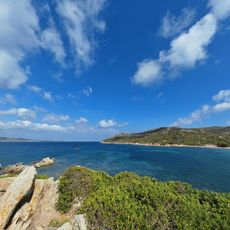
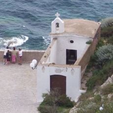
Local people appreciate this cove for its natural setting and use it as a retreat from busier parts of the coast. The spot holds meaning for those who value Corsica's unspoiled character and connection to the sea.
The cove is only accessible by water, with regular boat trips departing from Bonifacio harbor that take about 30 minutes. The terrain is rocky and rugged, so proper footwear and care when entering are needed.
The cove hosts diverse underwater life with fish species living among seagrass meadows and exploring natural granite formations. This marine environment draws visitors who enjoy snorkeling and watching sea life.
Location: Bonifacio / Bunifaziu
Address: Unnamed Road, Bonifacio, France
GPS coordinates: 41.34407,9.25385
Latest update: December 6, 2025 19:05
Corsica is a Mediterranean island with a varied landscape that ranges from rocky coastlines to white sand beaches, mountain lakes, and deep canyons. The island combines water in many forms: quiet coves with clear seas, mountain streams flowing through granite rock, and lagoons at sheltered coastal sections. These locations show the geological history of the island, with rock formations shaped by wind and water over thousands of years. Along the coast stand old watchtowers from the time when the island needed protection from attacks by sea, while inland prehistoric sites give evidence of early settlers.From the black pebble beaches on the northern coast to the long sandy beaches in the south, the island offers a range of landscapes. Some beaches lie in remote coves accessible only on foot or by boat, others are found at river mouths where fresh water meets the sea. In the mountains there are waterfalls and clear alpine lakes at elevations over 6000 feet (1800 meters). Roads through the canyons follow river courses and connect the coast to the interior, passing through narrow valleys between steep rock walls.
Citadel of Bonifacio
9.3 km
Strait of Bonifacio natural reserve
6 km
Golf de Sperone
4.7 km
Église Sainte-Marie-Majeure de Bonifacio
9.3 km
Plage du petit Spérone
4 km
Phare Pertusato
6.4 km
Isola Razzoli Lighthouse
8.3 km
Phare des Îles Lavezzi
1.1 km
Araguina-Sennola
9.1 km
Torra di Sant' Amanza
8.1 km
Cara Longu
5.5 km
Scenic viewpoint
9.2 km
La Caverne D'Ali Bonbon
9.1 km
Beaches Sant'Amanza
7.9 km
Scenic viewpoint
6.3 km
Grotte de Saint Antoine
6.7 km
Chapelle Saint-Roch de Bonifacio
9.1 km
Phare écueil Lavezzi
3.1 km
Chapelle Saint-Jean le Baptiste de Bonifacio
9.3 km
Maison Charles Quint de Bonifacio
9.2 km
Site archéologique de Piantarella
4.1 km
Scenic viewpoint
9.3 km
Archipelago of La Maddalena and Islands of Bocche di Bonifacio
5 km
Cimetières et pyramide de la Sémillante
581 m
Chapelle Notre-Dame-du-Mont-Carmel du cimetière de Furcone de îles Lavezzi
716 m
Maison Doria
9.2 km
Plage de Maora
7.8 km
Baie de Piantarella
4.2 kmVisited this place? Tap the stars to rate it and share your experience / photos with the community! Try now! You can cancel it anytime.
Discover hidden gems everywhere you go!
From secret cafés to breathtaking viewpoints, skip the crowded tourist spots and find places that match your style. Our app makes it easy with voice search, smart filtering, route optimization, and insider tips from travelers worldwide. Download now for the complete mobile experience.
A unique approach to discovering new places❞
— Le Figaro
All the places worth exploring❞
— France Info
A tailor-made excursion in just a few clicks❞
— 20 Minutes