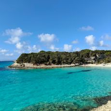
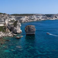
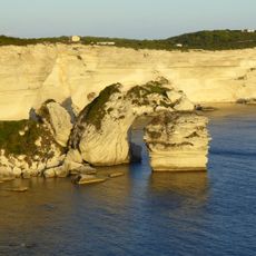
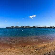
Cara Longu, Sand beach in Bonifacio, France.
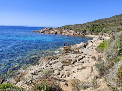
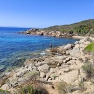
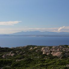
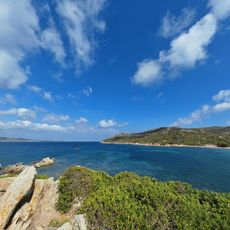
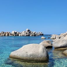
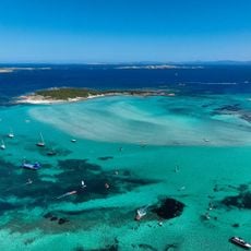
Cara Longu is a sand beach near Bonifacio featuring fine sand and clear water with views toward the Lavezzi archipelago. The shoreline stretches with an open view across the Mediterranean Sea.
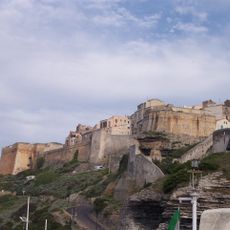
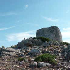
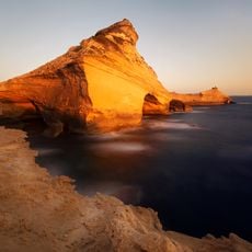
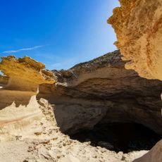
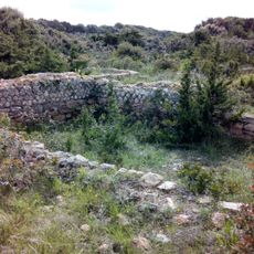
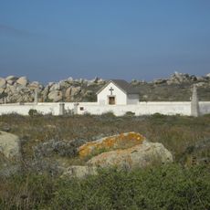
This beach lies near limestone cliffs that served as defensive positions during medieval times. These structures were part of a broader system protecting the coast from pirate attacks.
The beach serves as a gathering place where locals and visitors connect with the sea and its rhythms. It remains woven into the daily life of Bonifacio's community and reflects how people here relate to their coastal surroundings.
This beach is reachable by car in about 10 minutes from Bonifacio and has parking available. During summer months, boat access is also an option for visitors.
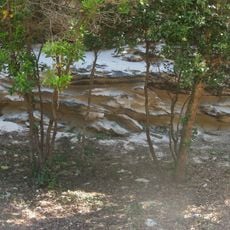
Natural rock pools form at low tide along the shoreline, offering chances to observe small Mediterranean sea creatures. These protected pools reveal how marine life shelters in shallow waters.
Location: Bonifacio
Address: 20169 Bonifacio, France
GPS coordinates: 41.39139,9.23555
Latest update: December 6, 2025 19:02
Corsica is a Mediterranean island with a varied landscape that ranges from rocky coastlines to white sand beaches, mountain lakes, and deep canyons. The island combines water in many forms: quiet coves with clear seas, mountain streams flowing through granite rock, and lagoons at sheltered coastal sections. These locations show the geological history of the island, with rock formations shaped by wind and water over thousands of years. Along the coast stand old watchtowers from the time when the island needed protection from attacks by sea, while inland prehistoric sites give evidence of early settlers.From the black pebble beaches on the northern coast to the long sandy beaches in the south, the island offers a range of landscapes. Some beaches lie in remote coves accessible only on foot or by boat, others are found at river mouths where fresh water meets the sea. In the mountains there are waterfalls and clear alpine lakes at elevations over 6000 feet (1800 meters). Roads through the canyons follow river courses and connect the coast to the interior, passing through narrow valleys between steep rock walls.
Citadel of Bonifacio
6.4 km
Strait of Bonifacio natural reserve
5.1 km
Golf de Sperone
2.7 km
Église Sainte-Marie-Majeure de Bonifacio
6.4 km
Plage du petit Spérone
2.6 km
Phare Pertusato
5 km
Monument de la Légion Etrangère
6.6 km
Araguina-Sennola
5.8 km
Torra di Sant' Amanza
3.2 km
Scenic viewpoint
6.4 km
La Caverne D'Ali Bonbon
6.1 km
Beaches Sant'Amanza
2.4 km
Scenic viewpoint
5 km
Grotte de Saint Antoine
5.3 km
Église Saint-Érasme de Bonifacio
6.2 km
Cala di Chiesa
5.5 km
Chapelle Saint-Jean le Baptiste de Bonifacio
6.5 km
Chapelle Saint-Roch de Bonifacio
6.3 km
Maison Charles Quint de Bonifacio
6.3 km
Site archéologique de Piantarella
2.5 km
Scenic viewpoint
6.6 km
Cimetières et pyramide de la Sémillante
5.8 km
Chapelle Saint-Croix de Bonifacio
6.6 km
Chapelle Notre-Dame-du-Mont-Carmel du cimetière de Furcone de îles Lavezzi
6.2 km
Maison de Charles Quint
6.5 km
Maison Doria
6.4 km
Plage de Maora
2.5 km
Baie de Piantarella
2.3 kmReviews
Visited this place? Tap the stars to rate it and share your experience / photos with the community! Try now! You can cancel it anytime.
Discover hidden gems everywhere you go!
From secret cafés to breathtaking viewpoints, skip the crowded tourist spots and find places that match your style. Our app makes it easy with voice search, smart filtering, route optimization, and insider tips from travelers worldwide. Download now for the complete mobile experience.
A unique approach to discovering new places❞
— Le Figaro
All the places worth exploring❞
— France Info
A tailor-made excursion in just a few clicks❞
— 20 Minutes