
Pantai Otan
Location: Kupang
Address: R9HP+JMV, Otan, Semau, Kupang Regency, East Nusa Tenggara, Indonesia
GPS coordinates: -10.16448,123.38861
Latest update: March 30, 2025 14:05


Keli Mutubuurai
232.8 km
Kelimutu National Park
230.7 km
Lewotolo
211.1 km
Mount Egon
196 km
Mount Sirung
202.4 km
Lewotobi
194 km
Iliboleng
203.2 km
Ashmore Reef Marine Park
233.3 km
Iya
238.7 km
Iliwerung
182.9 km
Lifau monument
148.3 km
Noefefan Bridge
147 km
Ave Maria church
225.5 km
Fort Santo António of Lifau
145.4 km
Koka
214.2 km
Ilimuda
203.6 km
Sacred Heart Cathedral, Maliana
239.4 km
Marobo hot springs
248.7 km
Fort Balibo
225.1 km
Reduto do Conselheiro Jacinto Cândido
220.5 km
Fort Solor
189.8 km
Fort Concordia
20.4 km
Igreja de Nossa Senhora do Rosário, Pante Macassar
152.5 km
Igreja da Imaculada Conceição Bobonaro
246.9 km
Kolam Airnona
21.7 km
Pantai Deere
261.8 km
Mota'ain Bridge
217.9 km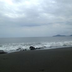
Pantai Pedenlaran
186.5 kmReviews
Visited this place? Tap the stars to rate it and share your experience / photos with the community! Try now! You can cancel it anytime.
Discover hidden gems everywhere you go!
From secret cafés to breathtaking viewpoints, skip the crowded tourist spots and find places that match your style. Our app makes it easy with voice search, smart filtering, route optimization, and insider tips from travelers worldwide. Download now for the complete mobile experience.

A unique approach to discovering new places❞
— Le Figaro
All the places worth exploring❞
— France Info
A tailor-made excursion in just a few clicks❞
— 20 Minutes