Enable Location

We need your location to show you interesting places around you

Discover nearby places

Find interesting locations and hidden gems around you

Precise directions

Get accurate directions and distances to places

Your location is never shared with other users. It's only used when you tap the location button.

Runkerry Stand

Log in to your account

Start exploring — it's free

Trusted by 62,834 travelers worldwide

Continue with Google
Continue with Apple
or

We will send you a code to connect

By continuing, you accept our Terms and Conditions and our Privacy Policy

Check your inbox

We've sent a pincode in your inbox. Please enter the code below.

Runkerry Stand

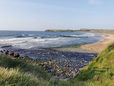
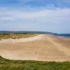
Runkerry Stand, Sand beach in Northern Ireland, United Kingdom.

This 500-meter-long sandy beach stretches along the northwest coast with an 80-meter width, backed by distinctive two-phase sand dunes featuring older reddish formations from 5,000-6,000 years ago and younger pale dunes from 4,000 years ago.

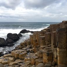
The beach formed after the last Midlandian glaciation when melting ice sheets caused land uplift and falling sea levels 12,000 years ago, followed by dune formation through wind action around 7,000-6,500 years ago as sea levels rose again.

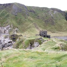
The nearby Victorian Runkerry House, built in the 1860s for Sir Edward Macnaghten, stands as a sandstone mansion overlooking the beach and now serves as private apartments, representing the area's architectural heritage.

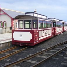
Visitors can access the beach via pathways from Portballintrae end beyond Bushfoot Golf Club, with the Giants Causeway and Bushmills Railway offering scenic 15-minute journeys four times daily on weekends through the dunes.

The beach demonstrates exceptional morphodynamics with sand bars that form parallel to the coast during winter storms, creating protective barriers and rip current channels that reshape the shoreline seasonally.

The community of curious travelers

AroundUs brings together thousands of curated places, local tips, and hidden gems, enriched daily by 60,000 contributors worldwide.

Start exploring
Address
Runkerry Beach, Portballintrae, Bushmills BT57 8YW, UK
GPS coordinates
55.22368,-6.53188
Latest update
August 22, 2025 13:24
Around this place
Show the full map
« Runkerry Stand - Sand beach in Northern Ireland, United Kingdom » is provided by Around Us (aroundus.com). Images and texts are derived from Wikimedia project under a Creative Commons license. You are allowed to copy, distribute, and modify copies of this page, under the conditions set by the license, as long as this note is clearly visible.

Discover hidden gems everywhere you go!

From secret cafés to breathtaking viewpoints, skip the crowded tourist spots and find places that match your style. Our app makes it easy with voice search, smart filtering, route optimization, and insider tips from travelers worldwide. Download now for the complete mobile experience.

Around Us App Screenshot

A unique approach to discovering new places

Le Figaro

All the places worth exploring

France Info

A tailor-made excursion in just a few clicks

20 Minutes

Around Us
Travel Guide & Maps
Download

Send to your phone

QR Code
1

Open the camera app on your mobile.

2

Point at the QR code with your camera. A notification will appear.

3

Tap the notification to open the link.