Enable Location

We need your location to show you interesting places around you

Discover nearby places

Find interesting locations and hidden gems around you

Precise directions

Get accurate directions and distances to places

Your location is never shared with other users. It's only used when you tap the location button.

Portstewart Strand

Log in to your account

Start exploring — it's free

Trusted by 62,832 travelers worldwide

Continue with Google
Continue with Apple
or

We will send you a code to connect

By continuing, you accept our Terms and Conditions and our Privacy Policy

Check your inbox

We've sent a pincode in your inbox. Please enter the code below.

Portstewart Strand

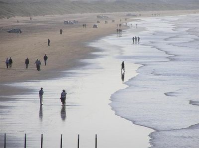
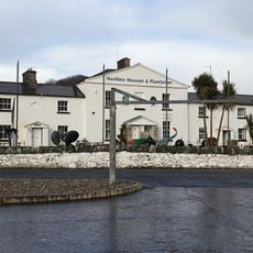
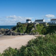
Portstewart Strand, Sandy beach in County Londonderry, Northern Ireland.

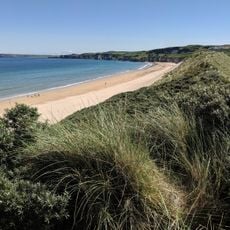
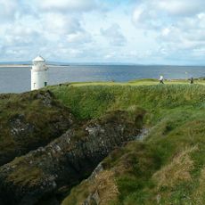
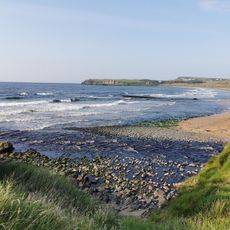
Portstewart Strand is a 2-mile long sandy beach on the Northern Ireland coast situated between Portstewart town and the River Bann estuary. The shoreline is framed by large sand dunes that run along the Atlantic Ocean.

The National Trust acquired this beach in 1980 and maintained an unusual tradition of allowing vehicles to park directly on the sand. This parking practice continues today as part of the site's character.

The beach served as a filming location for Season Five of Game of Thrones, representing the Dornish Coast in the series. This television production brought international attention to the location.

Free parking is available on the sand, and facilities include toilets with accessible features for people with disabilities. Different zones are designated for water sports activities, making the beach suitable for various visitors.

The dune system here is home to rare butterfly and bee orchid species that formed thousands of years ago. This area is recognized as part of the Bann Estuary Area of Special Scientific Interest.

The community of curious travelers

AroundUs brings together thousands of curated places, local tips, and hidden gems, enriched daily by 60,000 contributors worldwide.

Start exploring
Operator
National Trust
Address
Portstewart Strand, United Kingdom
GPS coordinates
55.16800,-6.74500
Latest update
December 12, 2025 12:06
Around this place
Royal Portrush Golf Club
United Kingdom

Royal Portrush Golf Club

8.3 km
Mussenden Temple
United Kingdom

Mussenden Temple

4.2 km
Barry's Amusements
United Kingdom

Barry's Amusements

7 km
Downhill House
United Kingdom

Downhill House

4.2 km
Binevenagh
United Kingdom

Binevenagh

12.4 km
Giant's Causeway and Bushmills Railway
United Kingdom

Giant's Causeway and Bushmills Railway

14.1 km
Dundarave House
United Kingdom

Dundarave House

15.6 km
Northburgh Castle
Ireland

Northburgh Castle

15.2 km
Liffock House
United Kingdom

Liffock House

3.2 km
Bann Bridge
United Kingdom

Bann Bridge

5.6 km
Town Hall The Diamond Coleraine Co.londonderry
United Kingdom

Town Hall The Diamond Coleraine Co.londonderry

6.2 km
Portrush Town Hall
United Kingdom

Portrush Town Hall

7.2 km
Portstewart Town Hall
United Kingdom

Portstewart Town Hall

2.3 km
Macosquin Abbey
United Kingdom

Macosquin Abbey

7.9 km
Craig Hill
United Kingdom

Craig Hill

16.6 km
Inishowen Lighthouse
Ireland

Inishowen Lighthouse

13.3 km
Inishowen Maritime Museum and Planetarium
Ireland

Inishowen Maritime Museum and Planetarium

15.8 km
Warren Point Lighthouse
Ireland

Warren Point Lighthouse

13.9 km
Runkerry Stand (Bushfoot)
United Kingdom

Runkerry Stand (Bushfoot)

14.9 km
St. John's R C Church Kyle's Brae Coleraine Co.londonderry
United Kingdom

St. John's R C Church Kyle's Brae Coleraine Co.londonderry

6.2 km
Inishowen East Lighthouse
Ireland

Inishowen East Lighthouse

13.3 km
Billy C Of I Parish Church 1 Cabragh Road Glebe Td Bushmills Co. Antrim Bt57 8ud
United Kingdom

Billy C Of I Parish Church 1 Cabragh Road Glebe Td Bushmills Co. Antrim Bt57 8ud

15.9 km
Methodist Church Circular Road Coleraine Co.londonderry
United Kingdom

Methodist Church Circular Road Coleraine Co.londonderry

6.1 km
St. Patrick's Church, Coleraine, Northern Ireland
United Kingdom

St. Patrick's Church, Coleraine, Northern Ireland

6.3 km
Holy Trinity Parish Church, Main St. Portrush
United Kingdom

Holy Trinity Parish Church, Main St. Portrush

7.3 km
Mausoleum Downhill Demesne Castlerock Co. Londonderry
United Kingdom

Mausoleum Downhill Demesne Castlerock Co. Londonderry

4.1 km
Presbyterian Church Church St./enfield St. Portstewart Co.londonderry
United Kingdom

Presbyterian Church Church St./enfield St. Portstewart Co.londonderry

2.5 km
Martello Tower Point Road Magilligan Limavady Co Londonderry
United Kingdom

Martello Tower Point Road Magilligan Limavady Co Londonderry

14.2 km
Show the full map
« Portstewart Strand - Sandy beach in County Londonderry, Northern Ireland » is provided by Around Us (aroundus.com). Images and texts are derived from Wikimedia project under a Creative Commons license. You are allowed to copy, distribute, and modify copies of this page, under the conditions set by the license, as long as this note is clearly visible.

Discover hidden gems everywhere you go!

From secret cafés to breathtaking viewpoints, skip the crowded tourist spots and find places that match your style. Our app makes it easy with voice search, smart filtering, route optimization, and insider tips from travelers worldwide. Download now for the complete mobile experience.

Around Us App Screenshot

A unique approach to discovering new places

Le Figaro

All the places worth exploring

France Info

A tailor-made excursion in just a few clicks

20 Minutes

Around Us
Travel Guide & Maps
Download

Send to your phone

QR Code
1

Open the camera app on your mobile.

2

Point at the QR code with your camera. A notification will appear.

3

Tap the notification to open the link.