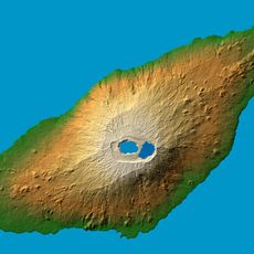
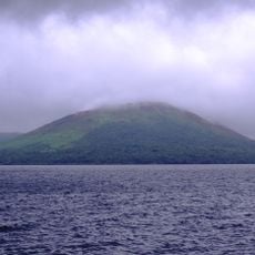
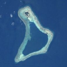
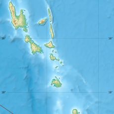
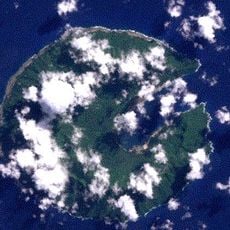
Anuta, Volcanic island in Temotu Province, Solomon Islands
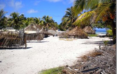
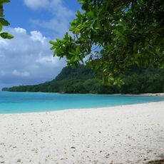
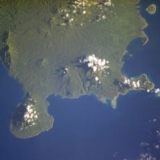
Anuta is a volcanic island in Temotu Province with a rounded shape and low profile above the ocean. It sits within a fringing coral reef and supports a small year-round population living in scattered dwellings across the terrain.
The island was discovered by HMS Pandora in 1791 and first named Cherry Island by the European observer. Since then it has remained largely removed from outside influence and change.
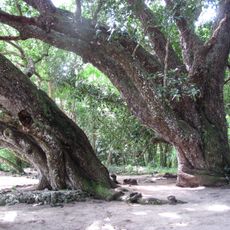
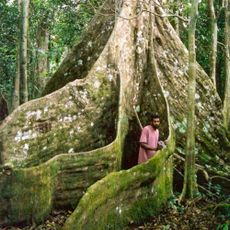
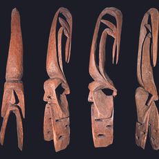
The residents speak their own language and practice traditional crafts like canoe building and woodcarving that remain central to everyday life. These skills are passed down naturally within families and shape how people use the surrounding waters and forests.
Weather follows two patterns: April to October brings trade winds with cooler temperatures, while October to April brings monsoon rains. Plan visits during the drier months when conditions are more stable and travel is easier.
The nearest inhabited island, Tikopia, sits over 100 km away, making this among the most isolated settlements in the Pacific Ocean. This remoteness has allowed the island to develop its own path largely undisturbed.
Address: Anuta, Solomon Islands
GPS coordinates: -11.63333,169.83333
Latest update: December 6, 2025 19:08
The Solomon Islands in the South Pacific preserve numerous traces of World War II. In Honiara, the National Museum and Vilu War Museum document the Guadalcanal Campaign through collections of artillery pieces, aircraft wrecks, and military equipment. Offshore, sunken warships and planes have become...
Kuwae
595.1 km
Champagne Beach
488.9 km
Lombenben
472 kmMount Tabwemasana
532.2 km
Lopevi
566.2 km
Aore Island Resort
525.9 km
Vanuatu Cultural Centre
699.7 km
Marum
546.1 km
Korman Stadium
697.9 km
Chief Roi Mata’s Domain
696.2 km
Mount Gharat
387.5 km
Nalongo and Nupani
481.5 km
Вануа-Лава
352.4 km
Siri Waterfall
382.5 km
Cathédrale du Sacré-Coeur, Port Vila
698.6 km
Benbow
548 km
Luganville Soccer Stadium
698.1 km
Аоба (вулкан)
469.1 km
Benbow
547.8 km
Mangaas
690.1 km
Лопеві (вулкан)
565.8 km
Ureparapara
341.2 km
Makura
634.1 km
Roy Mata's grave
692.2 km
Vatthe Conservation Area
499.1 km
Fels Cave
688 km
Suretamatai
352.2 km
Yalo, Apialo and the sacred geography of Northwest Malakula
565.2 kmVisited this place? Tap the stars to rate it and share your experience / photos with the community! Try now! You can cancel it anytime.
Discover hidden gems everywhere you go!
From secret cafés to breathtaking viewpoints, skip the crowded tourist spots and find places that match your style. Our app makes it easy with voice search, smart filtering, route optimization, and insider tips from travelers worldwide. Download now for the complete mobile experience.
A unique approach to discovering new places❞
— Le Figaro
All the places worth exploring❞
— France Info
A tailor-made excursion in just a few clicks❞
— 20 Minutes