Boring Lava Field
14.2 km
Milo McIver State Park
5.2 km
Philip Foster Farm
9.6 km
North Fork Reservoir
6.5 km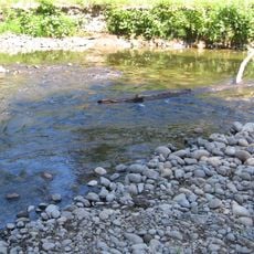
Bonnie Lure State Recreation Area
9.5 km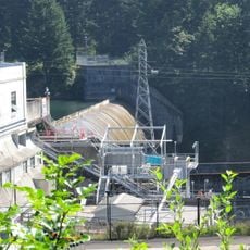
River Mill Hydroelectric Project
3.5 km
Eagle Creek Upper Falls
9.9 km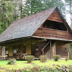
Horace Baker Log Cabin
5 km
North Fork Dam
4.9 km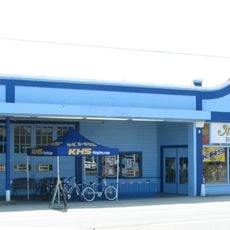
R. S. Smith Motor Company Building
14.2 km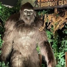
North American Bigfoot Center
17.4 km
Mill River Park
3.4 km
Big Cliff
11.5 km
Firwood Veneer Corporation Reservoir
13.9 km
Mount Hood National Forest Headquarters
14.5 km
Clackamas Hatchery Visitor Center
3.9 km
Mountain View Golf Course
17 km
Springwater Golf Course
3.8 km
Eagle Creek Golf Course
8.1 km
Greenlea Golf Course
16.4 km
Clackamas Hatchery
3.9 km
Jonsrud Viewpoint
15.3 km
Milo McIver Memorial Viewpoint
4.7 km
Clackamas Falls
12.1 km
Waterfall
8.2 km
Waterfall
8.3 km
Memaloose Falls
12.5 km
Lower Clackamas Falls
11.7 kmReviews
Visited this place? Tap the stars to rate it and share your experience / photos with the community! Try now! You can cancel it anytime.
Discover hidden gems everywhere you go!
From secret cafés to breathtaking viewpoints, skip the crowded tourist spots and find places that match your style. Our app makes it easy with voice search, smart filtering, route optimization, and insider tips from travelers worldwide. Download now for the complete mobile experience.

A unique approach to discovering new places❞
— Le Figaro
All the places worth exploring❞
— France Info
A tailor-made excursion in just a few clicks❞
— 20 Minutes