Enable Location

We need your location to show you interesting places around you

Discover nearby places

Find interesting locations and hidden gems around you

Precise directions

Get accurate directions and distances to places

Your location is never shared with other users. It's only used when you tap the location button.

Boring Lava Field

Log in to your account

Start exploring — it's free

Trusted by 63,442 travelers worldwide

Continue with Google
Continue with Apple
or

We will send you a code to connect

By continuing, you accept our Terms and Conditions and our Privacy Policy

Check your inbox

We've sent a pincode in your inbox. Please enter the code below.

Boring Lava Field
Discussion Reviews 1 Photos
15.1k Popularity

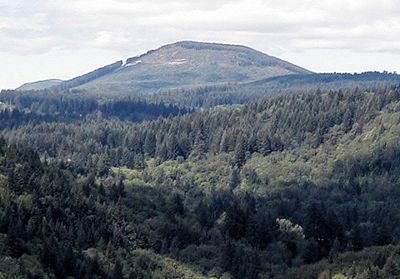
Boring Lava Field, Volcanic field in Portland metropolitan area, United States.

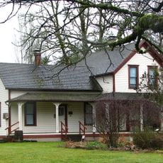
The Boring Lava Field is a volcanic region in the Portland area that spreads across parts of Oregon and Washington, marked by numerous cinder cones, shield volcanoes, and lava flows. Most formations sit beneath forests, though some peaks like Powell Butte and Mount Tabor have been developed as parks where trails reveal the geological features.

Volcanic activity created this field roughly 2.7 million years ago through repeated cycles of eruptions over vast timescales. The most recent known eruption happened at Beacon Rock about 57,000 years ago, making this one of the younger volcanic landscapes in the region.

The Chinook people established communities throughout this volcanic landscape before European arrival. Their settlements around the formations reflected how they adapted to and understood the terrain as part of their daily world.

The area is open year-round, with hiking trails available at Powell Butte Nature Park and Mount Tabor Park to explore the volcanic features. Most of the terrain is forested and can become slippery when wet, so sturdy footwear is important for safe exploration.

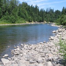
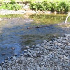
The field contains more than 80 volcanic vents scattered across the landscape, with some potentially hidden beneath sediments left by ancient Missoula Floods. These buried features reveal how water events layered additional material over the original lava surface.

The community of curious travelers

AroundUs brings together thousands of curated places, local tips, and hidden gems, enriched daily by 60,000 contributors worldwide.

Start exploring
GPS coordinates
45.30000,-122.50000
Latest update
December 7, 2025 19:31
Around this place
Willamette Meteorite
United States of America

Willamette Meteorite

9.9 km
Willamette Falls
United States of America

Willamette Falls

10.9 km
Oregon City Municipal Elevator
United States of America

Oregon City Municipal Elevator

10.6 km
Milo McIver State Park
United States of America

Milo McIver State Park

10 km
Willamette Falls Locks
United States of America

Willamette Falls Locks

11.1 km
Oregon City Bridge
United States of America

Oregon City Bridge

10.8 km
Abernethy Bridge
United States of America

Abernethy Bridge

10.9 km
Parents of Murdered Children Memorial
United States of America

Parents of Murdered Children Memorial

8.6 km
Francis Ermatinger House
United States of America

Francis Ermatinger House

10.3 km
Philip Foster Farm
United States of America

Philip Foster Farm

13.2 km
Bonnie Lure State Recreation Area
United States of America

Bonnie Lure State Recreation Area

11.2 km
Oregon Military Museum
United States of America

Oregon Military Museum

13.2 km
John McLoughlin Bridge
United States of America

John McLoughlin Bridge

11.4 km
Capt. John C. Ainsworth House
United States of America

Capt. John C. Ainsworth House

8.7 km
McLoughlin Promenade
United States of America

McLoughlin Promenade

10.6 km
Haggart Observatory
United States of America

Haggart Observatory

6.6 km
Morton Matthew McCarver House
United States of America

Morton Matthew McCarver House

9.4 km
Harvey Cross House
United States of America

Harvey Cross House

10.3 km
Clackamas County Courthouse
United States of America

Clackamas County Courthouse

10.6 km
William L. Holmes House
United States of America

William L. Holmes House

9.1 km
Oregon City Public Library
United States of America

Oregon City Public Library

10.2 km
Moontrap (Kelly)
United States of America

Moontrap (Kelly)

10.5 km
James Milne House
United States of America

James Milne House

10.4 km
Damascus School
United States of America

Damascus School

13.3 km
Bank of Commerce Building (Oregon City, Oregon)
United States of America

Bank of Commerce Building (Oregon City, Oregon)

10.6 km
Barclay House
United States of America

Barclay House

10.5 km
McLoughlin House
United States of America

McLoughlin House

10.4 km
McLoughlin Promenade Grand Staircase
United States of America

McLoughlin Promenade Grand Staircase

10.5 km
Show the full map
Reviews
Share your experience

No review yet

Discussions
Start a discussion...

No discussion yet

« Boring Lava Field - Volcanic field in Portland metropolitan area, United States » is provided by Around Us (aroundus.com). Images and texts are derived from Wikimedia project under a Creative Commons license. You are allowed to copy, distribute, and modify copies of this page, under the conditions set by the license, as long as this note is clearly visible.

Discover hidden gems everywhere you go!

From secret cafés to breathtaking viewpoints, skip the crowded tourist spots and find places that match your style. Our app makes it easy with voice search, smart filtering, route optimization, and insider tips from travelers worldwide. Download now for the complete mobile experience.

Around Us App Screenshot

A unique approach to discovering new places

Le Figaro

All the places worth exploring

France Info

A tailor-made excursion in just a few clicks

20 Minutes

Around Us
Travel Guide & Maps
Download

Send to your phone

QR Code
1

Open the camera app on your mobile.

2

Point at the QR code with your camera. A notification will appear.

3

Tap the notification to open the link.