South West Coast Path
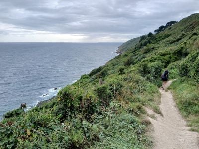
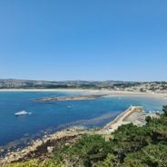
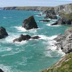
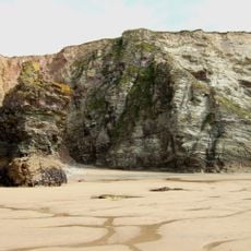
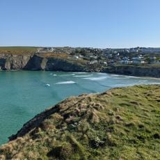
The South West Coast Path Section 16 is a hiking trail along the northern coastline of Cornwall from Porthcothan to Newquay. The route runs over cliffs and beaches lined with wildflowers and low shrubs, with constant sea views and small coves featuring rocky outcrops shaped by waves over centuries.
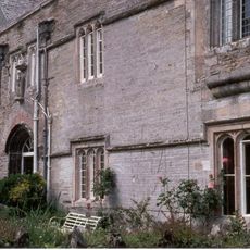
The area has been important for fishing and small trades for centuries, with old stone walls and remains of past settlements still visible today. It was a critical route for ships navigating the rocky coast, and local stories of storms and shipwrecks are passed down by villagers through time.
The route connects small fishing communities where local fishermen still practice traditional methods and visitors can observe the rhythm of coastal life. The settlements along the way tell stories of generations who have lived from the sea and shaped this landscape.
Sturdy footwear is recommended because some sections can be uneven or rocky, and a light jacket is advised since wind from the sea can be strong even on warm days. The route is suitable for most hikers with moderate fitness, with clear signs and rest spots at viewpoints.
A lighthouse once stood nearby and helped ships navigate the rocky coast safely, with such structures still visible at many points along the route. These historical buildings are silent witnesses to the time when navigation was a dangerous task for sailors.
Location: England
Reference: SWCP
Operator: National Trails
Address: S W Coast Path, United Kingdom
Website: http://wiki.openstreetmap.org/wiki/South_West_Coast_Path
GPS coordinates: 50.46122,-5.05437
Latest update: January 8, 2026 16:35
Bedruthan Steps
3.1 km
Japanese Garden
4 km
Watergate Beach
2.2 km
Church of St Mawgan
4 km
Lanherne Carmelite Convent
4 kmRose Cottage
4 kmBoundary Wall To Lanherne Carmelite Convent
3.9 kmMawgan Porth early medieval settlement and associated burial ground, 250m west of Lanerick
1.9 kmRedcliff Castle, later prehistoric cliff castle 550m south west of Bedruthan
3.2 kmGluvian Farmhouse
2.8 kmLiveloe, later prehistoric cliff castle with hut circles on Griffin's Point, and prehistoric round barrow 600m south west of Bre
910 mLanherne Cross, standing cross in the grounds of the convent, Lanherne
4 kmLantern cross approximately 7 metres north west of Church of St Mawgan
4 kmKitchen Garden Walls With Gate Piers About 30 Metres South West Of Lanherne Carmelite Convent
3.9 km
Dunes
1.7 kmLanherne Barton Farmhouse
3.9 kmTwo round barrows 440m and 510m north west of High Cove Farm
2.2 kmIvy Cottage
2.3 kmNatural Shower
1.8 kmMay Monument In The Churchyard About 8 Metres West Of Nave Of Church Of St Mawgan
4 kmBeacon Cove
1 kmStem
1 kmHigh Cove
2 kmTolcarne Merock Farmhouse With Attached Walls And Farm Building
2.6 km
Mawgan Porth
1.5 kmWarrior of the Surf
2.1 kmBedruthan Beach viewpoint
3 kmScenic viewpoint
2.8 kmVisited this place? Tap the stars to rate it and share your experience / photos with the community! Try now! You can cancel it anytime.
Discover hidden gems everywhere you go!
From secret cafés to breathtaking viewpoints, skip the crowded tourist spots and find places that match your style. Our app makes it easy with voice search, smart filtering, route optimization, and insider tips from travelers worldwide. Download now for the complete mobile experience.
A unique approach to discovering new places❞
— Le Figaro
All the places worth exploring❞
— France Info
A tailor-made excursion in just a few clicks❞
— 20 Minutes