Domažlice, Historic market town in Plzeň Region, Czech Republic
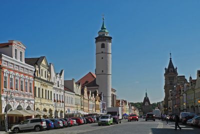
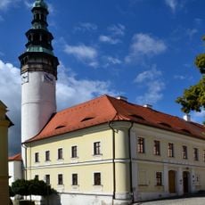
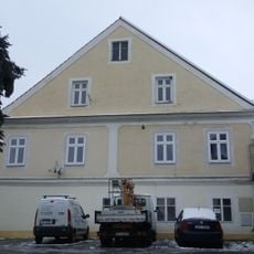
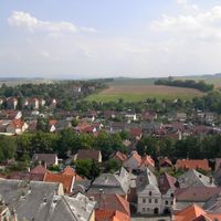
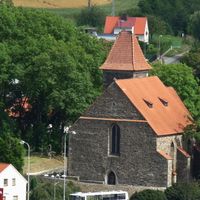
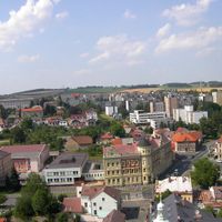
Domažlice is a town in the Plzeň Region with medieval fortifications and narrow streets arranged around a central square dominated by a 56-meter church tower. The old town structure follows a compact, grid-like layout typical of fortified settlements from this period.
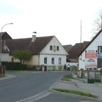
King Ottokar II established this as a royal settlement in 1265, positioning it as a fortified border post between Bohemia and Bavaria. This strategic role as a frontier defense shaped its development for centuries to come.
The Chodsko region maintains its own traditions visible in handcrafted ceramics and local dress styles that reflect community identity. These cultural elements remain woven into everyday life and shape how the place feels to visitors.
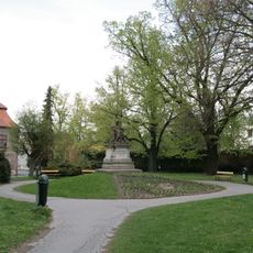
The town center is compact and easily walkable, with marked pathways providing direct access to the historic streets and squares. Regular bus connections link the area to larger hubs like Plzeň and Prague for travelers arriving from other regions.
Residents speak a distinct local dialect and maintain a tradition of playing bagpipes that has shaped the region for centuries. This living musical heritage sets the place apart from other parts of Bohemia.
Location: Domažlice District
Location: upravni občinski okoliš z razširjenimi pristojnostmi Domažlice
Elevation above the sea: 428 m
Reference: CZ0321553425
Shares border with: Stráž, Tlumačov, Babylon, Zahořany, Újezd, Chrastavice, Mrákov, Pasečnice, Meclov, Luženičky, Nevolice
Email: podatelna@mesto-domazlice.cz
Website: http://domazlice.eu
GPS coordinates: 49.44061,12.92980
Latest update: December 20, 2025 02:07
Památník husitského vítězství u Domažlic
2.6 km
Chodský hrad
230 m
Baldov
2.6 km
Chapel of Saint Lawrence
2.6 km
Tuhošť
3.3 km
Church of All Saints in Domažlice
625 m
Muzeum Jindřicha Jindřicha
333 m
Jewish cemetery in Domažlice
897 mSmolovský železniční most
3.4 km
Kozinova čp. 46
627 m
Vavřinecké lípy
2.7 kmMost přes Zubřinu do mlýna Lonských
1.3 kmMost silnice III/1907 přes Nevolický potok
3.3 km
Dub u gymnázia
314 mMost silnice III/1908 přes levé rameno Tlumačovského potoka
3.4 kmŽelezniční most přes Zubřinu a silnici III/19367 v Havlovicích
4 kmMost silnice III/1907 přes Tlumačovský potok
3.6 kmLuženická lípa
4.1 km
Vila Benešova č.p. 282 se zahradou a oplocením
453 m
Příhodův park
253 mAkvadukt v Havlovicích
4.6 km
Vila, Domažlice, Benešova č.p. 282
453 mLávka přes Zubřinu v Domažlicích u Havlíčkovy ulice proti Klímově ulici
445 mLávka přes Zubřinu v Domažlicích proti Smetanově ulici
828 mMost ulice Na Ostrůvku přes Zubřinu v Domažlicích
358 mMost Masarykovy ulice přes Zubřinu v Domažlicích
669 mLávka přes Zubřinu v Havlovících u čp. 105
3.1 km
Vila pro Luisu Froňkovou-Neužilovou
551 mVisited this place? Tap the stars to rate it and share your experience / photos with the community! Try now! You can cancel it anytime.
Discover hidden gems everywhere you go!
From secret cafés to breathtaking viewpoints, skip the crowded tourist spots and find places that match your style. Our app makes it easy with voice search, smart filtering, route optimization, and insider tips from travelers worldwide. Download now for the complete mobile experience.
A unique approach to discovering new places❞
— Le Figaro
All the places worth exploring❞
— France Info
A tailor-made excursion in just a few clicks❞
— 20 Minutes