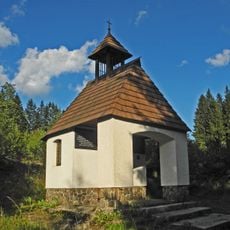
Pancíř, Mountain summit in Plzeň Region, Czech Republic.
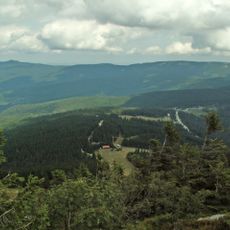
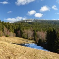
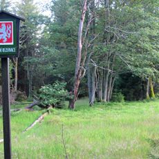
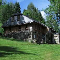
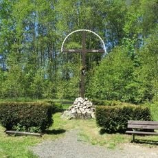
Pancíř is a mountain summit in the Plzeň Region that rises to 1,214 meters and features open meadows, spruce forests, and planted dwarf pines across its slopes. The peak transitions gradually from wooded areas to more exposed terrain, creating diverse landscapes within a compact space.
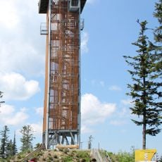
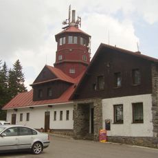
An 18-meter observation tower with 68 steps was constructed on the peak, leading to a 15-meter high viewing platform. This structure was added to provide visitors with elevated views across the surrounding territory.
Three rivers originate from Pancíř mountain: Úhlava and Křemelná flowing toward the North Sea, while Řezná flows into the Black Sea.
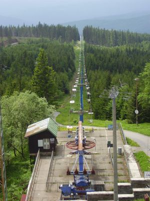
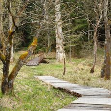
A chairlift system connects the lower area to the summit through Hofmanka station, offering easy access to hiking trails and winter sports facilities. The infrastructure around the mountain is well-organized for seasonal activities and makes navigation straightforward.
On clear days, visitors can spot the Alps from the observation platform, particularly the Dachstein massif roughly 200 kilometers away. This far-reaching visibility makes the view from this point exceptionally valuable for those interested in distant mountain landscapes.
GPS coordinates: 49.17795,13.25356
Latest update: December 12, 2025 07:55
Landschaftsschutzgebiet Böhmerwald
3.2 km
Spitzberg
3.3 km
Rozhledna Špičák u Železné Rudy
3.3 km
Brückelberg
2.7 km
Pancíř
29 m
Brčálnické mokřady
2.9 km
Brčálnický jasan
2.8 km
Prameniště
2.3 km
Chapel of Virgin Mary
4.5 km
Brčálnická lípa
2.7 km
Páteříkova Huť
4.7 km
Chapel of Saint Anthony of Padua and Saint Barbara (Železná Ruda)
4.3 km
Pomník vojenské vzpoury
4.8 km
Pohřebiště Barabů
4 km
Pomník osvobození na Klostermannově náměstí v Železné Rudě
4.7 km
Usedlost čp. 54
4.3 km
Pomník Petru Kintzlovi u skiareálu ve Špičáku
2.8 km
Zámeček Železná Ruda
4.7 km
Pomník padlým v 1.světové válce v Železné Rudě
4.5 km
Kříž u kostela v Železné Rudě
4.7 km
Kříž na pohřebišti barabů u cesty ze Špičáku do Železné Rudy
4 km
Kříž v Belvederské ulici v Železné Rudě
4.5 km
Boží muka na Křížové cestě v Železné Rudě
4.4 km
Kříž u kaple svaté Anny v Železné Rudě
4.1 km
Chapel of Saint Anne
4 km
Kaple pod chatou Rebel ve Špičáku
3.6 km
Malá výklenková kaplička nad sjezdovkou pod Belvederem v Železné Rudě
4 km
Fara v Železné Rudě
4.7 kmVisited this place? Tap the stars to rate it and share your experience / photos with the community! Try now! You can cancel it anytime.
Discover hidden gems everywhere you go!
From secret cafés to breathtaking viewpoints, skip the crowded tourist spots and find places that match your style. Our app makes it easy with voice search, smart filtering, route optimization, and insider tips from travelers worldwide. Download now for the complete mobile experience.
A unique approach to discovering new places❞
— Le Figaro
All the places worth exploring❞
— France Info
A tailor-made excursion in just a few clicks❞
— 20 Minutes