Burkův vrch, Mountain summit at Moravian-Silesian Beskids, Slovakia.
Burkův vrch is a 1031.7 m summit on the Czech-Slovak border ridge of the Moravian-Silesian Beskids, rising west of Veľký Polom and east of Malý Polom. Its top is covered by continuous spruce forest, and the state border and the Black Sea–Baltic Sea watershed run along the ridge. A marked ridge trail passes just north of the summit.
The summit lies on the border ridge between the Czech Republic and Slovakia, which here also forms the European watershed between the Oder and Danube basins. The ridge path from Velký Polom to Malý Polom passes just north of the top, and the summit is reached by a short unmarked spur. About 1 km west, a nameless 1022 m contour was named Burkův vrch – Z vrchol by the Tisícovky Čech, Moravy a Slezska project.
The summit lies in the Kysuce Protected Landscape Area on the Slovak side and in the Czech part of the Moravian-Silesian Beskids. The state border and the European watershed between the Oder and Danube run along the ridge here, and the mountain is climbed from the villages of Horní Lomná, Klokočov and Olešná.
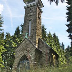
The shortest route starts in Horní Lomná, following the yellow trail 3.5 km to the chapel below Muřinkový vrch, then the red ridge trail west; after 1300 m an unmarked southwest spur leads to the top, 5.5 km in all with over 500 m of climbing. The marked ridge path bypasses the summit to the north, so reaching it needs a short detour.
The peak serves as a watershed dividing two major European basins, with streams flowing in opposite directions toward the Kysuca and Olše rivers. This hydrological feature makes the summit a notable point for observing how water naturally disperses across the region.
The community of curious travelers
AroundUs brings together thousands of curated places, local tips, and hidden gems, enriched daily by 92,151 contributors worldwide.