Enable Location

We need your location to show you interesting places around you

Discover nearby places

Find interesting locations and hidden gems around you

Precise directions

Get accurate directions and distances to places

Your location is never shared with other users. It's only used when you tap the location button.

Tiverton Four Corners Historic District

Log in to your account

Start exploring — it's free

Trusted by 62,556 travelers worldwide

Continue with Google
Continue with Apple
or

We will send you a code to connect

By continuing, you accept our Terms and Conditions and our Privacy Policy

Check your inbox

We've sent a pincode in your inbox. Please enter the code below.

Tiverton Four Corners Historic District

Tiverton Four Corners Historic District, Historic district in Tiverton, United States.

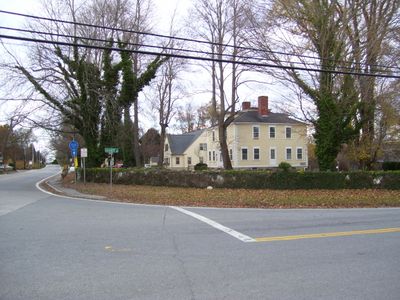
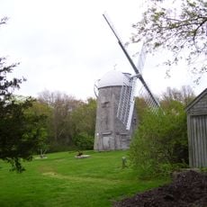
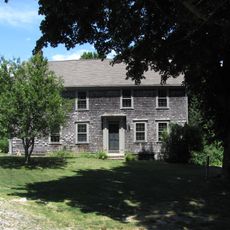
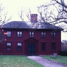
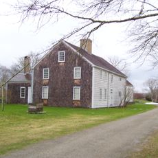
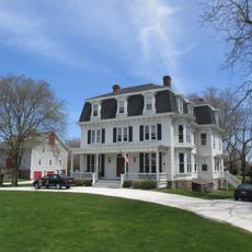
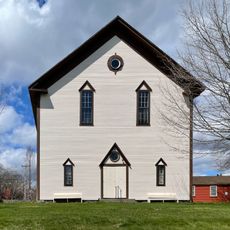
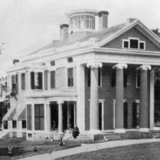
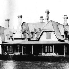
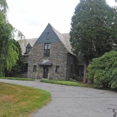
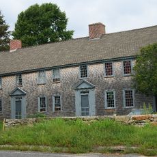
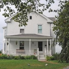
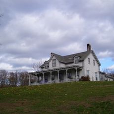
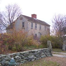
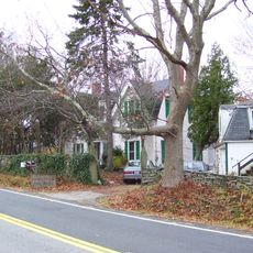
Tiverton Four Corners Historic District is a collection of buildings from the 18th and 19th centuries located at a major road intersection. The structures display various architectural styles and represent different periods of development at this important crossroads.

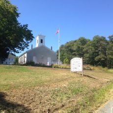
The area developed as a colonial marketplace where key roads intersected for trade and commerce. Its listing on the National Register of Historic Places in 1974 recognized its importance as a long-standing economic and social center.

Local galleries and craft shops inside the historic buildings continue to reflect the area's heritage of skilled trades and community connection. The shops and galleries show how these spaces still serve as gathering points for residents and visitors alike.

Visitors can reach the district via Main Road, West Road, and East Road, with parking available near the main buildings. The area is easy to explore on foot and the structures are visible and accessible from the street.

The district developed as a central meeting point where farmers and traders would exchange goods from the surrounding region. This original purpose as a hub for agricultural commerce shaped the character of the place and remains visible in its layout today.

The community of curious travelers

AroundUs brings together thousands of curated places, local tips, and hidden gems, enriched daily by 60,000 contributors worldwide.

Start exploring
Location
GPS coordinates
41.57140,-71.18830
Latest update
December 14, 2025 13:01
Around this place
Mount Hope Bridge
United States of America

Mount Hope Bridge

9.6 km
Green Animals Topiary Garden
United States of America

Green Animals Topiary Garden

7.9 km
Sakonnet River Bridge
United States of America

Sakonnet River Bridge

7.7 km
Battle of Rhode Island Site
United States of America

Battle of Rhode Island Site

6.8 km
Norman Bird Sanctuary
United States of America

Norman Bird Sanctuary

9.6 km
Prescott Farm
United States of America

Prescott Farm

8.8 km
Stone Bridge
United States of America

Stone Bridge

6.5 km
Portsmouth Abbey
United States of America

Portsmouth Abbey

7.8 km
Westport Town Farm
United States of America

Westport Town Farm

9.1 km
Whitehall Museum House
United States of America

Whitehall Museum House

9.5 km
Rhode Island Red Monument
United States of America

Rhode Island Red Monument

5.4 km
Sakonnet River Rail Bridge
United States of America

Sakonnet River Rail Bridge

7.8 km
Wilbor House
United States of America

Wilbor House

8.5 km
Little Compton Common Historic District
United States of America

Little Compton Common Historic District

7 km
Musselbed Shoals Light
United States of America

Musselbed Shoals Light

9.4 km
William Whalley Homestead
United States of America

William Whalley Homestead

3.5 km
Bailey Farm
United States of America

Bailey Farm

8.8 km
Borden Farm
United States of America

Borden Farm

6.4 km
Union Church
United States of America

Union Church

5.8 km
Benjamin Barker House
United States of America

Benjamin Barker House

7.9 km
Greenvale Farm
United States of America

Greenvale Farm

5.8 km
Stonybrook Estate Historic District
United States of America

Stonybrook Estate Historic District

8.4 km
Cadman-White-Handy House
United States of America

Cadman-White-Handy House

9.3 km
First Baptist Church of Tiverton
United States of America

First Baptist Church of Tiverton

3.9 km
Dennis J. Murphy House at Ogden Farm
United States of America

Dennis J. Murphy House at Ogden Farm

8.2 km
Osborn-Bennett Historic District
United States of America

Osborn-Bennett Historic District

8 km
Lawton-Almy-Hall Farm
United States of America

Lawton-Almy-Hall Farm

7.4 km
Oak Glen
United States of America

Oak Glen

7.9 km
Show the full map
« Tiverton Four Corners Historic District - Historic district in Tiverton, United States » is provided by Around Us (aroundus.com). Images and texts are derived from Wikimedia project under a Creative Commons license. You are allowed to copy, distribute, and modify copies of this page, under the conditions set by the license, as long as this note is clearly visible.

Discover hidden gems everywhere you go!

From secret cafés to breathtaking viewpoints, skip the crowded tourist spots and find places that match your style. Our app makes it easy with voice search, smart filtering, route optimization, and insider tips from travelers worldwide. Download now for the complete mobile experience.

Around Us App Screenshot

A unique approach to discovering new places

Le Figaro

All the places worth exploring

France Info

A tailor-made excursion in just a few clicks

20 Minutes

Around Us
Travel Guide & Maps
Download

Send to your phone

QR Code
1

Open the camera app on your mobile.

2

Point at the QR code with your camera. A notification will appear.

3

Tap the notification to open the link.