Enable Location

We need your location to show you interesting places around you

Discover nearby places

Find interesting locations and hidden gems around you

Precise directions

Get accurate directions and distances to places

Your location is never shared with other users. It's only used when you tap the location button.

Westport Town Farm

Log in to your account

Start exploring — it's free

Trusted by 61,948 travelers worldwide

Continue with Google
Continue with Apple
or

We will send you a code to connect

By continuing, you accept our Terms and Conditions and our Privacy Policy

Check your inbox

We've sent a pincode in your inbox. Please enter the code below.

Westport Town Farm

Westport Town Farm, Protected area in Westport, Massachusetts, United States.

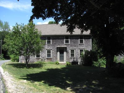
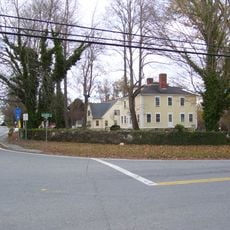
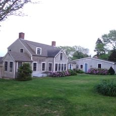
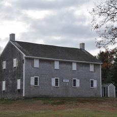
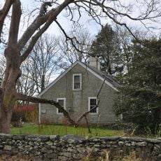
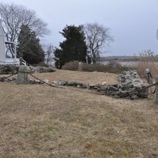
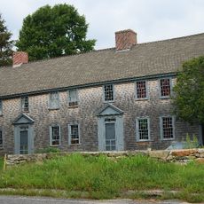
Westport Town Farm is a protected preserve in Massachusetts spanning 40 acres with hiking trails, farmland, and salt marsh habitat along a river. The property holds an antique farmhouse, dairy barn, corn crib, and stone walls built during colonial times that remain visible throughout the grounds.

The property functioned as the town's poor farm and infirmary until 1956, sheltering people in need while they worked shared agricultural land. The buildings and stone walls that remain today date from this era when farming was part of the community's welfare system.

The place reflects how farming and community care were woven together in this region's past. Today visitors can sense this connection by walking past the working farm buildings and the fields that still show signs of agricultural use.

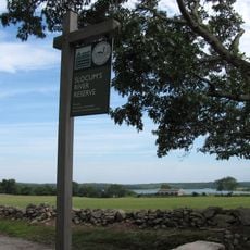
Trails are open from sunrise to sunset with access via the trailhead on Drift Road, where you will find gravel parking and picnic tables. Wear good shoes since paths cross varied terrain and can be damp in places, especially near the marsh and river areas.

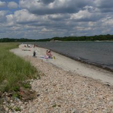
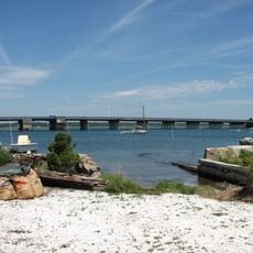
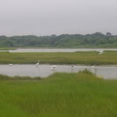
The property includes about a quarter-mile of shoreline along the East Branch of the Westport River, where salt marshes serve as breeding and nursery grounds for crabs and fish. This tidal zone is one of the most biologically active areas of the entire preserve.

The community of curious travelers

AroundUs brings together thousands of curated places, local tips, and hidden gems, enriched daily by 60,000 contributors worldwide.

Start exploring
Location
GPS coordinates
41.58040,-71.07980
Latest update
December 12, 2025 17:40
Around this place
Sakonnet River Bridge
United States of America

Sakonnet River Bridge

12.9 km
Buttonwood Park Zoo
United States of America

Buttonwood Park Zoo

11.9 km
Comet
United States of America

Comet

6.9 km
Demarest Lloyd State Park
United States of America

Demarest Lloyd State Park

10 km
Stone Bridge
United States of America

Stone Bridge

12.5 km
Rhode Island Red Monument
United States of America

Rhode Island Red Monument

5 km
Slocum's River Reserve
United States of America

Slocum's River Reserve

6.7 km
Tiverton Four Corners Historic District
United States of America

Tiverton Four Corners Historic District

9.1 km
Paul Cuffe Farm
United States of America

Paul Cuffe Farm

3.6 km
Apponegansett Meeting House
United States of America

Apponegansett Meeting House

7 km
Little Compton Common Historic District
United States of America

Little Compton Common Historic District

11 km
Normand Edward Fontaine Bridge
United States of America

Normand Edward Fontaine Bridge

7.1 km
Buttonwood Park Historic District
United States of America

Buttonwood Park Historic District

12.1 km
Barneys Joy Point Military Reservation
United States of America

Barneys Joy Point Military Reservation

11.2 km
William Whalley Homestead
United States of America

William Whalley Homestead

8.5 km
Fall River Bleachery
United States of America

Fall River Bleachery

11.6 km
Russells Mills Village Historic District
United States of America

Russells Mills Village Historic District

6.3 km
Howland Mill Village Historic District
United States of America

Howland Mill Village Historic District

12.8 km
Quequechan Valley Mills Historic District
United States of America

Quequechan Valley Mills Historic District

12.6 km
Westport Point Historic District
United States of America

Westport Point Historic District

6.4 km
Benjamin Barker House
United States of America

Benjamin Barker House

12.5 km
Hixville Village Historic District
United States of America

Hixville Village Historic District

12 km
Russell Garrison
United States of America

Russell Garrison

10.4 km
Cadman-White-Handy House
United States of America

Cadman-White-Handy House

1 km
First Baptist Church of Tiverton
United States of America

First Baptist Church of Tiverton

5.6 km
Tucker Farm Historic District
United States of America

Tucker Farm Historic District

9.8 km
Osborn-Bennett Historic District
United States of America

Osborn-Bennett Historic District

12.1 km
Allens Pond Wildlife Sanctuary
United States of America

Allens Pond Wildlife Sanctuary

9.4 km
Show the full map
« Westport Town Farm - Protected area in Westport, Massachusetts, United States » is provided by Around Us (aroundus.com). Images and texts are derived from Wikimedia project under a Creative Commons license. You are allowed to copy, distribute, and modify copies of this page, under the conditions set by the license, as long as this note is clearly visible.

Discover hidden gems everywhere you go!

From secret cafés to breathtaking viewpoints, skip the crowded tourist spots and find places that match your style. Our app makes it easy with voice search, smart filtering, route optimization, and insider tips from travelers worldwide. Download now for the complete mobile experience.

Around Us App Screenshot

A unique approach to discovering new places

Le Figaro

All the places worth exploring

France Info

A tailor-made excursion in just a few clicks

20 Minutes

Around Us
Travel Guide & Maps
Download

Send to your phone

QR Code
1

Open the camera app on your mobile.

2

Point at the QR code with your camera. A notification will appear.

3

Tap the notification to open the link.