Barneys Joy Point Military Reservation

Log in to your account

AroundUs is a community-driven map of interesting places, built by curious explorers like you. It grows with every review, story, and photo you share.
Connect to save your favorite spots, contribute locations, and create personalized routes.
Continue with Google
Continue with Apple
Continue with X
Continue with Facebook
Continue with email
By continuing, you accept our Terms and Conditions and our Privacy Policy
Create an account

Barneys Joy Point Military Reservation

Add to collection
Map
Suggest a change
Share

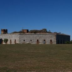
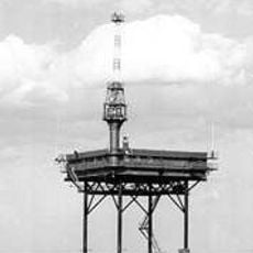
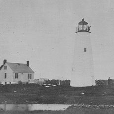
Barneys Joy Point Military Reservation, Military fort in Dartmouth, United States.

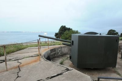
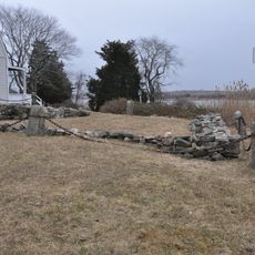
Barneys Joy Point Military Reservation is a coastal fortification in Dartmouth, Massachusetts, with concrete foundations and defensive gun positions facing Buzzards Bay. The installation contained multiple artillery pieces of different calibers and mounting types to provide comprehensive harbor defense.

The reservation was established in 1943 as part of the Harbor Defenses of New Bedford during World War II. The site was strategically positioned to counter threats from fast attack boats and naval operations in the region.

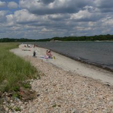
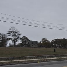
The site reflects how this stretch of coast was defended and shows the role that defensive positions played in protecting the region's economic lifeline.

The site is not open to visitors today, but historical records are available through the National Archives and local military repositories. Advance research about the location's history is worthwhile before planning a visit to the surrounding area.

The reservation used both fixed-mount and mobile artillery pieces to provide flexible defensive capabilities. This mixed approach allowed rapid responses to different types of potential attacks.

Location: Dartmouth

Inception: 1943

GPS coordinates: 41.51055,-70.98356

Latest update: December 14, 2025 16:41

Photos
Around this place
Buttonwood Park Zoo
United States of America

Buttonwood Park Zoo

13.5 km
Fort Rodman
United States of America

Fort Rodman

11.5 km
Demarest Lloyd State Park
United States of America

Demarest Lloyd State Park

1.8 km
Buzzards Bay Entrance Light
United States of America

Buzzards Bay Entrance Light

13.3 km
Westport Town Farm
United States of America

Westport Town Farm

11.2 km
Butler Flats Light
United States of America

Butler Flats Light

12.8 km
Rhode Island Red Monument
United States of America

Rhode Island Red Monument

13 km
Slocum's River Reserve
United States of America

Slocum's River Reserve

5.1 km
Paul Cuffe Farm
United States of America

Paul Cuffe Farm

8.3 km
Apponegansett Meeting House
United States of America

Apponegansett Meeting House

8.2 km
Normand Edward Fontaine Bridge
United States of America

Normand Edward Fontaine Bridge

7.1 km
Russells Mills Village Historic District
United States of America

Russells Mills Village Historic District

7.2 km
Cuttyhunk Light
United States of America

Cuttyhunk Light

11.1 km
Moreland Terrace Historic District
United States of America

Moreland Terrace Historic District

13.6 km
Clarks Point Light
United States of America

Clarks Point Light

11.5 km
Hazelwood Park
United States of America

Hazelwood Park

12.1 km
Howland Mill Village Historic District
United States of America

Howland Mill Village Historic District

12.5 km
Westport Point Historic District
United States of America

Westport Point Historic District

7.7 km
Dumpling Rocks Light
United States of America

Dumpling Rocks Light

6 km
New Bedford Marine Commerce Terminal
United States of America

New Bedford Marine Commerce Terminal

13.8 km
Russell Garrison
United States of America

Russell Garrison

10 km
Cadman-White-Handy House
United States of America

Cadman-White-Handy House

10.3 km
Robert C. Ingraham School
United States of America

Robert C. Ingraham School

13.3 km
Tucker Farm Historic District
United States of America

Tucker Farm Historic District

13.2 km
Thompson Street School
United States of America

Thompson Street School

13.2 km
Allens Pond Wildlife Sanctuary
United States of America

Allens Pond Wildlife Sanctuary

3.4 km
South End Beach Compass
United States of America

South End Beach Compass

11.6 km
Dumpling Rocks Light
United States of America

Dumpling Rocks Light

6 km
Show the full map
Reviews

Visited this place? Tap the stars to rate it and share your experience / photos with the community! Try now! You can cancel it anytime.

« Barneys Joy Point Military Reservation - Military fort in Dartmouth, United States » is provided by Around Us (aroundus.com). Images and texts are derived from Wikimedia project under a Creative Commons license. You are allowed to copy, distribute, and modify copies of this page, under the conditions set by the license, as long as this note is clearly visible.

Discover hidden gems everywhere you go!

From secret cafés to breathtaking viewpoints, skip the crowded tourist spots and find places that match your style. Our app makes it easy with voice search, smart filtering, route optimization, and insider tips from travelers worldwide. Download now for the complete mobile experience.

Around Us App Screenshot

A unique approach to discovering new places

Le Figaro

All the places worth exploring

France Info

A tailor-made excursion in just a few clicks

20 Minutes