Enable Location

We need your location to show you interesting places around you

Discover nearby places

Find interesting locations and hidden gems around you

Precise directions

Get accurate directions and distances to places

Your location is never shared with other users. It's only used when you tap the location button.

Russells Mills Village Historic District

Log in to your account

Start exploring — it's free

Trusted by 62,883 travelers worldwide

Continue with Google
Continue with Apple
or

We will send you a code to connect

By continuing, you accept our Terms and Conditions and our Privacy Policy

Check your inbox

We've sent a pincode in your inbox. Please enter the code below.

Russells Mills Village Historic District
Discussion Reviews 1 Photos
1.3k Popularity

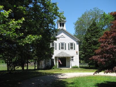
Russells Mills Village Historic District, Historic district in Dartmouth, Massachusetts.

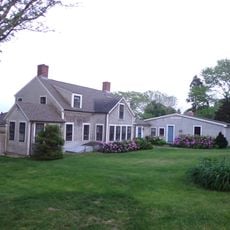
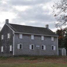
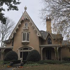
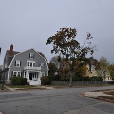
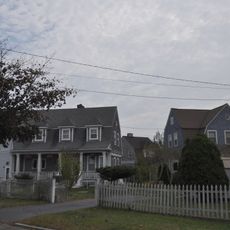
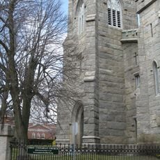
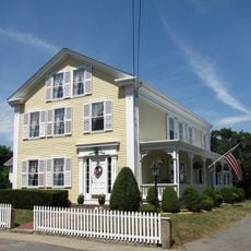
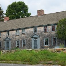
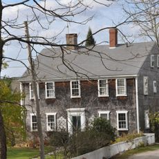
The Russells Mills Village Historic District is a village in southwestern Dartmouth containing about 40 buildings from different periods scattered along several interconnected roads. These structures span from the 1600s to more recent times and represent various architectural styles and building types from the region's past.

The district originated in the 1650s and became important when the Russell family built mills at Destruction Brook in the 1670s, creating a production center. These water-powered facilities shaped the area's economic development for generations to come.

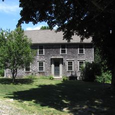
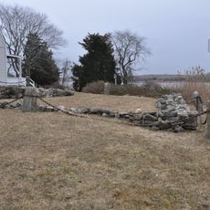
The district contains Dartmouth's oldest surviving building from 1670 and a historical animal pound from 1831, both offering insights into early settlement and daily life. The architecture and arrangement of these structures show how the community developed over generations.

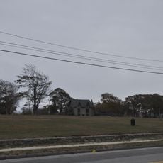
The district lies south of US Route 6 and spreads across several interconnected roads leading to different historical structures. Walking through the area is the best way to see all the buildings and their details properly.

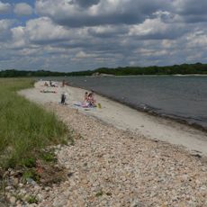
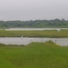
The area developed around water-powered mills along the Paskamanset River and Destruction Brook where both grain was ground and lumber was sawn. This industrial use of water power shaped the landscape and community's fortune for a long time.

The community of curious travelers

AroundUs brings together thousands of curated places, local tips, and hidden gems, enriched daily by 60,000 contributors worldwide.

Start exploring
Location
GPS coordinates
41.57306,-71.00500
Latest update
December 14, 2025 18:14
Around this place
Buttonwood Park Zoo
United States of America

Buttonwood Park Zoo

7.7 km
Fort Rodman
United States of America

Fort Rodman

8.9 km
Comet
United States of America

Comet

7.7 km
Demarest Lloyd State Park
United States of America

Demarest Lloyd State Park

5.5 km
Westport Town Farm
United States of America

Westport Town Farm

6.3 km
Slocum's River Reserve
United States of America

Slocum's River Reserve

2.4 km
Paul Cuffe Farm
United States of America

Paul Cuffe Farm

5.9 km
Apponegansett Meeting House
United States of America

Apponegansett Meeting House

1.5 km
Normand Edward Fontaine Bridge
United States of America

Normand Edward Fontaine Bridge

8.1 km
Buttonwood Park Historic District
United States of America

Buttonwood Park Historic District

7.9 km
Barneys Joy Point Military Reservation
United States of America

Barneys Joy Point Military Reservation

7.2 km
William J. Rotch Gothic Cottage
United States of America

William J. Rotch Gothic Cottage

8.8 km
Moreland Terrace Historic District
United States of America

Moreland Terrace Historic District

8.4 km
Clarks Point Light
United States of America

Clarks Point Light

8.9 km
Hazelwood Park
United States of America

Hazelwood Park

8.4 km
Howland Mill Village Historic District
United States of America

Howland Mill Village Historic District

7.7 km
County Street Historic District
United States of America

County Street Historic District

8.9 km
Westport Point Historic District
United States of America

Westport Point Historic District

8 km
Dumpling Rocks Light
United States of America

Dumpling Rocks Light

8 km
Russell Garrison
United States of America

Russell Garrison

4.9 km
Cadman-White-Handy House
United States of America

Cadman-White-Handy House

6 km
Robert C. Ingraham School
United States of America

Robert C. Ingraham School

8.7 km
Thomas Donaghy School
United States of America

Thomas Donaghy School

9 km
Tucker Farm Historic District
United States of America

Tucker Farm Historic District

6.6 km
Thompson Street School
United States of America

Thompson Street School

8.4 km
Allens Pond Wildlife Sanctuary
United States of America

Allens Pond Wildlife Sanctuary

7.5 km
South End Beach Compass
United States of America

South End Beach Compass

8.3 km
Dumpling Rocks Light
United States of America

Dumpling Rocks Light

8 km
Show the full map
« Russells Mills Village Historic District - Historic district in Dartmouth, Massachusetts » is provided by Around Us (aroundus.com). Images and texts are derived from Wikimedia project under a Creative Commons license. You are allowed to copy, distribute, and modify copies of this page, under the conditions set by the license, as long as this note is clearly visible.

Discover hidden gems everywhere you go!

From secret cafés to breathtaking viewpoints, skip the crowded tourist spots and find places that match your style. Our app makes it easy with voice search, smart filtering, route optimization, and insider tips from travelers worldwide. Download now for the complete mobile experience.

Around Us App Screenshot

A unique approach to discovering new places

Le Figaro

All the places worth exploring

France Info

A tailor-made excursion in just a few clicks

20 Minutes

Around Us
Travel Guide & Maps
Download

Send to your phone

QR Code
1

Open the camera app on your mobile.

2

Point at the QR code with your camera. A notification will appear.

3

Tap the notification to open the link.