Lake Monongahela, Prehistoric glacial lake in western Pennsylvania, West Virginia, and Ohio, US.
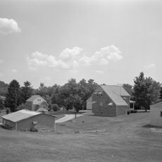
Lake Monongahela was a vast prehistoric water body that covered areas of western Pennsylvania, West Virginia, and Ohio, reaching an elevation of about 1,100 feet (335 meters) above sea level. The basin accumulated fine-grained sediments and clay deposits that remain visible today in the flat terrain of the region.
Around 900,000 years ago during the Pre-Illinoian glacial period, the Laurentide Ice Sheet blocked northward drainage and created this lake south of the ice front. The water body eventually disappeared as climate changed and drainage patterns in the region shifted.
I.C. White, first director of the West Virginia Geological Survey, named this water body Lake Monongahela based on its formation through river system obstruction.
The flat areas where this ancient lake once existed can be identified by their level terrain and characteristic clay deposits visible in the landscape. Visitors exploring the region can observe the gentle slopes and terrain features shaped by the former water body and its sediments.
The sediments of this vanished lake preserve shifts in magnetic polarity and pollen records revealing how forests transformed from pine and spruce woodlands to hemlock and hardwood forests. These layers allow scientists to track environmental changes spanning hundreds of thousands of years.
The community of curious travelers
AroundUs brings together thousands of curated places, local tips, and hidden gems, enriched daily by 60,000 contributors worldwide.