Penn-Craft Historic District

Log in to your account

AroundUs is a community-driven map of interesting places, built by curious explorers like you. It grows with every review, story, and photo you share.
Connect to save your favorite spots, contribute locations, and create personalized routes.
Continue with Google
Continue with Apple
Continue with X
Continue with Facebook
Continue with email
By continuing, you accept our Terms and Conditions and our Privacy Policy
Create an account
Add to collection
Map
Suggest a change
Share

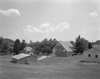
Penn-Craft Historic District, Historic district in Luzerne Township, Fayette County, Pennsylvania.

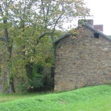
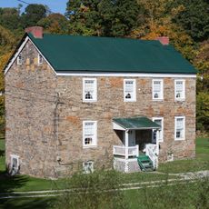
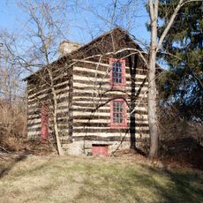
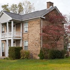
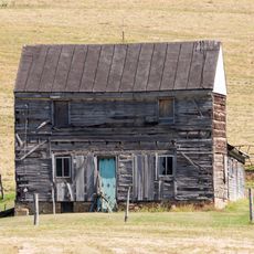
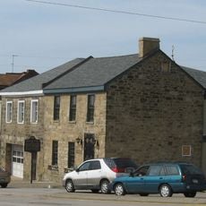
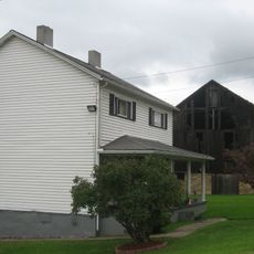
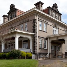
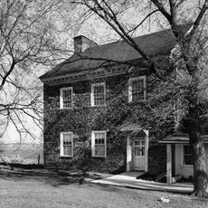
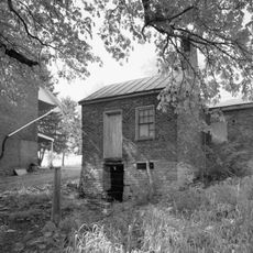
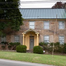
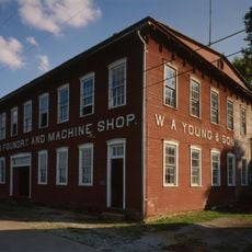
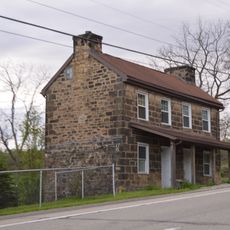
Penn-Craft Historic District is a residential area with over one hundred buildings spread across a large property in Luzerne Township. Most of the houses are constructed from stone and date from the late 1930s through the early 1940s, alongside a cooperative store and other community structures.

The area was established in 1937 to provide homes for unemployed coal miners after the economy collapsed during the Great Depression. The government organization that created it believed that people could live and work on small farms and in communities rather than depending solely on factory jobs.

The layout and design of the houses show how people imagined building communities during hard times, with shared spaces for work and daily life. You can see this vision in how the stone homes and nearby buildings are arranged together.

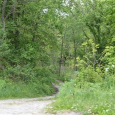
The site is located in a rural area and is easy to explore on foot, as the roads and houses are relatively close together. The best way to experience the area is to walk around and observe the various houses and community buildings from different angles.

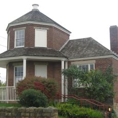
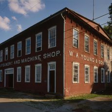
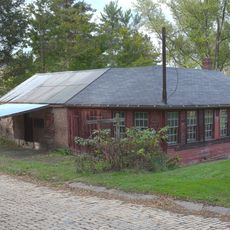
A knitting factory from 1939 still stands on the property and reveals that residents did not simply farm but also worked in small manufacturing facilities. This blend of agricultural and industrial labor within a planned community was unusual for its time.

Location: Pennsylvania

GPS coordinates: 39.95920,-79.91250

Latest update: December 14, 2025 11:26

Photos
Around this place
Bowman's Castle
United States of America

Bowman's Castle

7.5 km
Dunlap's Creek Bridge
United States of America

Dunlap's Creek Bridge

7.3 km
Searights Tollhouse, National Road
United States of America

Searights Tollhouse, National Road

10.2 km
Brownsville Bridge
United States of America

Brownsville Bridge

7.3 km
Lane Bane Bridge
United States of America

Lane Bane Bridge

7.7 km
Peter Colley Tavern and Barn
United States of America

Peter Colley Tavern and Barn

7.3 km
Andrew Rabb House
United States of America

Andrew Rabb House

9.9 km
Regester Log House
United States of America

Regester Log House

9.3 km
Oak Hill Estate
United States of America

Oak Hill Estate

2 km
Wallace-Baily Tavern
United States of America

Wallace-Baily Tavern

6.5 km
William Crawford House
United States of America

William Crawford House

7.9 km
Brownsville Northside Historic District
United States of America

Brownsville Northside Historic District

7.5 km
Brier Hill
United States of America

Brier Hill

7.4 km
W. A. Young and Sons Foundry and Machine Shop
United States of America

W. A. Young and Sons Foundry and Machine Shop

7.4 km
Carmichaels Covered Bridge
United States of America

Carmichaels Covered Bridge

8.7 km
Thomas H. Thompson House
United States of America

Thomas H. Thompson House

5.9 km
Joseph Dorsey House
United States of America

Joseph Dorsey House

6.9 km
West Brownsville Junction Bridge
United States of America

West Brownsville Junction Bridge

8.9 km
Brownsville Commercial Historic District
United States of America

Brownsville Commercial Historic District

7.3 km
Harrison House
United States of America

Harrison House

9.5 km
Springer Farm
United States of America

Springer Farm

1.9 km
Hugh Laughlin House
United States of America

Hugh Laughlin House

7.5 km
Johnson-Hatfield Tavern
United States of America

Johnson-Hatfield Tavern

7.7 km
Brown-Moore Blacksmith Shop
United States of America

Brown-Moore Blacksmith Shop

2 km
Rice's Landing Historic District
United States of America

Rice's Landing Historic District

7.6 km
National Pike Steam Gas and Horse Association
United States of America

National Pike Steam Gas and Horse Association

8.5 km
Hepner–Bailey Field at Adamson Stadium
United States of America

Hepner–Bailey Field at Adamson Stadium

10.1 km
Josiah Frost House
United States of America

Josiah Frost House

9.1 km
Show the full map
Reviews

Visited this place? Tap the stars to rate it and share your experience / photos with the community! Try now! You can cancel it anytime.

« Penn-Craft Historic District - Historic district in Luzerne Township, Fayette County, Pennsylvania » is provided by Around Us (aroundus.com). Images and texts are derived from Wikimedia project under a Creative Commons license. You are allowed to copy, distribute, and modify copies of this page, under the conditions set by the license, as long as this note is clearly visible.

Discover hidden gems everywhere you go!

From secret cafés to breathtaking viewpoints, skip the crowded tourist spots and find places that match your style. Our app makes it easy with voice search, smart filtering, route optimization, and insider tips from travelers worldwide. Download now for the complete mobile experience.

Around Us App Screenshot

A unique approach to discovering new places

Le Figaro

All the places worth exploring

France Info

A tailor-made excursion in just a few clicks

20 Minutes