Seventy Six Falls, Waterfall in Clinton County, Kentucky, US.
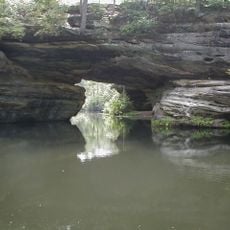
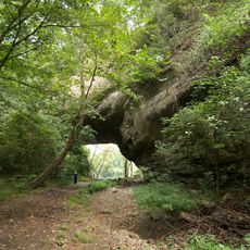
Seventy Six Falls is a waterfall on Indian Creek in Clinton County that drops 38 feet (11.5 meters) before flowing into Lake Cumberland. The cascade moves through rocky terrain and forms a notable feature of the local watershed.
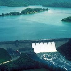
Before Wolf Creek Dam was built to create Lake Cumberland, this waterfall measured 84 feet (25.6 meters) in its natural state. The damming of water fundamentally altered the waterfall's size and flow.
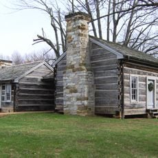
The name connects to the community of Seventy Six, which established its post office in 1830 under the name Goodson before adopting a new identity in 1834. Local heritage shaped how people view this waterfall area.
The falls are accessible via Kentucky State Route 3062, where a paved parking area provides visitor access. Safety fencing surrounds viewing points to help guests explore the site safely.
The waterfall is part of the Fort Payne geological formation, which contains distinct layers of siltstone, shale, and limestone. This layered structure is often overlooked by visitors despite revealing the region's geology.
The community of curious travelers
AroundUs brings together thousands of curated places, local tips, and hidden gems, enriched daily by 60,000 contributors worldwide.