Winston-Salem Tobacco Historic District

Log in to your account

AroundUs is a community-driven map of interesting places, built by curious explorers like you. It grows with every review, story, and photo you share.
Connect to save your favorite spots, contribute locations, and create personalized routes.
Continue with Google
Continue with Apple
Continue with X
Continue with Facebook
Continue with email
By continuing, you accept our Terms and Conditions and our Privacy Policy
Create an account
Add to collection
Map
Suggest a change
Share

Winston-Salem Tobacco Historic District, Industrial heritage district in Winston-Salem, North Carolina.

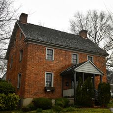
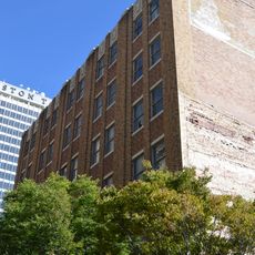
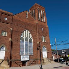
The Winston-Salem Tobacco Historic District is a 31-acre industrial section containing 16 contributing buildings and 16 structures that developed between 1890 and 1959. The area displays a mix of massive tobacco warehouses and varied commercial buildings lined along several streets through the city center.

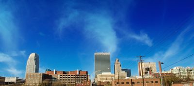
The area emerged around 1890 with the rise of major tobacco factories and soon became the center of R.J. Reynolds Tobacco Company operations. Over seven decades, the area grew with the industry and shaped the economic development of the entire city.

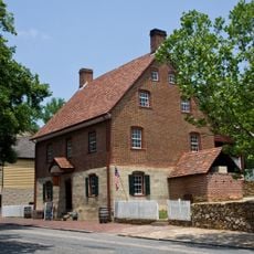
The district served as the economic heart for tobacco workers across generations and housed a thriving African American business quarter alongside wholesale trading zones. The spaces today show how daily life was interwoven with the tobacco industry.

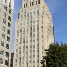
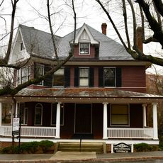
The area is best explored on foot by following the boundaries along Chestnut Street, Fifth and Seventh Streets, Linden Street, and Fourth and Fogle Streets. Many buildings remain in private hands, but the street-level views offer good perspectives of the facades and overall layout.

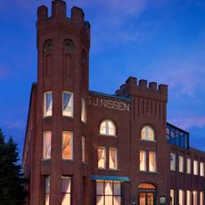
The district contains the remarkably preserved S.J. Nissen Building with its Romanesque Revival architecture, standing out among more utilitarian warehouse structures. This single ornamental building speaks to the wealth and architectural ambition that the tobacco business created in the city.

Location: North Carolina

GPS coordinates: 36.10056,-80.24000

Latest update: December 14, 2025 18:10

Photos
Around this place
Old Salem
United States of America

Old Salem

1.5 km
Reynolds Building
United States of America

Reynolds Building

441 m
100 North Main Street
United States of America

100 North Main Street

385 m
Winston Tower
United States of America

Winston Tower

428 m
BB&T Financial Center
United States of America

BB&T Financial Center

858 m
Salem Tavern
United States of America

Salem Tavern

1.7 km
Single Brothers' House
United States of America

Single Brothers' House

1.5 km
S. J. Nissen Building
United States of America

S. J. Nissen Building

312 m
Forsyth County Courthouse
United States of America

Forsyth County Courthouse

481 m
Home Moravian Church
United States of America

Home Moravian Church

1.4 km
Goler Metropolitan AME Zion Church
United States of America

Goler Metropolitan AME Zion Church

1.1 km
Zevely House
United States of America

Zevely House

1.6 km
8 West Third Street
United States of America

8 West Third Street

531 m
Winston-Salem City Hall
United States of America

Winston-Salem City Hall

686 m
Pepper Building
United States of America

Pepper Building

529 m
Goler Memorial African Methodist Episcopal Zion Church
United States of America

Goler Memorial African Methodist Episcopal Zion Church

238 m
Brickenstein-Leinbach House
United States of America

Brickenstein-Leinbach House

1.2 km
Agnew Hunter Bahnson House
United States of America

Agnew Hunter Bahnson House

1.2 km
Craver Apartment Building
United States of America

Craver Apartment Building

336 m
James Mitchell Rogers House
United States of America

James Mitchell Rogers House

986 m
J. S. Hill House
United States of America

J. S. Hill House

1.6 km
Winston-Salem Southbound Railway Freight Warehouse and Office
United States of America

Winston-Salem Southbound Railway Freight Warehouse and Office

1.1 km
A. Robinson Building
United States of America

A. Robinson Building

267 m
William Allen Blair House
United States of America

William Allen Blair House

1.1 km
S. G. Atkins House
United States of America

S. G. Atkins House

1.3 km
H. D. Poindexter Houses
United States of America

H. D. Poindexter Houses

1.2 km
Conrad-Starbuck House
United States of America

Conrad-Starbuck House

1 km
Holly Avenue Historic District
United States of America

Holly Avenue Historic District

1.4 km
Show the full map
Reviews

Visited this place? Tap the stars to rate it and share your experience / photos with the community! Try now! You can cancel it anytime.

« Winston-Salem Tobacco Historic District - Industrial heritage district in Winston-Salem, North Carolina » is provided by Around Us (aroundus.com). Images and texts are derived from Wikimedia project under a Creative Commons license. You are allowed to copy, distribute, and modify copies of this page, under the conditions set by the license, as long as this note is clearly visible.

Discover hidden gems everywhere you go!

From secret cafés to breathtaking viewpoints, skip the crowded tourist spots and find places that match your style. Our app makes it easy with voice search, smart filtering, route optimization, and insider tips from travelers worldwide. Download now for the complete mobile experience.

Around Us App Screenshot

A unique approach to discovering new places

Le Figaro

All the places worth exploring

France Info

A tailor-made excursion in just a few clicks

20 Minutes