Enable Location

We need your location to show you interesting places around you

Discover nearby places

Find interesting locations and hidden gems around you

Precise directions

Get accurate directions and distances to places

Your location is never shared with other users. It's only used when you tap the location button.

South Wedge Historic District

Log in to your account

Start exploring — it's free

Trusted by 62,474 travelers worldwide

Continue with Google
Continue with Apple
or

We will send you a code to connect

By continuing, you accept our Terms and Conditions and our Privacy Policy

Check your inbox

We've sent a pincode in your inbox. Please enter the code below.

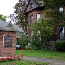
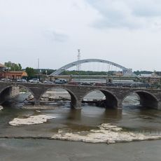
South Wedge Historic District, Historic district in southeast Rochester, United States.

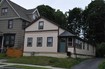
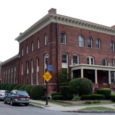
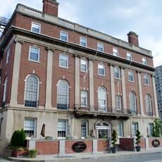
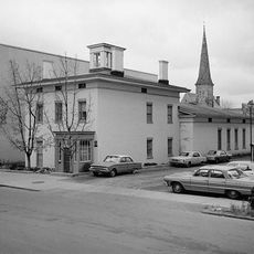
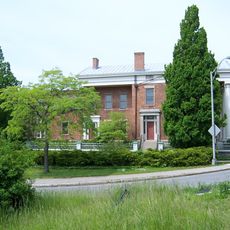
The South Wedge Historic District is a residential area in southeast Rochester covering about 77 acres with mostly two-story homes built between 1840 and 1920. The buildings display Italianate and Queen Anne architectural styles with varying window arrangements, ornamental details, and roof designs.

The area developed as a popular residential neighborhood during Rochester's industrial growth, attracting workers and merchants. It was added to the National Register of Historic Places in 2013, recognizing its importance to American architectural history.

The neighborhood displays homes from different periods that show how people's building tastes changed over time. You notice these differences in the facades and details when walking through the streets.

The district is easy to explore on foot at a leisurely pace through its various streets. The best time to visit is during daylight hours when you can clearly see the architectural details and differences between the homes.

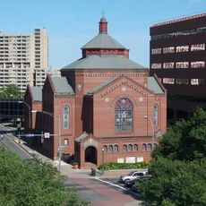
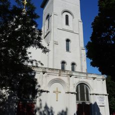
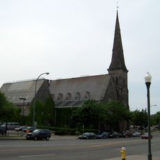
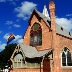
Many visitors overlook St. Andrew's Episcopal Church and Engine Company Number 8, two notable buildings that shaped the area's history. These structures show how public and religious buildings were also part of neighborhood development.

The community of curious travelers

AroundUs brings together thousands of curated places, local tips, and hidden gems, enriched daily by 60,000 contributors worldwide.

Start exploring
Location
Address
20-98 Alexander, 20-123 Ashland, 39-336 Averill, 14-89 Bond, 38-149 Comfort, 1-396 Gregory, 59-279 Hamilton Sts.
GPS coordinates
43.14333,-77.60389
Latest update
December 12, 2025 09:08
Around this place
United States of America

National Toy Hall of Fame

1.1 km
The National Museum of Play
United States of America

The National Museum of Play

1 km
Xerox Tower
United States of America

Xerox Tower

1.2 km
Geva Theatre Center
United States of America

Geva Theatre Center

992 m
Statue of Frederick Douglass
United States of America

Statue of Frederick Douglass

1.2 km
Broad Street Bridge
United States of America

Broad Street Bridge

1.4 km
Frederick Douglass-Susan B. Anthony Memorial Bridge
United States of America

Frederick Douglass-Susan B. Anthony Memorial Bridge

960 m
Legacy Tower
United States of America

Legacy Tower

1.3 km
Tower 280
United States of America

Tower 280

1.4 km
Gannett Building
United States of America

Gannett Building

1.4 km
Linden-South Historic District
United States of America

Linden-South Historic District

526 m
First Universalist Church
United States of America

First Universalist Church

1.2 km
Nazareth House
United States of America

Nazareth House

483 m
Ellwanger Garden
United States of America

Ellwanger Garden

1.1 km
Immaculate Conception Church
United States of America

Immaculate Conception Church

1.2 km
Court Street Bridge
United States of America

Court Street Bridge

1.2 km
First Presbyterian Church
United States of America

First Presbyterian Church

1.4 km
United States of America

Third Ward Historic District

1.2 km
University Club
United States of America

University Club

1.4 km
Saint Andrew's Episcopal Church
United States of America

Saint Andrew's Episcopal Church

438 m
Ebenezer Watts House
United States of America

Ebenezer Watts House

1.4 km
Soldiers' and Sailors' Monument
United States of America

Soldiers' and Sailors' Monument

1.1 km
Washington Square Park
United States of America

Washington Square Park

1.1 km
Campbell-Whittlesey House
United States of America

Campbell-Whittlesey House

1.1 km
Rochester City School No. 24
United States of America

Rochester City School No. 24

829 m
Mount Hope-Highland Historic District
United States of America

Mount Hope-Highland Historic District

1 km
Equal Grounds Coffee House
United States of America

Equal Grounds Coffee House

307 m
Five Star Bank Plaza
United States of America

Five Star Bank Plaza

1.3 km
Show the full map
« South Wedge Historic District - Historic district in southeast Rochester, United States » is provided by Around Us (aroundus.com). Images and texts are derived from Wikimedia project under a Creative Commons license. You are allowed to copy, distribute, and modify copies of this page, under the conditions set by the license, as long as this note is clearly visible.

Discover hidden gems everywhere you go!

From secret cafés to breathtaking viewpoints, skip the crowded tourist spots and find places that match your style. Our app makes it easy with voice search, smart filtering, route optimization, and insider tips from travelers worldwide. Download now for the complete mobile experience.

Around Us App Screenshot

A unique approach to discovering new places

Le Figaro

All the places worth exploring

France Info

A tailor-made excursion in just a few clicks

20 Minutes

Around Us
Travel Guide & Maps
Download

Send to your phone

QR Code
1

Open the camera app on your mobile.

2

Point at the QR code with your camera. A notification will appear.

3

Tap the notification to open the link.