Montgomery Locks and Dam

Log in to your account

AroundUs is a community-driven map of interesting places, built by curious explorers like you. It grows with every review, story, and photo you share.
Connect to save your favorite spots, contribute locations, and create personalized routes.
By continuing, you accept our Terms and Conditions and our Privacy Policy

Montgomery Locks and Dam

Add to collection
Map
Suggest a change
Share

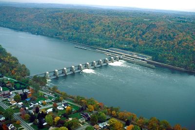
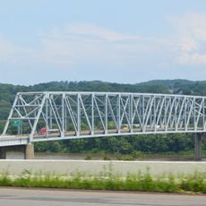
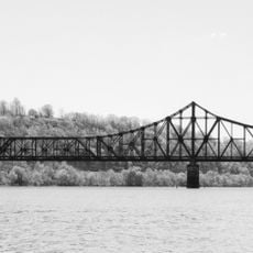
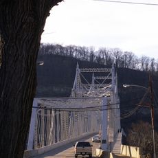
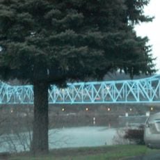
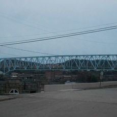
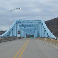
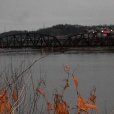
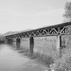
Montgomery Locks and Dam, Lock and gravity dam system on Ohio River, Beaver County, US

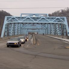
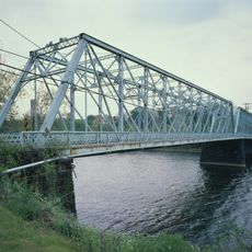
Montgomery Locks and Dam is a two-lock system on the Ohio River in Beaver County that manages vessel passage through a gravity dam structure. The larger commercial lock accommodates barge traffic while the smaller recreational lock serves pleasure boats and smaller craft.

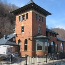
Construction began in 1932 and concluded in June 1936 as part of Depression-era infrastructure development along the Ohio River. The United States Army Corps of Engineers built the facility to improve navigation safety and reliability on the waterway.

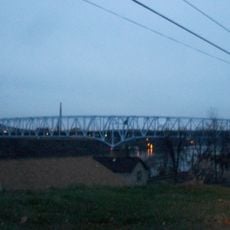
The facility is woven into the daily life of river transportation, connecting communities and industries along the waterway. Visitors can observe how this place has shaped the region's connection to commerce and travel.

The site offers viewpoints where visitors can watch vessels pass through the locks, with more traffic typically occurring during warmer months. Arriving early in the day increases chances of seeing active lock operations and boat movements.

An environmental monitoring station at the site has collected water quality data since the late 1930s, making it one of the longest-running observation points on the river. This decades-long record allows researchers to track changes in river conditions and ecosystem health.

Location: Beaver County

GPS coordinates: 40.65030,-80.38600

Latest update: December 13, 2025 17:04

Photos
Around this place
Old Economy Village
United States of America

Old Economy Village

14.3 km
Beginning Point of the U.S. Public Land Survey
United States of America

Beginning Point of the U.S. Public Land Survey

11.3 km
Chester teapot
United States of America

Chester teapot

15 km
Legionville
United States of America

Legionville

13.7 km
Fort McIntosh
United States of America

Fort McIntosh

8.4 km
Jennings Randolph Bridge
United States of America

Jennings Randolph Bridge

15.2 km
Beaver Bridge
United States of America

Beaver Bridge

9.3 km
Matthew S. Quay House
United States of America

Matthew S. Quay House

8.4 km
Carnegie Free Library of Beaver Falls
United States of America

Carnegie Free Library of Beaver Falls

12.7 km
Merrick Art Gallery
United States of America

Merrick Art Gallery

11.2 km
Ambridge-Aliquippa Bridge
United States of America

Ambridge-Aliquippa Bridge

14.2 km
Monaca – East Rochester Bridge
United States of America

Monaca – East Rochester Bridge

11.1 km
B.F. Jones Memorial Library
United States of America

B.F. Jones Memorial Library

12.1 km
Captain William Vicary House
United States of America

Captain William Vicary House

12 km
Rochester-Monaca Bridge
United States of America

Rochester-Monaca Bridge

10.1 km
William B. Dunlap Mansion
United States of America

William B. Dunlap Mansion

9.8 km
Shippingport Bridge
United States of America

Shippingport Bridge

4.7 km
Merrill Lock No. 6
United States of America

Merrill Lock No. 6

3.5 km
Eastvale Bridge
United States of America

Eastvale Bridge

14.2 km
Vanport Bridge
United States of America

Vanport Bridge

5.6 km
Bridgewater Historic District
United States of America

Bridgewater Historic District

9.9 km
Fallston Bridge
United States of America

Fallston Bridge

10.7 km
David Littell House
United States of America

David Littell House

10.5 km
Old Main
United States of America

Old Main

14.6 km
Rochester-Beaver Railroad Bridge
United States of America

Rochester-Beaver Railroad Bridge

9.7 km
Beaver River Railroad Bridge
United States of America

Beaver River Railroad Bridge

11.4 km
Beaver Historic District
United States of America

Beaver Historic District

8.3 km
Hilltop Drive-In
United States of America

Hilltop Drive-In

14.7 km
Show the full map
Reviews

Visited this place? Tap the stars to rate it and share your experience / photos with the community! Try now! You can cancel it anytime.

« Montgomery Locks and Dam - Lock and gravity dam system on Ohio River, Beaver County, US » is provided by Around Us (aroundus.com). Images and texts are derived from Wikimedia project under a Creative Commons license. You are allowed to copy, distribute, and modify copies of this page, under the conditions set by the license, as long as this note is clearly visible.

Discover hidden gems everywhere you go!

From secret cafés to breathtaking viewpoints, skip the crowded tourist spots and find places that match your style. Our app makes it easy with voice search, smart filtering, route optimization, and insider tips from travelers worldwide. Download now for the complete mobile experience.

Around Us App Screenshot

A unique approach to discovering new places

Le Figaro

All the places worth exploring

France Info

A tailor-made excursion in just a few clicks

20 Minutes