Enable Location

We need your location to show you interesting places around you

Discover nearby places

Find interesting locations and hidden gems around you

Precise directions

Get accurate directions and distances to places

Your location is never shared with other users. It's only used when you tap the location button.

Bryant Creek State Park

Log in to your account

Start exploring — it's free

Trusted by 61,343 travelers worldwide

Continue with Google
Continue with Apple
or

We will send you a code to connect

By continuing, you accept our Terms and Conditions and our Privacy Policy

Check your inbox

We've sent a pincode in your inbox. Please enter the code below.

Bryant Creek State Park

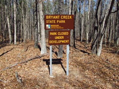
Bryant Creek State Park, State park in Douglas County, Missouri, US

Description

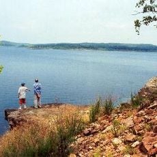
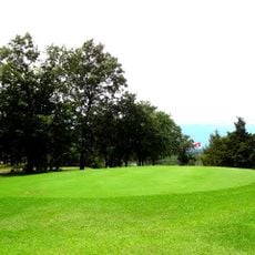
Bryant Creek State Park is a 2,917-acre nature preserve in Douglas County with oak and pine forests, dolomite cliffs, sandstone rock formations, and four tributary hollows along the water course. The grounds include two hiking trails totaling 5.1 miles and picnic areas with tables.

History

The area served as a major north-south travel route through the watershed before automobiles became common, with people moving on foot, horseback, or by wagon. This route played a role in early human movement through the Ozark region.

Culture

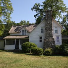
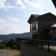
The place demonstrates how the Ozark region is protected and used for outdoor recreation today. Visitors can see how people experience this forested landscape with its creeks and rocky features.

Practical

The two hiking trails require normal footwear and offer a good way to explore the park, while picnic areas provide spots for a rest. An electronic off-road track chair is available to improve accessibility for visitors with mobility needs.

Did you know?

The park is home to Missouri's only native pine species, a tree type rarely found in the eastern United States. This rare tree species makes the forest ecosystem here particularly noteworthy.

Location
Inception
2016
GPS coordinates
36.81870,-92.42220
Latest update
December 12, 2025 17:44

AroundUs brings together thousands of curated places, local tips, and hidden gems, enriched daily by 60,000 contributors worldwide. Discover all places nearby (Missouri).

Around this place
Bull Shoals Lake
United States of America

Bull Shoals Lake

52.3 km
United States of America

Lake Taneycomo

67.7 km
Laura Ingalls Wilder House
United States of America

Laura Ingalls Wilder House

33.4 km
Bull Shoals-White River State Park
United States of America

Bull Shoals-White River State Park

53.2 km
Cotter Bridge
United States of America

Cotter Bridge

62.3 km
Hodgson-Aid Mill
United States of America

Hodgson-Aid Mill

18.6 km
Jacob Wolf House
United States of America

Jacob Wolf House

68.8 km
Laura Ingalls Wilder Historic Home & Museum
United States of America

Laura Ingalls Wilder Historic Home & Museum

33.8 km
Baxter County Courthouse
United States of America

Baxter County Courthouse

53.9 km
North Fork Bridge
United States of America

North Fork Bridge

68.4 km
Mountain Home Commercial Historic District
United States of America

Mountain Home Commercial Historic District

54 km
John Conkin and Clara Layton Harlin House
United States of America

John Conkin and Clara Layton Harlin House

23.7 km
United States of America

Mount Zion Lodge Masonic Temple

52 km
Case-Shiras-Dearmore House
United States of America

Case-Shiras-Dearmore House

53.8 km
Courthouse Square Historic District
United States of America

Courthouse Square Historic District

51.8 km
Ava Ranger Station Historic District
United States of America

Ava Ranger Station Historic District

25.1 km
Col. Thomas C. Love House
United States of America

Col. Thomas C. Love House

49.5 km
Casey House
United States of America

Casey House

55.2 km
Cotter Water Tower
United States of America

Cotter Water Tower

61.4 km
Rollins Hospital
United States of America

Rollins Hospital

60 km
Fairview School Building
United States of America

Fairview School Building

56.4 km
Horace Mann School Historic District
United States of America

Horace Mann School Historic District

69.4 km
Davis House
United States of America

Davis House

68.9 km
Buford School Building
United States of America

Buford School Building

63.5 km
County Line School and Lodge
United States of America

County Line School and Lodge

44.2 km
KY3-Sendemast
United States of America

KY3-Sendemast

60.8 km
Lost Woods Golf Course
United States of America

Lost Woods Golf Course

34.6 km
Topaz Mill
United States of America

Topaz Mill

24.1 km
Show the full map
« Bryant Creek State Park - State park in Douglas County, Missouri, US » is provided by Around Us (aroundus.com). Images and texts are derived from Wikimedia project under a Creative Commons license. You are allowed to copy, distribute, and modify copies of this page, under the conditions set by the license, as long as this note is clearly visible.

Discover hidden gems everywhere you go!

From secret cafés to breathtaking viewpoints, skip the crowded tourist spots and find places that match your style. Our app makes it easy with voice search, smart filtering, route optimization, and insider tips from travelers worldwide. Download now for the complete mobile experience.

Around Us App Screenshot

A unique approach to discovering new places

Le Figaro

All the places worth exploring

France Info

A tailor-made excursion in just a few clicks

20 Minutes

Around Us
Travel Guide & Maps
Download

Send to your phone

QR Code
1

Open the camera app on your mobile.

2

Point at the QR code with your camera. A notification will appear.

3

Tap the notification to open the link.