Enable Location

We need your location to show you interesting places around you

Discover nearby places

Find interesting locations and hidden gems around you

Precise directions

Get accurate directions and distances to places

Your location is never shared with other users. It's only used when you tap the location button.

Jamaica State Park

Log in to your account

Start exploring — it's free

Trusted by 61,895 travelers worldwide

Continue with Google
Continue with Apple
or

We will send you a code to connect

By continuing, you accept our Terms and Conditions and our Privacy Policy

Check your inbox

We've sent a pincode in your inbox. Please enter the code below.

Jamaica State Park

Jamaica State Park, State park in Jamaica, Vermont, United States.

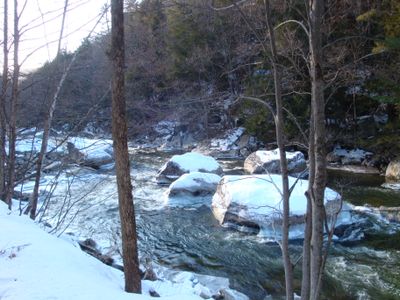
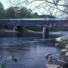
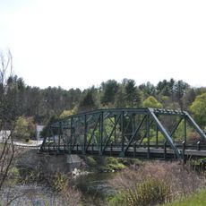
Jamaica State Park is a forested preserve in Vermont spanning over 700 acres with maintained trails and camping facilities distributed across the landscape. The property borders the West River, where water access points allow visitors to reach the riverbank from multiple locations.

A railroad line ran through the current park grounds starting in 1879, but a major flood in 1927 destroyed the tracks and infrastructure. This natural disaster ended rail service and changed how the land was used afterward.

The park serves as an educational center where visitors participate in nature programs focused on local wildlife, plant species, and environmental conservation.

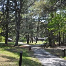
The park provides tent camping spaces and covered shelter areas with modern restroom facilities and warm showers located in several buildings. Picnic spots are scattered throughout the property for day visitors who want to spend a few hours by the river or in the woods.

When Ball Mountain Dam releases water, whitewater kayakers find temporary rapids and challenging current conditions for technical paddling. These scheduled water releases transform sections of the West River into an appealing destination for river sports enthusiasts seeking a test of their skills.

The community of curious travelers

AroundUs brings together thousands of curated places, local tips, and hidden gems, enriched daily by 60,000 contributors worldwide.

Start exploring
Location
Inception
1969
GPS coordinates
43.10570,-72.77340
Latest update
December 14, 2025 09:43
Around this place
Stratton Mountain
United States of America

Stratton Mountain

12.5 km
Scott Covered Bridge
United States of America

Scott Covered Bridge

8.9 km
Townshend State Park
United States of America

Townshend State Park

9.8 km
Park Farm
United States of America

Park Farm

15.3 km
West Townshend Stone Arch Bridge
United States of America

West Townshend Stone Arch Bridge

5.7 km
Kidder Covered Bridge
United States of America

Kidder Covered Bridge

15.3 km
Historical Society of Windham County
United States of America

Historical Society of Windham County

16.6 km
First Congregational Church and Meetinghouse
United States of America

First Congregational Church and Meetinghouse

10.7 km
South Londonderry Village Historic District
United States of America

South Londonderry Village Historic District

9.7 km
Old Brick Church
United States of America

Old Brick Church

16 km
Follett Stone Arch Bridge Historic District
United States of America

Follett Stone Arch Bridge Historic District

8.3 km
Windham Village Historic District
United States of America

Windham Village Historic District

8.8 km
Middletown Rural Historic District
United States of America

Middletown Rural Historic District

15.3 km
Grafton Public Library
United States of America

Grafton Public Library

15.5 km
Grafton Village Historic District
United States of America

Grafton Village Historic District

15.4 km
Brookline-Newfane Bridge
United States of America

Brookline-Newfane Bridge

16.4 km
Londonderry Town House
United States of America

Londonderry Town House

10.5 km
Wheelock House
United States of America

Wheelock House

12 km
Mechanicsville Historic District
United States of America

Mechanicsville Historic District

15.9 km
Simpsonville Stone Arch Bridge
United States of America

Simpsonville Stone Arch Bridge

10.4 km
Houghtonville Historic District
United States of America

Houghtonville Historic District

14.5 km
Grafton District Schoolhouse No. 2
United States of America

Grafton District Schoolhouse No. 2

15.5 km
Milldean and Alexander-Davis House
United States of America

Milldean and Alexander-Davis House

15.3 km
South Windham Village Historic District
United States of America

South Windham Village Historic District

5.5 km
Stratton Mountain Lookout Tower
United States of America

Stratton Mountain Lookout Tower

12.5 km
Hamilton Falls
United States of America

Hamilton Falls

3.5 km
West Townshend Village Historic District
United States of America

West Townshend Village Historic District

5.6 km
Newfane Village Historic District
United States of America

Newfane Village Historic District

16.2 km
Show the full map
« Jamaica State Park - State park in Jamaica, Vermont, United States » is provided by Around Us (aroundus.com). Images and texts are derived from Wikimedia project under a Creative Commons license. You are allowed to copy, distribute, and modify copies of this page, under the conditions set by the license, as long as this note is clearly visible.

Discover hidden gems everywhere you go!

From secret cafés to breathtaking viewpoints, skip the crowded tourist spots and find places that match your style. Our app makes it easy with voice search, smart filtering, route optimization, and insider tips from travelers worldwide. Download now for the complete mobile experience.

Around Us App Screenshot

A unique approach to discovering new places

Le Figaro

All the places worth exploring

France Info

A tailor-made excursion in just a few clicks

20 Minutes

Around Us
Travel Guide & Maps
Download

Send to your phone

QR Code
1

Open the camera app on your mobile.

2

Point at the QR code with your camera. A notification will appear.

3

Tap the notification to open the link.