Townshend State Park

Log in to your account

AroundUs is a community-driven map of interesting places, built by curious explorers like you. It grows with every review, story, and photo you share.
Connect to save your favorite spots, contribute locations, and create personalized routes.
Continue with Google
Continue with Apple
Continue with X
Continue with Facebook
Continue with email
By continuing, you accept our Terms and Conditions and our Privacy Policy
Create an account
Add to collection
Map
Suggest a change
Share

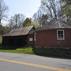
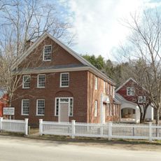
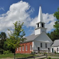
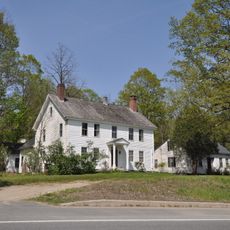
Townshend State Park, Recreation area in Townshend, United States.

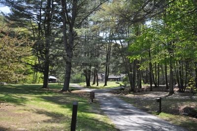
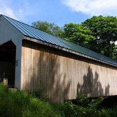
Townshend State Park is a campground spread across roughly 18 acres at the foot of Bald Mountain, surrounded by mixed forest and crisscrossed with several trails through the woods. The property holds 30 tent sites and 4 lean-to shelters alongside basic facilities like restrooms and coin showers for visitors.

The park was founded in 1927 during the Great Depression as a project of the Civilian Conservation Corps, a federal program that gave work to young men across the nation. This Depression-era construction shaped the park's layout and the trails visitors use today.

The park draws visitors who value simple outdoor camping and sleeping under the trees in the traditional Vermont style. The mix of tent sites and lean-to shelters shows how people in this region have always preferred to experience nature on its own terms.

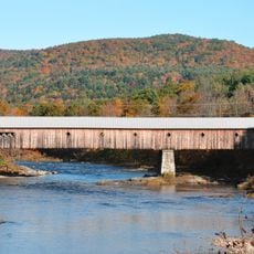
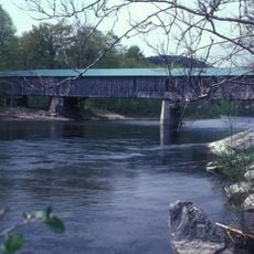
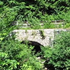
You reach the park by driving Town Highway 4, a gravel road running beside the West River and easy to find by car. Bear in mind the place fills up during summer months, and the trails can be muddy or harder to walk after rain.

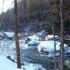
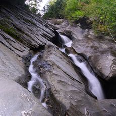
The main trail climbs steeply from the campground up the north slope of Bald Mountain, passing through rock chutes, small waterfalls, and natural pools formed in the stone. This single path changes what visitors experience, transforming a quiet campsite into an adventure for those willing to hike.

Location: Townshend

Inception: 1927

Website: https://vtstateparks.com/townshend.html

GPS coordinates: 43.04090,-72.69240

Latest update: December 14, 2025 18:03

Photos
Around this place
West Dummerston Covered Bridge
United States of America

West Dummerston Covered Bridge

13.3 km
Jamaica State Park
United States of America

Jamaica State Park

9.8 km
Scott Covered Bridge
United States of America

Scott Covered Bridge

888 m
Round Schoolhouse
United States of America

Round Schoolhouse

7.5 km
Sacketts Brook Stone Arch Bridge
United States of America

Sacketts Brook Stone Arch Bridge

16 km
Williamsville Covered Bridge
United States of America

Williamsville Covered Bridge

10.9 km
Dover Town Hall
United States of America

Dover Town Hall

14 km
Putney Village Historic District
United States of America

Putney Village Historic District

15.5 km
Rice Farm Road Bridge
United States of America

Rice Farm Road Bridge

15.3 km
West Townshend Stone Arch Bridge
United States of America

West Townshend Stone Arch Bridge

5 km
Kidder Covered Bridge
United States of America

Kidder Covered Bridge

15.9 km
Historical Society of Windham County
United States of America

Historical Society of Windham County

7 km
First Congregational Church and Meetinghouse
United States of America

First Congregational Church and Meetinghouse

2 km
Old Brick Church
United States of America

Old Brick Church

13 km
Follett Stone Arch Bridge Historic District
United States of America

Follett Stone Arch Bridge Historic District

1.6 km
Windham Village Historic District
United States of America

Windham Village Historic District

15.4 km
Theophilus Crawford House
United States of America

Theophilus Crawford House

13.5 km
Brookline-Newfane Bridge
United States of America

Brookline-Newfane Bridge

6.6 km
South Newfane Bridge
United States of America

South Newfane Bridge

11.5 km
Wheelock House
United States of America

Wheelock House

2.5 km
Brookline Baptist Church
United States of America

Brookline Baptist Church

7.5 km
Simpsonville Stone Arch Bridge
United States of America

Simpsonville Stone Arch Bridge

4.5 km
Sabin-Wheat Farm
United States of America

Sabin-Wheat Farm

13.9 km
Milldean and Alexander-Davis House
United States of America

Milldean and Alexander-Davis House

16.1 km
South Windham Village Historic District
United States of America

South Windham Village Historic District

9.9 km
Hamilton Falls
United States of America

Hamilton Falls

12.1 km
West Townshend Village Historic District
United States of America

West Townshend Village Historic District

5.1 km
Newfane Village Historic District
United States of America

Newfane Village Historic District

6.6 km
Show the full map
Reviews

Visited this place? Tap the stars to rate it and share your experience / photos with the community! Try now! You can cancel it anytime.

« Townshend State Park - Recreation area in Townshend, United States » is provided by Around Us (aroundus.com). Images and texts are derived from Wikimedia project under a Creative Commons license. You are allowed to copy, distribute, and modify copies of this page, under the conditions set by the license, as long as this note is clearly visible.

Discover hidden gems everywhere you go!

From secret cafés to breathtaking viewpoints, skip the crowded tourist spots and find places that match your style. Our app makes it easy with voice search, smart filtering, route optimization, and insider tips from travelers worldwide. Download now for the complete mobile experience.

Around Us App Screenshot

A unique approach to discovering new places

Le Figaro

All the places worth exploring

France Info

A tailor-made excursion in just a few clicks

20 Minutes