Enable Location

We need your location to show you interesting places around you

Discover nearby places

Find interesting locations and hidden gems around you

Precise directions

Get accurate directions and distances to places

Your location is never shared with other users. It's only used when you tap the location button.

Log in to your account

Start exploring — it's free

Trusted by 68,121 travelers worldwide

Continue with Google
Continue with Apple
or

We will send you a code to connect

By continuing, you accept our Terms and Conditions and our Privacy Policy

Check your inbox

We've sent a pincode in your inbox. Please enter the code below.

Discussion Reviews Photo
1.2k Popularity

Clinton Square Historic District, Commercial district in Clinton, Missouri.

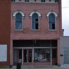
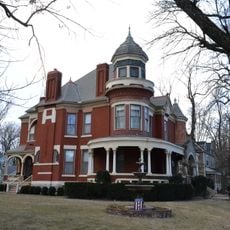
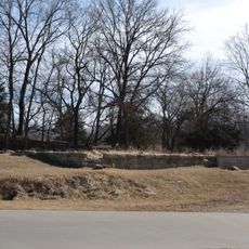
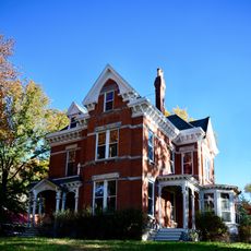
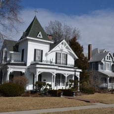
Clinton Square Historic District is a commercial area in Clinton, Missouri, containing 62 buildings, one structure, and one object with Italianate and Romanesque Revival architectural styles. The collection ranges from preserved storefronts and office buildings to prominent public structures surrounding the central plaza.

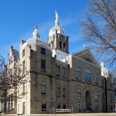
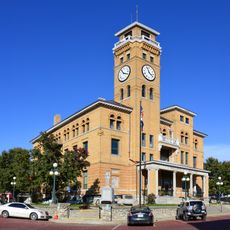
The district developed between 1885 and 1957, with notable structures like the Henry County Courthouse from 1893 and the Anheuser-Busch Brewing Association Building taking shape during this era. This period established the area as a major commercial and administrative hub.

The 1921 Bandstand on Courthouse Square serves as a central gathering place where locals gather for community events and celebrations throughout the year. The square functions as the social heart of this downtown area.

The district is easy to explore on foot, with most buildings clustered around the central plaza. You can view all the structures from street level and get a sense of the area within a short walk.

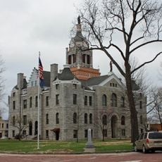
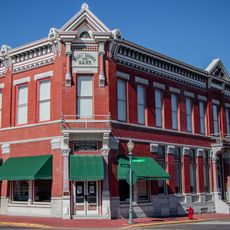
The Old City Hall built in 1891 stands as a distinctive architectural landmark featuring design elements that set it apart from surrounding buildings. Its prominent appearance makes it a natural reference point when exploring the district.

The community of curious travelers

AroundUs brings together thousands of curated places, local tips, and hidden gems, enriched daily by 60,000 contributors worldwide.

Start exploring
Location
GPS coordinates
38.37028,-93.77667
Latest update
December 14, 2025 18:02
Around this place
Truman Reservoir
United States of America

Truman Reservoir

34.6 km
Weaubleau structure
United States of America

Weaubleau structure

44.9 km
Knob Noster State Park
United States of America

Knob Noster State Park

45.4 km
Rock Island Trail State Park
United States of America

Rock Island Trail State Park

29.1 km
510th Missile Squadron
United States of America

510th Missile Squadron

44.7 km
Harry S Truman State Park
United States of America

Harry S Truman State Park

31.3 km
Osage Village State Historic Site
United States of America

Osage Village State Historic Site

57.6 km
509th Missile Squadron
United States of America

509th Missile Squadron

44.7 km
Building at 217 West Main Street
United States of America

Building at 217 West Main Street

60.1 km
United States of America

Fort Carondelet

53.1 km
Upper Bridge
United States of America

Upper Bridge

36.8 km
Harris House
United States of America

Harris House

60.2 km
Johnson County Courthouse
United States of America

Johnson County Courthouse

44.1 km
Howard School
United States of America

Howard School

44.1 km
Harrisonville Courthouse Square Historic District
United States of America

Harrisonville Courthouse Square Historic District

59 km
Bates County Courthouse
United States of America

Bates County Courthouse

52.1 km
Papinville Marais des Cygnes River Bridge
United States of America

Papinville Marais des Cygnes River Bridge

52.1 km
Pleasant View School
United States of America

Pleasant View School

39 km
Jones Brothers Mule Barn
United States of America

Jones Brothers Mule Barn

43.8 km
Johnson County Courthouse
United States of America

Johnson County Courthouse

44.1 km
Warren Street Methodist Episcopal Church
United States of America

Warren Street Methodist Episcopal Church

43.7 km
Glasgow Commercial Historic District
United States of America

Glasgow Commercial Historic District

17.1 km
South Main Street Historic District
United States of America

South Main Street Historic District

26.6 km
Grover Street Victorian Historic District
United States of America

Grover Street Victorian Historic District

43.7 km
Montserrat Recreational Demonstration Area Bridge
United States of America

Montserrat Recreational Demonstration Area Bridge

46.1 km
Montserrat Recreational Demonstration Area Rock Bath House
United States of America

Montserrat Recreational Demonstration Area Rock Bath House

45.4 km
Butler Aquatic Center
United States of America

Butler Aquatic Center

51.2 km
Henry County Museum
United States of America

Henry County Museum

174 m
Show the full map
Reviews
Share your experience

No review yet

Discussions
Start a discussion...

No discussion yet

« Clinton Square Historic District - Commercial district in Clinton, Missouri » is provided by Around Us (aroundus.com). Images and texts are derived from Wikimedia project under a Creative Commons license. You are allowed to copy, distribute, and modify copies of this page, under the conditions set by the license, as long as this note is clearly visible.

Discover hidden gems everywhere you go!

From secret cafés to breathtaking viewpoints, skip the crowded tourist spots and find places that match your style. Our app makes it easy with voice search, smart filtering, route optimization, and insider tips from travelers worldwide. Download now for the complete mobile experience.

Around Us App Screenshot

A unique approach to discovering new places

Le Figaro

All the places worth exploring

France Info

A tailor-made excursion in just a few clicks

20 Minutes

Around Us
Travel Guide & Maps
Download

Send to your phone

QR Code
1

Open the camera app on your mobile.

2

Point at the QR code with your camera. A notification will appear.

3

Tap the notification to open the link.