Log in to your account

AroundUs is a community-driven map of interesting places, built by curious explorers like you. It grows with every review, story, and photo you share.
Connect to save your favorite spots, contribute locations, and create personalized routes.
Continue with Google
Continue with Apple
Continue with X
Continue with Facebook
Continue with email
By continuing, you accept our Terms and Conditions and our Privacy Policy
Create an account

Poison Springs State Forest

Add to collection
Map
Suggest a change
Share

Poison Springs State Forest, State forest and wildlife management area near Camden, Arkansas

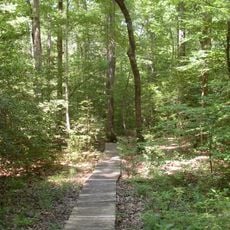
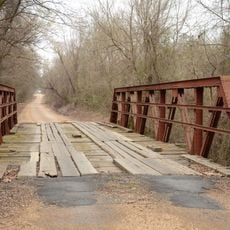
Poison Springs State Forest is a woodland area spanning about 23,500 acres across two counties with dense pine stands and open natural spaces. The property features varied habitats and zones for different uses and protection areas.

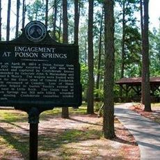
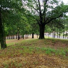
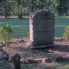
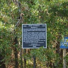
The woodland was the site of a major Civil War battle in 1864 when Confederate forces defeated Union troops in combat. An 85-acre battleground remains as a reminder of this military engagement.

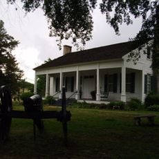
The forest serves as a place where visitors spend time outdoors and engage in simple activities like camping and hiking. The management demonstrates through its work how forests can be maintained while allowing public access.

Visitors can camp at over 90 primitive sites with free permits that allow stays of up to two weeks at a time. Site reservations open each year in mid-July and can be arranged in advance.

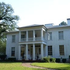
The forest contains several specialized conservation zones including the Sand Barren and an Oak-Pine Forest Reserve. These distinct areas preserve rare habitats and allow natural observation and research.

GPS coordinates: 33.63122,-93.02683

Latest update: December 14, 2025 13:00

Photos
Around this place
White Oak Lake State Park
United States of America

White Oak Lake State Park

10.4 km
Poison Springs Battleground State Park
United States of America

Poison Springs Battleground State Park

2.1 km
Fort Southerland
United States of America

Fort Southerland

20.4 km
Camden Expedition Sites National Historic Landmark
United States of America

Camden Expedition Sites National Historic Landmark

18.6 km
Camden Confederate Monument
United States of America

Camden Confederate Monument

18.9 km
Fort Lookout
United States of America

Fort Lookout

18.2 km
McCollum-Chidester House
United States of America

McCollum-Chidester House

17.9 km
McNeely Creek Bridge
United States of America

McNeely Creek Bridge

33.1 km
Sidney A. Umsted House
United States of America

Sidney A. Umsted House

18.6 km
Ouachita County Courthouse
United States of America

Ouachita County Courthouse

19 km
Rumph House
United States of America

Rumph House

18.1 km
Bragg House
United States of America

Bragg House

13.1 km
Oakland Farm
United States of America

Oakland Farm

19.4 km
Ben Laney Bridge
United States of America

Ben Laney Bridge

19.7 km
Arkansas Highway 57 Bridge
United States of America

Arkansas Highway 57 Bridge

24.6 km
Two Bayou Methodist Church and Cemetery
United States of America

Two Bayou Methodist Church and Cemetery

11.3 km
Carolina Methodist Church
United States of America

Carolina Methodist Church

13.9 km
Ed Knight House
United States of America

Ed Knight House

34.1 km
Leake–Ingham Building
United States of America

Leake–Ingham Building

17.7 km
Capt. John T. Burkett House
United States of America

Capt. John T. Burkett House

30.3 km
Elliott-Meek House
United States of America

Elliott-Meek House

18 km
Hickman House
United States of America

Hickman House

20.9 km
Mount Prospect Methodist Church
United States of America

Mount Prospect Methodist Church

29.5 km
Dennis and Christine Garrison House
United States of America

Dennis and Christine Garrison House

24.6 km
Tate's Barn
United States of America

Tate's Barn

19.6 km
Graham-Gaughan-Betts House
United States of America

Graham-Gaughan-Betts House

18.1 km
Benjamin T. Powell House
United States of America

Benjamin T. Powell House

18.8 km
St. John's Episcopal Church
United States of America

St. John's Episcopal Church

18.8 km
Show the full map
Reviews

Visited this place? Tap the stars to rate it and share your experience / photos with the community! Try now! You can cancel it anytime.

« Poison Springs State Forest - State forest and wildlife management area near Camden, Arkansas » is provided by Around Us (aroundus.com). Images and texts are derived from Wikimedia project under a Creative Commons license. You are allowed to copy, distribute, and modify copies of this page, under the conditions set by the license, as long as this note is clearly visible.

Discover hidden gems everywhere you go!

From secret cafés to breathtaking viewpoints, skip the crowded tourist spots and find places that match your style. Our app makes it easy with voice search, smart filtering, route optimization, and insider tips from travelers worldwide. Download now for the complete mobile experience.

Around Us App Screenshot

A unique approach to discovering new places

Le Figaro

All the places worth exploring

France Info

A tailor-made excursion in just a few clicks

20 Minutes