Enable Location

We need your location to show you interesting places around you

Discover nearby places

Find interesting locations and hidden gems around you

Precise directions

Get accurate directions and distances to places

Your location is never shared with other users. It's only used when you tap the location button.

Log in to your account

Start exploring — it's free

Trusted by 65,437 travelers worldwide

Continue with Google
Continue with Apple
or

We will send you a code to connect

By continuing, you accept our Terms and Conditions and our Privacy Policy

Check your inbox

We've sent a pincode in your inbox. Please enter the code below.

Eaton Reservoir
Discussion Reviews Photo
1.3k Popularity

Eaton Reservoir, body of water

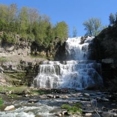
Eaton Reservoir is a Y-shaped body of water located near West Eaton in Madison County that draws fishers and walkers to its shores. The water is notably clear with steep banks, and rooted plants grow to about 50 feet (15 meters) from shore, particularly on the south side of the causeway and western arm where they create a lively appearance.

The reservoir was constructed to supply water to the Erie Canal, a major shipping route for boats and freight in earlier times. This early infrastructure reshaped the landscape and created a new environment for wildlife that continues today.

The name reflects the local Eaton Brook and the area's connection to regional waterways built long ago. Today, people use this spot for simple outdoor activities like fishing and walking, which are embedded in local habits and traditions.

Access is via Eaton Brook Road about 2 miles east of West Eaton, where a concrete boat ramp and parking for 13 cars with trailers are available. The mostly natural setting with few facilities means you should bring everything you need, but the walk to the water is easy and straightforward.

The exceptionally clear water lets you see the bottom in many places, which makes fish easy to spot but more difficult to catch as they retreat to deeper areas. This unusual transparency for an inland reservoir creates a striking visual experience that visitors notice while walking the shore or fishing.

The community of curious travelers

AroundUs brings together thousands of curated places, local tips, and hidden gems, enriched daily by 60,000 contributors worldwide.

Start exploring
Location
GPS coordinates
42.86087,-75.69923
Latest update
February 9, 2026 07:46
Around this place
Chittenango Falls State Park
United States of America

Chittenango Falls State Park

18.1 km
Chenango Canal
United States of America

Chenango Canal

11.5 km
Lorenzo State Historic Site
United States of America

Lorenzo State Historic Site

15.2 km
Gerrit Smith Estate
United States of America

Gerrit Smith Estate

11.9 km
Spirit House
United States of America

Spirit House

20.9 km
Stone Quarry Hill Art Park
United States of America

Stone Quarry Hill Art Park

12.4 km
Smithfield Presbyterian Church
United States of America

Smithfield Presbyterian Church

11.7 km
Earlville Opera House
United States of America

Earlville Opera House

18.5 km
Old Madison County Courthouse
United States of America

Old Madison County Courthouse

6.3 km
Notleymere
United States of America

Notleymere

16.5 km
Earlville Historic District
United States of America

Earlville Historic District

18.4 km
Delphi Baptist Church
United States of America

Delphi Baptist Church

17.6 km
Morrisville Public Library
United States of America

Morrisville Public Library

6.2 km
Seventh Day Baptist Church
United States of America

Seventh Day Baptist Church

18.8 km
First National Bank of Morrisville
United States of America

First National Bank of Morrisville

6.2 km
Hascall Hall
United States of America

Hascall Hall

14.2 km
Upperville Meeting House
United States of America

Upperville Meeting House

19.2 km
Cazenovia Village Historic District
United States of America

Cazenovia Village Historic District

14.9 km
Fenner Baptist Church
United States of America

Fenner Baptist Church

14.1 km
Adon Smith House
United States of America

Adon Smith House

13.3 km
Peterboro Land Office
United States of America

Peterboro Land Office

11.9 km
Albany Street Historic District
United States of America

Albany Street Historic District

14.9 km
Delphi Falls
United States of America

Delphi Falls

16.3 km
Annas Farmhouse
United States of America

Annas Farmhouse

16.6 km
Delphi Village School
United States of America

Delphi Village School

17.7 km
Hamilton Village Historic District
United States of America

Hamilton Village Historic District

13.5 km
Perryville Falls
United States of America

Perryville Falls

18.7 km
Lenox District No. 4 Schoolhouse
United States of America

Lenox District No. 4 Schoolhouse

20.5 km
Show the full map
Reviews
Share your experience

No review yet

Discussions
Start a discussion...

No discussion yet

« Eaton Reservoir - body of water » is provided by Around Us (aroundus.com). Images and texts are derived from Wikimedia project under a Creative Commons license. You are allowed to copy, distribute, and modify copies of this page, under the conditions set by the license, as long as this note is clearly visible.

Discover hidden gems everywhere you go!

From secret cafés to breathtaking viewpoints, skip the crowded tourist spots and find places that match your style. Our app makes it easy with voice search, smart filtering, route optimization, and insider tips from travelers worldwide. Download now for the complete mobile experience.

Around Us App Screenshot

A unique approach to discovering new places

Le Figaro

All the places worth exploring

France Info

A tailor-made excursion in just a few clicks

20 Minutes

Around Us
Travel Guide & Maps
Download

Send to your phone

QR Code
1

Open the camera app on your mobile.

2

Point at the QR code with your camera. A notification will appear.

3

Tap the notification to open the link.